Utility records, design plans, and surface markings are important starting points, but they do not always show what is actually in the ground. When a proposed excavation, foundation, bore path, or new utility route depends on a utility’s exact position, a contractor or engineer may need more than an interpreted signal or estimated depth.
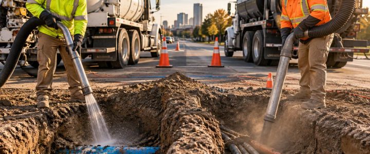
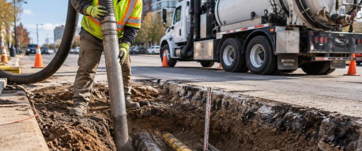
Utility daylighting services use vacuum excavation to physically expose a targeted portion of an underground utility. Once exposed, the utility can be observed, measured, photographed, and documented for design or construction decisions. This process is also called utility potholing, utility exposure, or creating a utility test hole.
For projects in Pennsylvania, New Jersey, Delaware, Maryland, New York, and the Washington, D.C. to New York City corridor, daylighting can help teams resolve a specific field question before it becomes an excavation conflict. The key is to plan test holes around decisions that need to be made—not simply to dig holes wherever marks appear.
Utility locating identifies a potential path; daylighting verifies field conditions
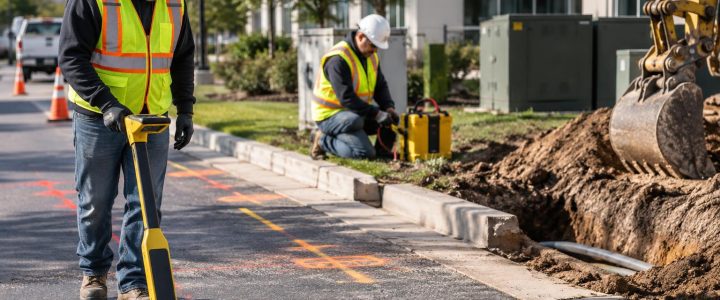
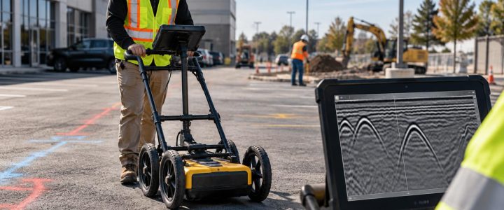
Private utility locating commonly uses electromagnetic methods, ground penetrating radar (GPR), visual evidence, records, and other field observations to designate suspected utilities. These methods can provide valuable information about a utility’s probable route and can identify areas that need further investigation.
However, locating and daylighting serve different purposes.
- Utility locating provides a surface designation or interpreted position. Some methods may also provide an estimated depth, subject to site conditions and method limitations.
- Utility daylighting physically exposes the targeted utility or feature so its observable characteristics can be measured and documented.
- Surveying may be needed after exposure when a project requires precise horizontal coordinates or a surveyed utility elevation tied to the project datum.
For example, an electromagnetic depth reading can help prioritize investigation. It should not automatically be treated as the actual depth of a utility at a proposed crossing. A vacuum-excavated test hole allows the team to measure the depth after exposure. If an engineer needs a reliable elevation for a profile or clearance calculation, the exposed utility must also be surveyed or measured using an appropriate project control procedure.
Visionary Subsurface Solutions can combine planned daylighting with private utility locating so the investigation progresses from surface evidence to physical verification where the project risk warrants it.
What can be verified through utility daylighting?
A properly planned utility test hole can provide field-observed information that is difficult or impossible to establish reliably from records or geophysical indications alone. The exact information available depends on whether the utility can be safely and sufficiently exposed, its condition, congestion in the area, and the purpose of the investigation.
Horizontal position at the test-hole location
Daylighting can confirm where the exposed utility is located horizontally at that specific point. This is especially helpful where a proposed structure, trench, duct bank, or bore path is close to a designated utility.
One exposed point does not prove that a utility remains straight over its full route. Pipes and conduits can change direction, bend around structures, or vary from historical records. Multiple test holes may be appropriate when a project depends on the utility’s alignment across a longer area.
Actual depth and vertical location
After exposure, the depth to the top of a utility can be measured from the existing surface or another identified reference. Depending on the project need, the investigator may also document the utility centerline, invert, crown, or bottom of a duct bank where accessible and appropriate.
It is important to define the measurement before fieldwork begins. “Depth” can mean different things to different teams. A design engineer may need the top-of-pipe elevation, while a directional drilling contractor may need a verified vertical separation between a proposed bore and an existing utility.
Surveyed elevation
Vacuum excavation exposes the utility; it does not by itself create a surveyed elevation. When precise vertical data is required, a surveyor or qualified field team should collect the exposed utility’s position and elevation using the project’s established control and datum.
This distinction matters when checking a gravity line profile, determining clearance below a road improvement, or resolving a crossing between two utility systems. A field note that says “approximately 6 feet deep” may be useful for planning, but it may not be enough for final design decisions.
Size, material, and configuration
Physical exposure can allow the field team to observe characteristics such as:
- Outside diameter or apparent width of a pipe, conduit, or duct bank
- Pipe material, when visible and identifiable
- Number and arrangement of visible conduits
- Casing pipes, spacers, concrete encasement, or protective coverings
- Whether a feature is a single pipe, multiple conduits, a duct bank, or another subsurface structure
- Visible joints, fittings, bends, abandoned segments, or changes in configuration
These details can materially affect design. A single marked line may represent a wider duct bank. A record showing a small utility may not reflect a casing or encasement that controls the actual clearance needed for construction.
Crossings and vertical separation
Utility crossing verification is one of the most useful reasons to daylight. If two utilities appear to cross near a proposed trench or bore path, surface marks alone may not establish which one is above the other or how much separation exists.
Test holes on one or both sides of a crossing can help establish the observed arrangement. In tight or high-consequence locations, the investigation plan may need additional exposure points because utility depth can change between test holes.
Why plans and records can differ from field conditions
Utility records are often created for planning, installation, maintenance, or billing purposes. They may not be detailed construction as-builts. Even good records may not capture later repairs, relocations, abandoned lines, private utility additions, roadway reconstruction, or site grading changes.
Actual utility depth can differ from a drawing or an earlier estimate for several reasons:
- The installed route differed from the planned route.
- Grades changed after installation, changing the depth below today’s surface.
- A utility was repaired, extended, or relocated without complete record updates.
- Multiple utility systems were added over time.
- Historical records are incomplete, generalized, or referenced to a different surface condition.
- The available utility information describes a nearby point rather than the exact conflict location.
Daylighting does not make every uncertainty disappear, but it allows a project team to replace assumptions at critical points with observed information.
When should engineers and contractors specify utility test holes?
Utility potholing is most valuable when the result will change a design, sequencing, means-and-methods decision, or risk-control measure. It is commonly considered before finalizing plans, before mobilizing heavy excavation equipment, and when unexpected field conditions arise.
Consider utility daylighting when:
- A proposed utility, footing, retaining wall, or structure is close to an existing line.
- A profile depends on a known utility elevation or vertical clearance.
- Two existing utilities appear to cross and their vertical order is unknown.
- A horizontal directional drill needs a verified route and crossing information.
- Records conflict with each other, with surface evidence, or with geophysical designations.
- A utility’s apparent size, material, or configuration affects design clearance.
- Mechanical excavation will begin near a known or suspected utility.
- A design team needs field data to evaluate a relocation, reroute, or conflict mitigation option.
A good test-hole plan identifies the question each hole is intended to answer. For instance: “Verify top-of-duct-bank elevation at proposed storm crossing,” or “Confirm whether the marked electric route is a single conduit or a multi-conduit bank.” Clear objectives help control unnecessary excavation and improve the usefulness of the final documentation.
How vacuum excavation supports Quality Level A investigations
ASCE 38-22 describes a framework for communicating subsurface utility information. In general terms, Quality Level B information is associated with geophysical designation of utilities, while Quality Level A information involves exposing a utility and obtaining precise horizontal and vertical data at the exposed point.
Vacuum excavation is commonly used to create the access needed for Quality Level A utility locating because it can remove soil around a targeted utility without relying on a conventional bucket directly at the utility. The exposure must still be planned, safely performed, measured, and documented to meet the project’s intended standard.
Not every vacuum excavation job is automatically a complete SUE investigation or a fully compliant Quality Level A deliverable. The scope must define the investigation limits, measurement method, survey requirements, documentation, and responsible parties. For projects requiring a coordinated approach, Subsurface Utility Engineering and QL-B services can help establish the surface utility picture that guides targeted test holes.
For additional context, project teams can review the ASCE 38-22 standard overview and the Federal Highway Administration’s Subsurface Utility Engineering resources. The standard and project contract documents should guide the final investigation approach.
Hydro excavation and air excavation: selecting the right method
Both hydro excavation and air excavation use a vacuum system to remove loosened soil from a small, controlled excavation. The best method depends on soil, utility sensitivity, water management, restoration requirements, weather, access, and the information needed.
Hydro excavation
Hydro excavation uses pressurized water to break up soil while vacuum equipment removes the slurry. It can be effective in compacted soils and may advance efficiently in conditions where air alone is less productive. It also creates slurry that must be contained, transported, and managed appropriately.
Air excavation
Air excavation uses compressed air to loosen soil for vacuum removal. It may be useful where minimizing introduced water is important or where dry spoils are easier to manage. Production can vary with soil type, moisture, rock content, and compaction.
Neither approach is risk-free or universally better. Operators need to use appropriate techniques, maintain awareness of the target utility, and follow site-specific safety procedures. Utility condition, shallow cover, damaged coatings, congested facilities, and unknown appurtenances can all affect how the exposure is performed.
Plan the test hole before the truck arrives
Effective non-destructive excavation begins with more than a requested depth and location. Before work starts, the project team should align on the purpose, limits, and deliverables.
- Define the decision. Identify the conflict, clearance, alignment, or design question the exposure must resolve.
- Review available information. Compare plans, utility records, prior designations, site observations, and proposed construction limits.
- Select targeted locations. Choose points that provide useful information about crossings, bends, conflict areas, and route changes.
- Set measurement requirements. State whether the project needs depth only, documented dimensions, surveyed coordinates, elevations, photographs, or a formal SUE deliverable.
- Plan the work zone. Address access, traffic control, surface type, spoil or slurry handling, restoration, and site safety requirements.
- Confirm the field communication path. Determine who will review unexpected findings and who can make design or sequencing decisions.
Common daylighting mistakes that reduce the value of the work
- Treating one test hole as proof of an entire route. Conditions can change between exposure points.
- Failing to define the needed reference point. Top of pipe, centerline, invert, and surface depth are not interchangeable.
- Skipping survey coordination. A physically exposed utility is valuable, but an unsurveyed observation may not satisfy profile or design-control needs.
- Not documenting visible configuration. A simple note of “electric found” may omit conduit count, bank width, encasement, and other useful observations.
- Digging without a decision-focused plan. Random holes can add cost while leaving the real conflict unresolved.
- Assuming vacuum excavation eliminates all utility risk. It is a controlled excavation method, not a substitute for planning, qualified personnel, and jobsite safety controls.
Use field-observed information before it becomes a field problem
Utility daylighting gives engineers and contractors an opportunity to verify key conditions before design is locked in or mechanical excavation reaches a conflict area. It can confirm what is present at an exposed point, support reliable depth and elevation measurements, and help teams coordinate practical solutions around existing infrastructure.
Visionary Subsurface Solutions provides vacuum excavation services, utility potholing, and utility exposure support for construction and infrastructure projects throughout the Mid-Atlantic and Northeast. Contact our team to discuss the utility questions, documentation needs, and site conditions for your project.