Horizontal directional drilling (HDD) can install utilities with far less surface disruption than open-cut construction. But a bore path still passes through an underground environment that may include active gas, electric, water, sewer, communications, drainage, and private utility infrastructure. A plan view, utility record, or surface mark can be useful for planning, but it may not provide enough information to safely establish a drill profile.
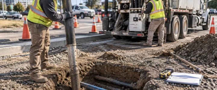
Utility daylighting for HDD planning uses vacuum excavation to physically expose selected utilities before drilling. The exposed utility can then be observed, measured, and documented. This helps the project team confirm whether a crossing is where it was expected, determine its actual depth at that location, and evaluate the vertical separation needed between the utility and the proposed bore.
For critical crossings, physically verified information can reduce uncertainty before the drill arrives. It does not eliminate all drilling risk or replace a complete HDD plan, competent drilling practices, or required jobsite controls. It gives engineers and contractors better field information for making those decisions.
Why HDD projects need more than utility records and surface marks
HDD design depends on a three-dimensional route. The drill team needs to consider entry and exit points, steering limits, bend radius, proposed cover, ground conditions, drill-fluid management, and existing infrastructure. A utility shown correctly on a plan in the horizontal direction may still be deeper, shallower, offset, abandoned, rerouted, or configured differently than expected.
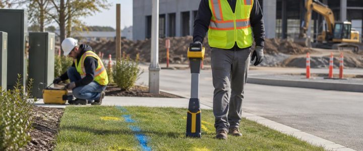
Utility records can reflect design intent, an installation sketch, or information available at the time a record was created. They may not show later work, service connections, unknown private lines, grade changes, or field adjustments made during installation. Surface utility marks and geophysical designation are also valuable tools, but they are interpreted information rather than direct observation of the buried asset.
For example, an electromagnetic locate may trace a conductive line and provide an estimated depth. Ground penetrating radar may identify a subsurface response that requires interpretation. Neither method alone necessarily confirms the utility’s exposed outside diameter, the number of conduits in a bank, a casing, or the exact elevation needed to set a drill profile.
A planned daylighting program helps answer the questions that matter most at specific risk points:
- Does the identified utility cross the proposed bore corridor?
- What is its actual horizontal position at the crossing?
- What depth is measured after exposure?
- What is the elevation of the exposed utility if it is surveyed?
- Is the asset a single pipe, multiple conduits, a duct bank, or a cased utility?
- What is the observable material, diameter, configuration, and condition?
- Is there enough verified separation for the proposed installation and the project requirements?
Utility locating and utility verification are not the same
Utility locating and utility verification work best together, but they serve different purposes.
Locating and designation establish a working utility picture
Private utility locating, electromagnetic methods, records research, visible features, and ground penetrating radar can help identify and trace known or suspected utilities. In a Subsurface Utility Engineering investigation, this type of geophysical designation is commonly associated with Quality Level B information under ASCE 38-22.
That information is important for selecting investigation areas and identifying possible conflicts. It also helps avoid random excavation. However, a designated line should not be treated as a guaranteed representation of every utility’s actual depth, configuration, or position.
Physical exposure supports higher-confidence information at selected points
Quality Level A work involves the physical exposure and measurement of a utility at a specific location using appropriate methods and documentation. The Federal Highway Administration likewise describes test holes as the method used to obtain the highest level of utility-location information in an SUE process. See the FHWA’s Subsurface Utility Engineering guidance for additional context.
Vacuum excavation is often used to create these test holes because it allows crews to remove soil around a known or suspected utility without relying on a conventional bucket at the point of exposure. Still, a vacuum excavation hole alone does not automatically make an investigation Quality Level A or satisfy every project requirement. The work must be planned, measured, documented, and performed to the applicable scope and standard.
When a design needs coordinates or utility elevations, a surveyor or other appropriate measurement process may be needed. A measured depth in an open test hole is not automatically the same as a surveyed elevation tied to the project’s vertical datum.
Where to place utility test holes for a planned bore
The best test-hole locations are driven by risk, not by a fixed spacing rule. The project team should review the proposed drill alignment, designated utilities, available records, site access, and likely consequences of a conflict. The goal is to expose the assets that could materially affect the bore path or construction method.
Common HDD daylighting locations include:
- Major utility crossings: Gas, electric, water, sanitary sewer, force mains, communications, and transmission facilities that intersect or closely approach the proposed route.
- Congested corridors: Areas where several utilities are designated near one another and their vertical order is unclear.
- Entry and exit areas: Locations where shallow utilities may interfere with drilling setup, tie-ins, or the initial drill path.
- Changes in proposed drill depth: Points where the profile rises, falls, or must route around an existing utility.
- Uncertain records: Crossings shown inconsistently on plans, record drawings, or utility-owner information.
- High-consequence infrastructure: Utilities for which a strike, loss of service, or settlement event would have significant safety or operational impacts.
- HDD tie-in locations: Areas where the new installation must connect to an existing system or pass near structures, vaults, manholes, or foundations.
One test hole may confirm one point only. A utility can change depth or direction between holes, and a utility corridor may contain additional lines beyond those initially designated. Engineers and contractors should choose the number and placement of test holes based on the proposed work, subsurface complexity, and the consequences of being wrong.
What vacuum excavation can verify at a crossing
Once the utility is safely exposed, the crew and project team can observe characteristics that cannot be reliably determined from a surface signal alone. The exact scope should be established before work begins so the right measurements and documentation are collected while the utility is visible.
Horizontal position, depth, and elevation
Physical exposure allows the team to identify where the utility is at the test-hole location. Depth can be measured from a defined surface reference to the exposed utility. If design requires a true elevation, the exposed utility should be surveyed or measured using a procedure tied to the project’s established horizontal and vertical control.
This distinction matters. An estimated depth from a locator is useful for investigation planning. A depth measured after exposure is field verification at that point. A surveyed elevation provides a coordinate-based result only when an appropriate survey process and project datum are used.
Size, material, and configuration
Daylighting can support observation of a pipe’s outside diameter, apparent material, casing, conduit-bank arrangement, number of visible conduits, and other exposed characteristics. For example, a signal that appears to represent a single communications route may require field verification to determine whether it is one conduit, a duct bank, or a conduit within a larger casing.
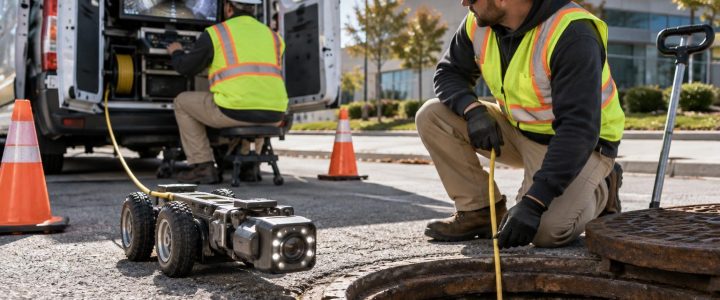
Exposure is limited to what can be safely and visibly observed. A test hole may not reveal the full configuration outside the excavation, internal condition, ownership, or the purpose of every line. If pipe condition or internal features are relevant, a separate investigation method, such as video inspection where access is available, may be appropriate.
Vertical separation and conflict conditions
At a utility crossing, the important question is often not simply whether two lines intersect in plan view. The team needs to know which facility is above or below the other and the measured separation at that location. This information can help the engineer adjust the HDD profile, evaluate clearance, select a different alignment, or plan additional verification.
Do not assume that an exposed utility proves the full route is clear. It verifies conditions at the exposure point. Additional test holes may be needed where the drill path changes, where utilities converge, or where uncertainty remains.
A practical workflow for HDD utility daylighting
- Review the proposed bore and available information. Gather current design drawings, utility records, one-call information as applicable, site observations, and previous locating results.
- Designate likely utilities. Use appropriate locating methods to establish a preliminary utility picture and identify areas that need verification. Visionary Subsurface Solutions can coordinate private utility locating with a targeted daylighting scope when both services are needed.
- Identify risk points and test-hole objectives. Define what each hole needs to answer: crossing position, depth, elevation, size, material, conduit count, or another design question.
- Plan access and controls. Address traffic control, work-zone protection, permits or site authorization, utility-owner coordination where needed, spoil or slurry handling, and surface restoration expectations.
- Expose carefully using the selected method. Hydro or air excavation may be selected based on soil, utility sensitivity, restoration needs, water availability, disposal options, and project conditions.
- Measure and document while exposed. Record the utility characteristics required by the scope. Obtain survey data when the design requires coordinate-based positions or elevations.
- Compare findings to the drill profile. The engineer and HDD team should review the verified information before finalizing or changing the bore plan.
Hydro excavation or air excavation for HDD test holes?
Both methods use a vacuum system to remove loosened material from the excavation. Hydro excavation uses pressurized water to break up soil. Air excavation uses compressed air. The right choice depends on the project rather than a universal preference.
Hydro excavation can be effective in many soil conditions and may advance efficiently in compacted ground. It produces slurry that must be managed and disposed of appropriately. Water use, groundwater, freezing temperatures, cleanup requirements, and disposal options should be considered before mobilization.
Air excavation may be useful where limiting water is important or where excavated material can potentially be handled as dry spoil, subject to site requirements. Its production can vary with soil type, moisture, and compaction. Both methods require trained operators, suitable techniques around exposed utilities, and site-specific safety planning.
Vacuum excavation is intended to reduce the risk associated with mechanical excavation around known or suspected utilities. It is not risk-free. Hard debris, shallow cover, congested facilities, unstable excavation conditions, poor access, and operator error can still create hazards. Crews must follow the applicable damage-prevention procedures, safe work practices, and project controls.
Common mistakes that weaken HDD verification
- Using a single depth reading as a route-wide answer. A depth is specific to the point and reference used.
- Failing to define the measurement reference. Notes should state whether depth was measured from existing grade, pavement, a benchmark, or another reference.
- Not surveying critical exposures. Measured depth may not be sufficient when an engineered profile requires elevations on project control.
- Recording only a paint mark. Clear photos, dimensions, utility descriptions, location references, and survey information where applicable make the finding usable later.
- Ignoring nearby or stacked facilities. A visible utility may be one part of a congested corridor, not the only facility present.
- Waiting until the drill crew is mobilized. Early test holes allow time to revise the design or resolve conflicts without placing the entire operation on hold.
Frequently asked questions about HDD utility daylighting
Does daylighting guarantee an HDD bore will not hit a utility?
No. Daylighting provides direct information at selected locations, but conditions can vary between test holes. The bore still requires proper planning, tracking, operation, and verification throughout the work.
Can a vacuum excavation crew determine utility ownership?
Not reliably from exposure alone. Markings, records, visible features, and coordination with utility owners may help, but ownership should not be assumed based only on a pipe or cable’s appearance.
When should test holes be completed?
For critical crossings, test holes are most useful early enough to influence design, bore planning, and scheduling. They can also be used during construction when new information or a conflict requires further verification.
What should the final documentation include?
The required deliverable varies by project. Typical information may include the test-hole location, date, surface reference, observed utility type and characteristics, measured depth, photographs, horizontal coordinates, and surveyed elevations when included in the scope.
Make verified field information part of the HDD plan
HDD work is most predictable when the bore plan is based on the best available field information, especially at high-risk crossings. Targeted utility daylighting gives the project team a way to move from interpreted marks and records to direct observation and documented measurements where they matter most.
Visionary Subsurface Solutions provides vacuum excavation, utility daylighting, and QL-A support for contractors, engineers, and infrastructure teams across Pennsylvania, New Jersey, Delaware, Maryland, New York, and the Washington, D.C. to New York City corridor. Contact our vacuum excavation team to discuss critical HDD crossings, utility test holes, and a daylighting plan for your project.