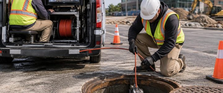
Foundation excavation often starts with a utility picture that is incomplete. Plans may show a line near the proposed footing, but the actual horizontal position, depth, crossing arrangement, or pipe material may be uncertain. A utility mark or geophysical signal can be valuable for planning, but it may not provide enough certainty when a foundation cut, grade beam, elevator pit, or deep utility trench will work close to the line.
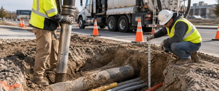
Utility daylighting uses vacuum excavation to physically expose a known or suspected utility at selected locations. The purpose is not simply to find a line. It is to observe and document field conditions that affect design, means and methods, and safe excavation planning. For foundation work, properly planned utility test holes can help a project team determine whether a utility conflicts with the proposed excavation and what controls may be needed before heavy equipment begins digging.
Vacuum excavation is intended to reduce the risk associated with mechanical digging around utilities, but it is not risk-free. It requires qualified operators, appropriate locating and work planning, safe exposure techniques, and site-specific traffic and excavation controls. It also does not guarantee that every underground feature will be found.
Why foundation excavation needs physical utility verification
Historical utility records are useful references, not proof of current field conditions. A service may have been installed on a different route than shown on drawings. A later addition, repair, abandoned line, reconstruction project, settlement, or previous grading operation may also change what is encountered in the field.
These differences matter when excavation is deep or close to structures. A line that appears outside the footing zone on a plan may actually run through the excavation limits. Two utilities that appear to cross may have little vertical separation. A shallow conduit bank or service lateral may be vulnerable during stripping, saw cutting, shoring installation, or bulk excavation.
Utility daylighting before foundation excavation is especially useful when the project includes:
- Deep foundations, basement walls, elevator pits, or retaining walls
- Footings near known utility corridors or building service entrances
- Redevelopment of an occupied commercial or institutional property
- Utility relocations that depend on accurate existing elevations
- Conflicting record drawings, locate marks, and field observations
- Private electric, communications, water, sewer, fire, or irrigation systems
- Proposed excavation near a utility crossing or tie-in point
- Limited room to adjust a foundation layout after construction begins
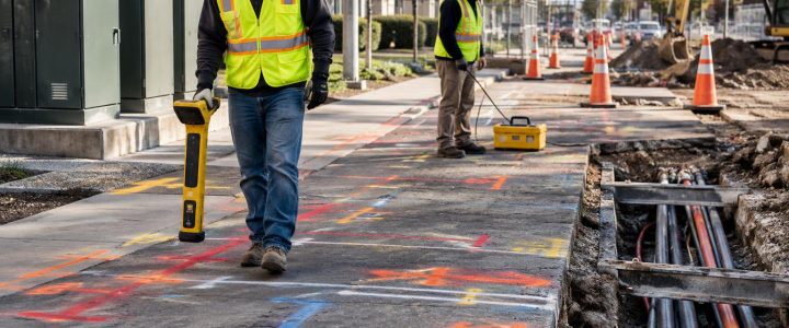
Before selecting test-hole locations, teams commonly begin with available records, 811 notifications where applicable, private utility locating, site observations, and design information. Private utility locating can help designate suspected routes, while test holes provide the physical observations needed at critical points.
Locating and daylighting answer different questions
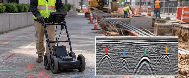
Utility locating and utility verification are related, but they are not the same activity. Electromagnetic locating can trace many conductive utilities and estimate a depth under suitable conditions. Ground penetrating radar can identify subsurface anomalies or features in some soils and site settings. Both methods can be important parts of an investigation, but their results are interpreted geophysical information.
Vacuum excavation allows the team to physically expose the utility. Once exposed, the utility’s location and visible characteristics can be observed rather than inferred from a signal. This distinction is important when the project needs a reliable basis for a design decision or for excavation near the utility.
What a test hole can help verify
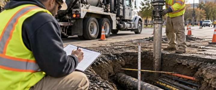
Depending on access, exposure extent, and field conditions, utility potholing can help document:
- The actual horizontal position of a utility at the exposure point
- Depth below the existing surface, measured after exposure
- The top, centerline, or invert location needed for the project’s design criteria
- Visible outside diameter or overall width of a pipe, duct bank, or conduit group
- Observable material, such as metal, plastic, clay, concrete, or a visible casing
- The number and arrangement of visible conduits or pipes
- Crossing relationships and observed vertical separation between utilities
- Visible conditions such as abandoned components, encasement, or unexpected connections
Physical exposure does not automatically create a surveyed elevation. A measured depth is typically a vertical distance from the ground surface at the test hole. If the design needs a precise coordinate or elevation tied to project control, a surveyor or an appropriate survey procedure should collect the required data while the utility is exposed. The team should also state whether an elevation represents the top of pipe, centerline, invert, top of duct bank, or another defined point.
How daylighting supports SUE and Quality Level A information
Subsurface Utility Engineering, or SUE, combines records research, field designation, utility coordination, physical exposure, and documentation as appropriate to the project. In the ASCE 38-22 framework, Quality Level B generally concerns geophysical designation of utilities, while Quality Level A involves exposing a utility and obtaining precise horizontal and vertical information at a specific point.
Quality Level A is not a label automatically created by every vacuum excavation job. The test-hole plan, measurement methods, survey control, documentation, and project requirements all matter. The ASCE 38-22 standard and the Federal Highway Administration’s SUE guidance both describe physical exposure as the highest-confidence utility information process when performed and documented to the applicable standard.
For a foundation project, this information can allow the civil or structural design team to revise a footing, adjust a utility relocation, establish protection measures, or confirm that planned clearance is realistic. It can also give the excavation contractor a clearer picture of where to transition from bulk excavation to more controlled work.
Plan test holes around decisions, not just utility marks
Random potholes can create cost and disruption without resolving the question that matters. A stronger approach is to identify the specific design or construction decision first, then choose test-hole locations that will answer it.
Common test-hole objectives near foundations
- Confirm a conflict: Expose the utility where its designated path enters the proposed footing or wall excavation area.
- Verify a crossing: Daylight the utilities near their apparent intersection to determine whether both are present and how they are arranged.
- Check a service entry: Verify utilities approaching an existing building before a new addition, excavation, or demolition operation begins.
- Establish a profile: Expose a utility at multiple planned locations when the proposed work runs parallel to it and its depth may change.
- Support a relocation: Document visible size, material, configuration, and connection conditions that can affect relocation planning.
The number of utility test holes depends on utility congestion, the size of the excavation, the consequences of a conflict, available information, and the degree to which utility depth or alignment may vary. One exposure point should not be assumed to represent an entire utility route, especially across a large site or where grade changes, bends, connections, and prior construction are likely.
Hydro excavation or air excavation?
Both hydro excavation and air excavation use pressurized media to loosen soil while a vacuum system removes the spoil. Either can be used for non-destructive excavation when the work is planned and performed correctly, but the appropriate choice depends on the site.
Hydro excavation
Hydro excavation typically uses pressurized water and vacuum removal. It can be effective in many compacted soils and can support efficient utility exposure. However, it produces slurry that must be contained, hauled, and disposed of in accordance with site and applicable disposal requirements. Water management can also be a major consideration in cold weather, near sensitive areas, or where restoration needs to remain clean and controlled.
Air excavation
Air excavation uses compressed air to break up soil for vacuum removal. It may be advantageous where minimizing water use or slurry is important. Soil response can vary significantly, however. Dense clay, rocky material, wet soils, and frozen ground may affect production and the shape of the excavation. Dust control and spoil handling also need planning.
Neither method is universally better. The vacuum excavation contractor should evaluate soil conditions, depth, groundwater, utility type, access, work-zone limits, restoration requirements, and disposal options before recommending a method.
A practical daylighting workflow before excavation
- Define the risk area. Compare foundation limits, shoring zones, crane pads, grading, and planned utility work with available utility information.
- Review records and designate utilities. Use available drawings, public marking processes where required, private locating, and site observations to identify candidate utilities.
- Select decision-based test-hole points. Prioritize utilities that may enter the excavation, cross proposed work, or affect required clearances.
- Coordinate access and controls. Address traffic control, building operations, permits, utility-owner coordination, surface restoration, and spoil or slurry management.
- Expose carefully. Use suitable vacuum excavation practices and avoid relying on mechanical equipment within the planned exposure area until conditions are understood.
- Measure and document. Record what was exposed, the reference surface, dimensions, observed material, configuration, photographs as required, and any limitations of the observation.
- Survey when needed. Collect horizontal and vertical data tied to project control if design, relocation, or construction layout requires it.
- Communicate findings promptly. Provide the information to the engineer, surveyor, contractor, and affected utility stakeholders before the findings are covered or the work advances.
Documentation that makes a test hole useful
A daylighted utility has limited value if the findings are not clear enough to use. Field documentation should identify the location, date, utility designation or description, and the specific characteristic observed. It should also distinguish confirmed observations from assumptions.
For a foundation-related utility test hole, a useful record may include:
- Test-hole identification and location reference
- Utility type, if known or confirmed by the responsible owner
- Measured depth and the surface reference used
- Surveyed coordinates or elevations, when collected
- Observed dimensions and whether they represent outside diameter, width, or another measure
- Visible material and configuration
- Relationship to proposed foundation limits, crossings, or nearby utilities
- Photographs and notes on access or exposure limitations
- Backfill and restoration status
Physical exposure may show a pipe or conduit, but it does not establish utility ownership or operational status by itself. Confirmation from records, utility owners, facility staff, or other qualified sources may still be needed.
Common mistakes to avoid
Using depth estimates as final design data
An electromagnetic depth estimate can support planning, but it should not be treated as a surveyed utility elevation or as proof of exact clearance. When a few inches matter, physically expose the utility and use the required measurement or survey procedure.
Testing only where access is easiest
An open lawn may be convenient, but the critical conflict may be near the proposed wall, service entrance, or roadway edge. Test-hole placement should serve the design or construction decision.
Failing to account for the full excavation footprint
Foundation risk is not limited to the final wall line. Consider overexcavation, working room, shoring, dewatering, temporary access, demolition, and equipment movements.
Leaving findings out of the field plan
Once a utility is exposed, the information needs to reach the people controlling design, layout, and excavation. Markups, survey files, test-hole logs, and a pre-excavation discussion can prevent a known condition from becoming a field surprise.
Frequently asked questions
Does daylighting eliminate the need for utility locating?
No. Locating helps identify likely utility routes and target test holes. Daylighting provides physical verification at selected locations. The two methods work best together as part of a planned investigation.
Can a test hole confirm utility depth for the entire site?
No. It confirms conditions at the point and extent exposed. Depth and alignment can change along a route, particularly near bends, connections, grade changes, repairs, and crossings.
Can vacuum excavation expose unknown utilities?
It can be used to investigate a suspected location, but it should follow appropriate planning and available locating information. No investigation method can assure that every utility or underground feature will be identified.
When should a surveyor be involved?
Involve a surveyor when the project needs utility coordinates or elevations tied to project control, such as when resolving a design profile, documenting required separation, or preparing construction layout information.
Make utility findings available before the foundation crew mobilizes
Utility daylighting is most valuable when it happens early enough to influence the plan. Confirming a critical utility before foundation excavation can give the project team time to adjust the design, coordinate a relocation, revise excavation sequencing, or establish protection measures without reacting to an unexpected condition in an open cut.
Visionary Subsurface Solutions provides vacuum excavation and QL-A utility verification services for construction and engineering projects across Pennsylvania, New Jersey, Delaware, Maryland, New York, and the Washington, D.C. to New York City corridor. Contact our team to discuss utility daylighting, test holes, and the documentation your foundation excavation project requires.