A utility mark, record drawing, or geophysical signal can identify a potential conflict. It does not always answer the question that matters most: can the planned work proceed without contacting an existing utility?
When utility position, depth, configuration, or vertical clearance will affect a design or excavation decision, vacuum excavation can provide the physical evidence needed to resolve the uncertainty. This process is often called utility daylighting, potholing, or a utility test hole. It exposes a limited area around the utility so qualified personnel can observe and document actual field conditions.
For contractors and engineers, the value is not simply finding a line. A well-planned utility conflict investigation can help determine whether a proposed trench, footing, bore path, drainage structure, pole base, or other feature conflicts with existing underground infrastructure before full production work begins.
Locating identifies a possible conflict; daylighting investigates it
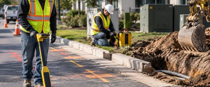
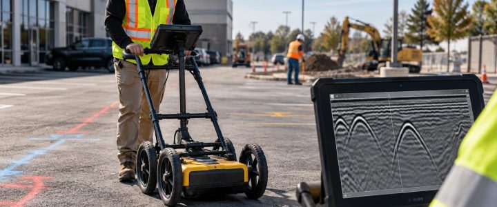
Utility locating and utility verification are related, but they serve different purposes. Electromagnetic locating can trace conductive utilities or tracer wire and provide an interpreted position. Ground penetrating radar may identify anomalies or subsurface features where conditions allow. Both methods are valuable for building a picture of the site and selecting investigation points.
However, locating results may not provide enough certainty where a utility is close to proposed work. Signal distortion, nearby parallel utilities, inaccessible connection points, congestion, soil conditions, abandoned infrastructure, and incomplete records can all affect interpretation. A displayed depth from an electromagnetic receiver is an estimate, not the same as a measurement taken after physical exposure.
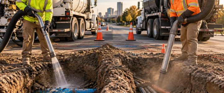
Vacuum excavation for utilities removes soil using controlled air or water and a vacuum system. Once the utility is safely exposed, the field team can observe characteristics that a geophysical signal alone may not reliably establish, including:
- The utility’s actual horizontal position at the test-hole location
- Depth below the existing surface or another defined project datum
- Outside diameter or approximate size
- Observable material, such as steel, ductile iron, PVC, HDPE, concrete, or conduit
- Number and arrangement of conduits or cables in an exposed bank
- Casing, encasement, insulation, abandoned lines, or other visible configuration details
- Whether the utility is above, below, or offset from another exposed feature
Physical exposure does not automatically establish surveyed coordinates or elevations. Where design depends on precise horizontal or vertical control, the exposed utility should be measured and tied to the project control system by appropriate surveying procedures.
When a utility conflict investigation is warranted
Not every marked utility requires a test hole. The investigation should focus on locations where uncertainty could change the design, sequence of work, method of excavation, or safety controls. Vacuum excavation is commonly considered when the answer to one of the following questions will affect the project.
A proposed excavation is close to a marked or indicated utility
A utility shown near a planned trench, storm structure, retaining wall, foundation, sign base, or curb line may be clear of the work—or it may be directly in its path. A conflict investigation can confirm the utility’s position at the critical point rather than relying only on plan scaling or surface marks.
A utility crossing has uncertain vertical separation
Two utilities can appear to cross on plans or in a utility designation drawing without showing which one is above the other. Daylighting at a carefully selected point may help establish their relative arrangement. If a design requires exact separation, surveying and additional test holes may be necessary because utility grade can change between exposure points.
Records and field evidence do not agree
Older drawings may show a utility route that does not match current marks, visible appurtenances, or geophysical results. This does not necessarily mean any one source is wrong. Utilities may have been rerouted, replaced, abandoned, repaired, or installed differently than documented. A targeted utility test hole can help determine which condition exists at the specific point that matters to the work.
A bore path or excavation method needs confirmation
Before directional drilling, crews may daylight known crossings and utilities near entry, exit, or high-risk areas. Before mechanical excavation, daylighting may help establish where hand digging, protective measures, revised equipment access, or a different sequence is needed. It supports planning; it does not eliminate the need to follow applicable safe-excavation procedures throughout the work.
The designer needs field data to make a decision
Design teams often need more than a utility route. They may need an observed pipe diameter, duct-bank configuration, utility material, or elevation at a proposed connection or crossing. Utility daylighting services can provide the physical information needed to assess clearance, revise a profile, coordinate a relocation, or investigate alternatives before construction commitments are made.
How vacuum excavation supports Quality Level A investigations
Subsurface Utility Engineering, or SUE, uses a structured process to manage utility uncertainty. In broad terms, Quality Level B information is based on geophysical designation, while Quality Level A involves exposing a utility at discrete points and documenting its precise location and attributes.
The ASCE 38-22 standard describes the investigation and documentation of existing utilities. The Federal Highway Administration also explains that Quality Level A information is obtained through nondestructive excavation and precise measurement at test-hole locations in its SUE guidance. These references support a practical point: a vacuum truck alone does not automatically make a project a Quality Level A investigation. The project must also use appropriate planning, observation, measurement, records, and documentation for its intended standard and deliverable.
For example, exposing a utility may verify that a conduit exists near a proposed structure. A Quality Level A deliverable for design may additionally require defined measurement methods, horizontal position, elevation, dimensions, material observations, photographs, and clear documentation of what was and was not observed.
A practical workflow for resolving a utility conflict
Utility potholing is most effective when it follows a project question. Random holes can create cost and disruption without resolving the decision that prompted the investigation.
- Define the conflict question. Identify the proposed feature, work limits, suspected utility, and decision that depends on the result. For example: “Does the existing gas line clear the proposed storm lateral?”
- Review available information. Compare utility records, design drawings, visible structures, public marks where applicable, private utility data, prior survey information, and field conditions.
- Perform or review utility designation. Use appropriate locating methods to trace suspected utilities and select exposure points. Visionary Subsurface Solutions can combine test-hole work with private utility locating when private-site infrastructure needs investigation.
- Select test-hole locations deliberately. Place holes where they can answer the conflict question, not merely where access is easiest. Consider the proposed excavation centerline, likely utility alignment, crossings, changes in grade, and work-zone constraints.
- Plan the work zone. Confirm access, traffic control, surface type, utility notifications, equipment setup, spoil or slurry management, groundwater concerns, and restoration expectations.
- Expose carefully. Use suitable non-destructive excavation methods and controlled techniques around known or suspected infrastructure. The work still requires competent operation, jobsite safety planning, and care around the exposed asset.
- Observe and measure. Record what is physically visible. If the project requires coordinates or elevations, have the exposure tied to project control through proper survey methods.
- Communicate the result. Provide the design and construction teams with clear findings, limitations, photos when required, and an explanation of whether the conflict is resolved or further investigation is needed.
Choosing hydro excavation or air excavation for conflict work
Hydro excavation uses pressurized water to loosen soil, which is then removed by vacuum. It can be productive in many soil types and is frequently used for utility exposure. It also produces slurry that must be managed and disposed of appropriately for the site and local requirements.
Air excavation uses compressed air to break up soil for vacuum removal. It may be useful where keeping excavated material relatively dry matters or where water use, slurry handling, restoration, or certain soil conditions make hydro excavation less desirable. It can be slower in some dense or cohesive soils.
Neither method is universally better. Soil type, depth, groundwater, utility congestion, pavement or landscape restoration, available access, weather, disposal needs, and the utility’s condition all influence the method. Frozen ground, deep utility placement, unstable soils, restricted staging areas, and active traffic can add time and complexity to either approach.
What a conflict investigation can and cannot prove
A test hole provides reliable information about what is exposed at that specific location. It should not be used to assume that the same depth, alignment, or configuration continues unchanged across the entire site. Pipes can slope, cables can shift within trenches, and utility routes can bend or transition. Additional test holes may be justified at grade breaks, intersections, connection points, or other critical locations.
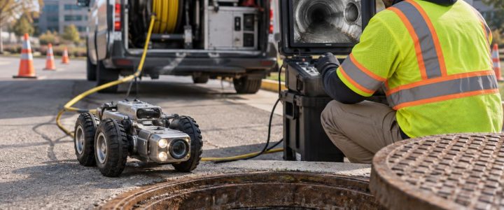
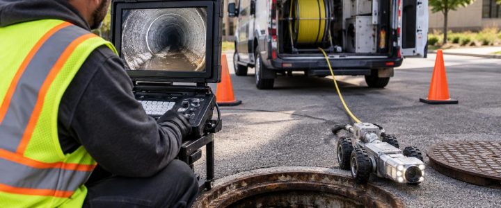
Likewise, visible material and size should be documented as observations. A partial exposure may not reveal a utility’s full configuration, ownership, service status, internal condition, or exact route beyond the excavation. If pipe condition or an internal connection is the main concern, other methods such as CCTV inspection may be more appropriate.
Common mistakes that leave conflicts unresolved
- Using a single test hole to represent a long utility segment. One point may not capture bends, elevation changes, or route transitions.
- Measuring from an undefined surface. Depth information is more useful when the reference surface or datum is clearly identified.
- Failing to involve survey support early. If design needs elevations, plan the survey work before the hole is backfilled.
- Assuming every line is active or inactive. Exposure alone may not establish operational status or ownership.
- Ignoring constructability. A confirmed utility conflict may require a design change, revised excavation sequence, utility coordination, or additional protection—not simply a deeper trench.
- Overlooking restoration and disposal. Pavement, landscaped areas, traffic lanes, groundwater, and slurry handling should be addressed in the work plan.
Frequently asked questions about utility conflict investigation
Can vacuum excavation confirm utility depth?
It can allow depth to be measured at the exposed location from a defined surface reference. If the project needs a precise elevation, a surveyor or appropriate project measurement process should tie the exposed utility to the required vertical datum.
Can a vacuum excavation contractor identify every utility?
No. Vacuum excavation exposes the area that is excavated. It is usually guided by records, locating results, design needs, and field observations. Unknown, abandoned, deeply buried, or inaccessible infrastructure may require additional investigation, and no method guarantees that every subsurface feature will be found.
Does daylighting replace utility locating?
No. Locating helps identify probable utility paths and target the investigation. Daylighting provides physical verification at selected points. The two methods are commonly used together.
Can a test hole establish whether a proposed design will clear a utility?
It can provide key information for that decision, especially when paired with accurate survey control and design geometry. The engineer or responsible project team should evaluate the documented field data, required tolerances, and conditions between exposure points.
Use physical verification before uncertainty becomes a field problem
When a utility conflict could affect design, schedule, excavation methods, or worker safety, resolving it early is usually more useful than carrying the uncertainty into production work. A focused utility daylighting plan can turn a questionable mark or record into field observations that the project team can use.
Visionary Subsurface Solutions provides vacuum excavation and QL-A utility exposure services for contractors, engineers, municipalities, and facility teams throughout Pennsylvania, New Jersey, Delaware, Maryland, New York, and the Washington, D.C. to New York City corridor. Contact our team to discuss the utility conflict, documentation needs, access conditions, and test-hole approach for your project.