Knowing that a utility is somewhere in the work area is not the same as knowing whether it conflicts with excavation. A surface mark may indicate an approximate route, but a contractor still needs practical answers: Is the line above or below the proposed grade? Does it cross the trench? Is there enough clearance for a bore, footing, drainage structure, or sign foundation?
Unknown utility depths are a common source of field changes because the answer often cannot be obtained from one map, one locate, or one instrument reading. A sound investigation uses the right level of evidence for the decision at hand. It starts with available records and surface observations, adds geophysical locating where appropriate, and uses test holes when a critical depth or crossing must be physically confirmed.
This approach helps contractors, engineers, and facility teams reduce uncertainty before it becomes an excavation delay or a utility strike.
Why surface marks do not settle a depth question
Surface markings are important. They communicate the approximate horizontal position of a detectable utility and help crews plan work safely. But a mark on pavement, grass, or a wall does not show the full underground picture.
Several conditions can make depth information uncertain:
- Grade may have changed. Asphalt overlays, fill, landscaping, reconstruction, and erosion can alter the distance between the ground surface and a buried line.
- Utilities may not be at a consistent depth. A line can rise or fall around structures, cross other facilities, or change elevation between access points.
- Records may show design intent rather than as-built conditions. Older plans may be incomplete, generalized, or based on a previous site configuration.
- Signals can be distorted. Congested corridors, nearby conductors, bonded lines, and certain site conditions can affect electromagnetic locating results.
- Some utilities are difficult to detect. Non-conductive pipe, abandoned lines, untraceable services, and deeply buried facilities may require multiple methods or may remain uncertain without exposure.
Electronic equipment can often produce a depth estimate for a traceable line. That estimate can be useful for planning, but it is not the same as a measured top-of-utility or measured centerline depth. Its reliability depends on correct signal identification, the utility’s path, soil and site conditions, and the reference surface used for the reading.
For a decision with meaningful consequences, such as setting a trench bottom near a gas line or drilling close to a duct bank, the project team should treat an instrument depth as an indicator to investigate, not as final proof.
Use the evidence level that fits the construction decision
A useful way to manage uncertainty is to match the investigation method to the risk of being wrong. The American Society of Civil Engineers standard ASCE 38-22 describes quality levels for documenting existing utilities. The Federal Highway Administration also recognizes subsurface utility engineering as a process for identifying and managing utility risks during project development. Together, these resources support a simple principle: information should become more precise where a utility conflict is more consequential.
ASCE 38-22 identifies four quality levels, ranging from existing records through non-destructive exposure. In practical terms, the levels can guide a project team as follows.
Quality Level D: Existing records and site knowledge
Quality Level D relies on available information such as utility atlases, owner records, as-built drawings, previous surveys, facility staff knowledge, and visible appurtenances. It is often the right starting point during early feasibility work.
However, records alone should not be used to set final excavation limits around a suspected conflict. They may not identify later additions, private services, abandoned infrastructure, or field changes made during past repairs.
Quality Level C: Surface-visible features
Quality Level C adds surveyed surface features such as manholes, valves, pedestals, utility poles, meters, cleanouts, and markers. This helps connect records to the actual site and can reveal likely utility routes.
Surface evidence can be very helpful, especially on established facilities. Still, it does not confirm that a line runs directly between two visible features, and it does not establish depth.
Quality Level B: Designating the horizontal position
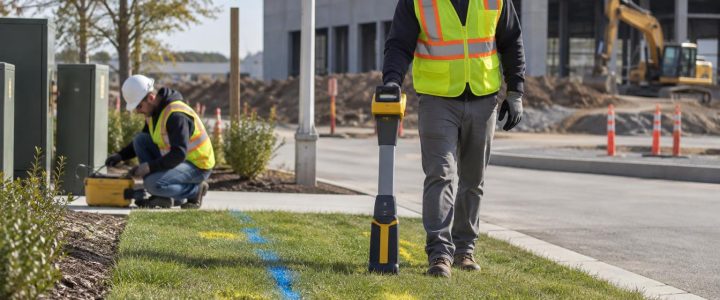
Quality Level B uses appropriate geophysical methods to designate the approximate horizontal position of utilities. Electromagnetic locating is commonly used for conductive lines or lines with a trace wire. Ground penetrating radar may provide additional information in suitable conditions, particularly where a target is not readily traceable.
Quality Level B can significantly improve design and planning, but it should be represented as designated information rather than physical verification. A competent utility investigation considers signal behavior, site congestion, access limits, records, and visible features instead of relying on a single sweep or one method.
For projects that need coordinated utility data for design, Subsurface Utility Engineering & QL-B can organize records research, field designating, survey support, and utility conflict information into a clearer planning process.
Quality Level A: Physical verification
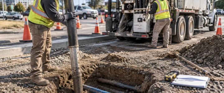
Quality Level A is obtained through non-destructive exposure, commonly called a test hole or pothole. Vacuum excavation removes soil using air or water and a vacuum system so the utility can be visually identified and measured while limiting the need for mechanical digging near the line.
When performed at the relevant crossing or proposed excavation location, a test hole can document the actual observed depth, horizontal position, size, material visible at the exposure point, and other relevant field conditions. It does not automatically establish those same characteristics everywhere along the utility route. The utility may change depth or direction beyond the exposure.
When an unknown depth should trigger a test hole
Not every marked utility needs to be exposed. Test holes add time, access coordination, restoration needs, and site logistics. They are most valuable when the result will change a design, method, sequence, or safety control.
Consider physical verification when any of the following applies:
- The proposed excavation, drilling, or boring is close to a designated utility path.
- The work requires a known vertical clearance, such as a new gravity line crossing an existing facility.
- A utility appears to conflict with a footing, retaining wall, vault, pole base, trench, or storm structure.
- The proposed grade is changing, making historic depth records less meaningful.
- Field designations and plans disagree, or multiple potential utility routes are present.
- The line is high consequence or service disruption would significantly affect the facility, public, or schedule.
- The site contains older private utilities with limited records.
- A trenchless crossing needs confirmed entry, exit, or crossing elevations.
The key question is not simply, “Can we get a depth reading?” It is, “What information do we need before this work can proceed with an acceptable level of uncertainty?” When the answer requires a measured elevation at a specific point, non-destructive exposure is often the appropriate next step.
A practical workflow for resolving depth uncertainty
1. Define the proposed work limits and required clearance
Start with the actual construction footprint, not a broad site boundary. Identify trench lines, excavation depths, bore paths, structure locations, grading limits, access routes, and staging areas. Then identify the needed clearance or decision point. A utility several feet from a sidewalk may not be a concern; the same utility at the edge of a deep trench may be critical.
2. Gather records before field work
Collect available civil plans, utility drawings, previous surveys, facility maintenance records, one-call ticket information, and owner-provided maps. Note the date and source of each record. Records are evidence, not confirmation, but they help the field team select methods, identify likely utility owners, and focus the investigation.
3. Walk the site and identify surface clues
Manholes, valves, cleanouts, meters, pedestals, transformers, hydrants, overhead-to-underground transitions, patched pavement, and unusual pavement seams may all provide useful context. Photograph and document features before construction activity changes the site.
4. Designate utilities with appropriate methods
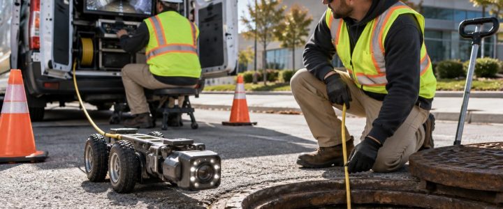
A private utility locator can investigate utilities beyond the scope of public one-call markings, subject to access and site conditions. The technician may use direct connection, induction, passive sweeps, and other methods appropriate to the target and setting. Ground penetrating radar can be a useful supplemental tool, but results should be interpreted alongside other evidence. GPR response can vary with soil, moisture, depth, target size, and site clutter, and an observed anomaly may not identify the utility’s purpose or ownership.
Field designations should be tied to the planned work. A broad sweep may be appropriate for early planning, while a dense, focused investigation may be needed at a proposed crossing or foundation line.
5. Compare findings and identify unresolved conflicts
Overlay record information, visible features, designations, and proposed construction limits. Look specifically for conflicts, gaps, and contradictions. Do not average conflicting information into a false sense of precision. Instead, identify what is known, what is estimated, and what must be verified.
6. Test-hole the locations that control the decision
Place test holes where they answer a construction question: at a proposed crossing, adjacent to a deep excavation, at a utility cluster, or where a line’s elevation affects a new design. Before exposure, coordinate site access, traffic control, restoration expectations, utility-owner requirements where applicable, and the work zone protection needed for the site.
With vacuum excavation, crews can carefully expose the utility under controlled conditions. The observed position should be measured from a documented surface reference. If the project needs survey-grade coordinates or elevations, involve the appropriate survey professional and establish the required control before field work begins.
7. Update the plan before mobilizing heavy excavation
Use the verified findings to revise the excavation approach, adjust design elevations, relocate a proposed feature, add protection measures, or change the construction sequence. Share the results with the superintendent, excavation crew, design team, and any affected facility representatives. A test-hole report that stays in an email folder does not reduce field risk.
What to document at each verified exposure
Clear documentation allows a test hole to support the next project decision. Depending on the project scope and access, useful information may include:
- Test-hole location and a reference to project control or recognizable site features.
- Date, weather, ground surface type, and the surface reference used for measurements.
- Observed utility type when it can be reasonably identified in the exposure.
- Measured depth and horizontal position at that specific test-hole location.
- Outside dimensions, visible material, configuration, and condition observations where safely visible.
- Photographs, notes about congestion, and any limitations on the observation.
- Backfill and restoration status.
Descriptions should distinguish observed facts from assumptions. For example, “a 4-inch orange conduit was observed at the test hole” is different from declaring its owner, contents, or full route. Additional coordination may be needed to confirm ownership, status, or operational requirements.
Common mistakes that leave depth risk unresolved
Treating a locate depth estimate as a dig authorization
Estimated depth is useful information, but it should not be treated as a substitute for safe excavation practices or physical verification where the work is close to the utility.
Exposing a utility too far from the actual conflict
A test hole at one location may not answer the question at a crossing 100 feet away. Place verification points where the utility and planned work interact.
Measuring from an inconsistent surface
Depth from existing pavement, proposed finished grade, and trench bottom are different measurements. State the reference surface clearly so the result is not misapplied later.
Assuming one exposed line explains the entire corridor
Utility corridors can contain multiple lines at different depths. A single exposure may verify one target while leaving nearby facilities unresolved.
Waiting until the excavation crew is already on site
Emergency potholing under schedule pressure limits options. Resolving critical depth questions during preconstruction or early mobilization gives the team more room to adjust safely.
Turn uncertainty into a defined field decision
Unknown utility depth is not always a problem that can be solved from the surface. The goal is to identify what the project needs to know, use designating methods to narrow the uncertainty, and physically verify the utilities that control the work.
For projects in Pennsylvania, New Jersey, Delaware, Maryland, New York, or the Washington, D.C. to New York City corridor, Visionary Subsurface Solutions can help evaluate where private utility locating, SUE, and Vacuum Excavation & QL-A test holes fit into the investigation. Contact the team to discuss the planned work, available records, and the questions that need to be resolved before excavation begins.