Before scheduling ground penetrating radar utility locating, contractors and engineers often ask one practical question: Will GPR work on this site?
The honest answer is that it depends. Ground penetrating radar can be a valuable part of underground utility detection and subsurface investigation, especially where records are incomplete or non-metallic utilities may be present. But GPR does not produce a simple underground photograph, and it does not perform the same way in every soil or every project area.
A useful GPR survey starts with understanding the site conditions, the project decision at stake, and the limits of the method. That preparation helps the project team choose the right combination of GPR, electromagnetic (EM) locating, records review, visual inspection, and vacuum excavation.
This guide explains the conditions that affect GPR results and how to decide whether professional GPR services are appropriate before excavation, drilling, coring, trenching, or design work.
What GPR detects underground
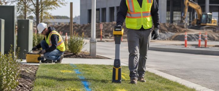
GPR sends electromagnetic energy into the ground or another material, then records reflections caused by changes in subsurface electromagnetic properties. A reflection may be associated with a pipe, duct bank, utility trench, void, buried structure, reinforced concrete, change in soil, or another anomaly.
That distinction matters. A GPR operator detects and interprets a response; the response is not automatically identified as a specific utility. A linear feature at a consistent depth may be interpreted as a likely pipe or conduit, but its material, owner, service, and exact position still may be uncertain without supporting evidence or physical verification.
Industry guidance from the Federal Highway Administration and research published by the U.S. Army Engineer Research and Development Center both describe GPR as a method that responds to contrasts in subsurface properties and whose results are influenced by site conditions. In practice, that means an experienced interpretation and a coordinated investigation plan are as important as the radar equipment itself.
When GPR utility locating is most useful
Ground penetrating radar utility locating is often considered when the project team needs information that EM locating alone may not provide. EM methods can be highly effective for tracing conductive lines, accessible tracer wires, and utilities that can be connected to a transmitter. GPR can add useful evidence where a suspected target is non-conductive or where the team needs to investigate broader subsurface conditions.
Common uses of GPR for construction include:
- Screening an excavation, bore pit, trench, or grading area for possible undocumented features.
- Investigating potential PVC, HDPE, concrete, fiberglass, or other non-metallic pipes where conditions are favorable.
- Searching for utility trenches, abandoned lines, buried foundations, tanks, slabs, or disturbed ground.
- Reviewing paved areas before saw cutting, pavement removal, utility installation, or roadway work.
- Supporting a utility conflict investigation when plans, surface evidence, and prior marks do not agree.
- Locating likely crossings or changes in alignment that need targeted verification before directional drilling or excavation.
- Scanning concrete to identify reinforcement and other embedded features before coring or drilling, using methods and equipment suited to the structure.
For private utility locating, GPR is commonly used alongside EM locating rather than as a replacement for it. One technology may support or challenge the interpretation from the other. Where the consequences of a strike are high, test holes remain the way to physically confirm a utility’s actual horizontal and vertical position.
The site conditions that most affect GPR results
Soil type, clay, and conductivity
Soil is often the biggest factor in GPR performance. Radar energy can travel more effectively in some dry, resistive materials, such as clean sand and gravel, than in highly conductive materials. Clay-rich soils and saline or otherwise conductive ground can reduce penetration and weaken deeper reflections.
This does not mean GPR is useless in every clay area. Shallow targets, strong contrasts, and carefully selected survey lines can still provide useful information. It does mean the team should avoid assuming a particular investigation depth or expecting every target to be visible.
Moisture and changing ground conditions
Water changes the electrical properties of soil. After heavy rain, seasonal saturation, irrigation, ponding, or a utility leak, GPR data may look different than it would in drier conditions. Moisture can sometimes increase contrast around a feature, but it also can increase signal loss and reduce useful penetration.
Report any recent rain, groundwater issues, known leaks, or wet areas when requesting a GPR survey. These details help the field team set realistic expectations and select appropriate methods.
Target size, depth, orientation, and material
Larger and shallower targets are generally easier to distinguish than small, deep targets. A pipe’s orientation relative to the survey path also matters. GPR operators collect multiple, closely spaced lines because a single pass can miss or poorly define a narrow target.
Non-metallic utility locating is possible because the pipe itself, the material around it, or the trench envelope may create a detectable contrast. However, a plastic pipe may be difficult to distinguish if it is small, deep, empty, aligned unfavorably, or surrounded by similar material. Metallic utilities can also be difficult to interpret if the ground conditions are poor or the area is congested.
Utility congestion and nearby structures
Congested corridors are challenging for every locating method. Multiple pipes, conduits, duct banks, backfilled trenches, reinforcement, and surface features can create overlapping responses. A GPR anomaly may represent one object, several closely spaced objects, or disturbed soil associated with prior construction.
Near buildings and industrial facilities, slabs, foundations, rebar, mesh, equipment pads, fences, and surface metal can further complicate the survey. A professional investigation may divide the site into priority zones and use focused GPR grids, EM methods, accessible utility entry points, and selected test holes to resolve the most important conflicts.
Surface access and pavement condition
GPR antennas need reasonably consistent contact with, or close coupling to, the surface. Smooth pavement and concrete can support organized survey grids. Heavy debris, standing water, dense vegetation, rough riprap, severe rutting, parked vehicles, pallets, and active operations can limit coverage or data quality.
Asphalt and concrete are not automatically barriers to GPR. However, pavement thickness, reinforcing steel, wire mesh, overlays, and subsurface layers can affect what can be interpreted below the surface. A scan of pavement should not be treated as proof that deeper utilities are absent.
Frequency selection: the depth and resolution tradeoff
GPR antennas operate at different frequencies. Higher-frequency antennas can provide more detail at shallower depths. Lower-frequency antennas may investigate deeper conditions in favorable materials, but they provide less detail and may be less effective at separating closely spaced targets.
There is no single “best” antenna frequency and no universal maximum depth for GPR utility detection. The appropriate setup depends on the target size, expected depth range, material conditions, surface access, and purpose of the investigation. A utility conflict beneath a shallow slab and a search for a larger buried feature beneath an open field are different survey problems.
What a professional GPR survey can and cannot establish
A well-planned GPR survey can provide a project team with interpreted evidence of likely utilities or other subsurface features, approximate horizontal alignments, areas of concern, and locations that deserve further investigation. Survey results may support markings, field sketches, mapping, design coordination, or recommendations for verification.
GPR alone cannot reliably establish all of the following:
- That every underground utility has been detected.
- The owner, service, or operating status of a detected feature.
- The exact material of every pipe or conduit.
- An exact depth under all conditions.
- The internal condition, blockage, or capacity of a buried pipe.
- Physical confirmation of a utility’s location before excavation.
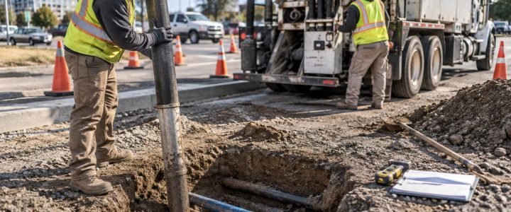
Depth estimates from GPR are interpretations based on travel time and estimated subsurface properties. Because those properties vary, estimated depths should be treated with appropriate caution. If an excavation, drilled shaft, HDD crossing, or other operation depends on a precise location, daylighting with vacuum excavation is the appropriate next step.
For projects requiring a structured utility investigation for design, GPR data can contribute to a broader Subsurface Utility Engineering and QL-B effort. Collecting GPR data by itself does not automatically establish a SUE Quality Level or replace the documentation, coordination, and verification required for the project scope.
How to prepare a site for GPR survey services
A little preparation can improve coverage and reduce delays. Before the field visit, provide available utility plans, prior locate information, as-builts, site plans, proposed excavation limits, and any known utility access points. Even incomplete records can help target the work.
On site, try to:
- Define the decision the survey must support, such as a bore path, footing location, trench route, core location, or excavation boundary.
- Mark or provide a drawing of proposed work limits.
- Remove movable obstructions where safe and practical.
- Identify restricted areas, traffic concerns, active equipment, and access requirements.
- Point out evidence of prior utility work, patches, vaults, cleanouts, valve boxes, manholes, and wet areas.
- Allow time for test holes when findings affect a high-risk construction activity.
When GPR alone is not enough
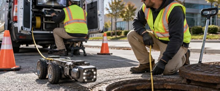
Bring in additional investigation methods when the consequences of uncertainty are high, data are ambiguous, or the site conditions limit radar performance. EM locating may help trace a conductive utility that GPR cannot clearly resolve. Pipe inspection may be more appropriate when the question is the condition inside an accessible sewer or drain. Vacuum excavation can expose the target and document its size, material, depth, and direction at a critical crossing.
This layered approach is especially important before deep excavation, directional drilling, foundation work, utility relocation, or work near hospitals, campuses, industrial facilities, and other sites with complex private utility systems.
FAQ: GPR utility detection before construction
Can GPR locate PVC or HDPE pipe?
Sometimes. GPR may detect a response from the pipe, its contents, or the surrounding trench material. Success depends on the soil, moisture, pipe size, depth, orientation, and contrast with surrounding materials. A non-metallic pipe is not automatically detectable.
Is GPR better than electromagnetic locating?
Neither method is universally better. EM locating is often effective for conductive utilities or accessible tracer wires. GPR can provide additional information about non-conductive utilities and other anomalies. Using both methods, when appropriate, gives the project team more evidence than relying on either one alone.
Does a clear GPR scan mean it is safe to excavate?
No. A clear or inconclusive scan does not prove an area is free of utilities. Follow the project’s utility damage-prevention process, use available records and required notifications, and physically verify critical conflicts before excavation.
Plan the investigation around the construction risk
GPR is most valuable when it is used to answer a defined project question: What may be beneath this proposed trench? Is there evidence of a crossing along this drill path? Where should the team place test holes? Which parts of a site need more investigation before design is finalized?
Visionary Subsurface Solutions provides GPR utility locating, private utility locating, utility mapping, and verification support throughout Pennsylvania, New Jersey, Delaware, Maryland, New York, and the Washington, D.C. to New York City corridor. Contact our team to discuss your site conditions, proposed work, and the level of subsurface information your project needs.