When a project team encounters an undocumented utility corridor, an unexplained pavement settlement area, or a proposed drill location with limited records, the immediate question is often: “What is down there?” Ground penetrating radar (GPR) can be a valuable part of the answer. It can help identify buried utilities, structural remnants, changes in subsurface materials, and other anomalies that deserve attention before excavation, drilling, coring, or design decisions.
However, a GPR survey is not an underground camera. GPR utility detection identifies reflections created by contrasts in subsurface electromagnetic properties. A trained professional reviews the data, compares it with site conditions and other evidence, and develops an interpretation. That interpretation may indicate a likely utility or feature, but a critical finding may still need to be traced with electromagnetic (EM) locating equipment or physically exposed with a test hole.
For contractors and engineers, the practical value of GPR is knowing where uncertainty exists, narrowing the investigation area, and choosing the right next step before work creates a utility strike, design conflict, or avoidable delay.
How ground penetrating radar detects buried features
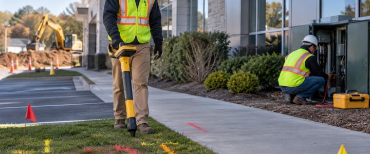
A GPR antenna sends short electromagnetic signals into the ground or a concrete element. When those signals encounter a boundary between materials with different electrical properties, part of the signal may return to the antenna. The equipment records the timing and strength of those returned signals as the operator moves across the survey area.
A pipe, the soil around a pipe, a void, a foundation edge, reinforcing steel, and a change from fill to native soil can all create reflections. On a profile view, a small rounded object such as a pipe may produce a curved pattern. Larger or continuous features may produce linear or layered responses. The pattern alone does not prove the identity of an object.
The basic operating principle and the importance of material contrast are described in guidance from both the Federal Highway Administration and the U.S. Army Corps of Engineers. Both also recognize that site conditions strongly affect the usefulness of the data.
What a GPR survey may help identify
Ground penetrating radar services are often used when there may be utilities or buried features that are not fully represented in plans, markings, or owner records. Depending on site conditions, survey access, and the survey objective, GPR may help identify:
- Possible buried utility alignments and crossings
- Non-metallic utility candidates, including some PVC, HDPE, concrete, and other plastic or non-conductive pipes
- Metallic utilities and conduits, particularly where they produce a clear contrast with surrounding soils
- Abandoned lines, ducts, foundations, tanks, slabs, and buried debris
- Changes in fill, subgrade, pavement structure, or near-surface geology
- Potential voids, loosened zones, or anomalous areas that warrant further evaluation
- Reinforcing steel, conduits, post-tensioning tendons, and other features in concrete when scanning is performed for that purpose
For a proposed excavation, the most useful result may be an interpreted plan-view map that shows marked areas of concern and the confidence or limits associated with each finding. For a roadway or paved site, the survey can also help the team decide where targeted test holes or other investigation methods are most justified.
Why GPR can help with non-metallic utility locating
EM utility locating works by detecting an electromagnetic field associated with a conductive utility or a conductive tracer wire. That makes it highly useful for many power, communications, and metallic pipe systems. A plastic pipe without a tracer wire generally cannot be directly traced by conventional EM methods.
GPR operates differently. It may detect the pipe itself, the disturbed soil envelope around it, water in or around the line, or another contrast associated with the installation. This is why GPR can be a useful addition to a private utility locating investigation where non-metallic lines are suspected.
That does not mean every plastic utility will appear clearly. Small diameter pipe, greater depth, poor contrast with surrounding soil, unfavorable orientation, wet clay-rich soil, and congestion can all reduce detectability. A lack of a clear GPR response is not evidence that no plastic utility is present.
What GPR cannot reliably determine by itself
A responsible GPR interpretation separates what the data shows from what can be confirmed. GPR alone generally cannot reliably determine:
- The owner of a utility
- The exact material, size, use, or operational status of a buried line
- Whether a pipe is active, abandoned, full, empty, pressurized, or safe to disturb
- The exact depth of every target without site-specific calibration and verification
- Whether every utility in the survey area has been detected
- The precise horizontal and vertical position needed for a critical excavation or design conflict
Depth estimates from GPR depend on the assumed signal velocity in the material being surveyed. Actual velocity can vary across a site. As a result, depth should be treated as an interpreted estimate unless it has been correlated to known conditions or verified by another method. A utility shown on a GPR profile may also be offset from the scan line, which adds another reason to collect data in multiple directions and use a defined grid where practical.
Site conditions that affect GPR utility detection
GPR performance is highly site-specific. Before relying on a GPR survey for construction decisions, project teams should understand the conditions that can improve or limit results.
Soil type and moisture
Dry, resistive soils often allow signals to travel farther than wet or conductive soils. Clay-rich soils, saline conditions, and high moisture can absorb or scatter GPR energy, reducing penetration and making deeper targets difficult to interpret. Conditions can also change after rain, flooding, or seasonal groundwater variation.
Antenna frequency and survey purpose
Higher-frequency antennas can provide finer detail near the surface but generally have less useful penetration. Lower-frequency antennas may investigate deeper conditions in favorable materials but provide less detail for small or closely spaced targets. The appropriate antenna depends on the anticipated depth range, target size, ground conditions, and required resolution. There is no single frequency or depth capability that applies to every job.
Congestion and target orientation
Closely spaced lines can create overlapping reflections. Parallel utilities may be difficult to separate, especially when they are at different depths. A utility aligned in an unfavorable direction relative to a survey line can also be less distinct. Collecting perpendicular or gridded scan lines often gives the interpreter a better basis for identifying a continuous feature and separating it from isolated clutter.
Surface access and reinforced environments
GPR needs practical antenna contact or near-contact with the surface. Rough ground, dense vegetation, stored materials, parked vehicles, heavy surface debris, and uneven pavement can limit coverage. In concrete, dense reinforcing steel, wire mesh, closely spaced conduits, and thick or variable slabs can complicate interpretation. These conditions do not automatically prevent a survey, but they affect what can reasonably be concluded.
GPR and EM locating work better together
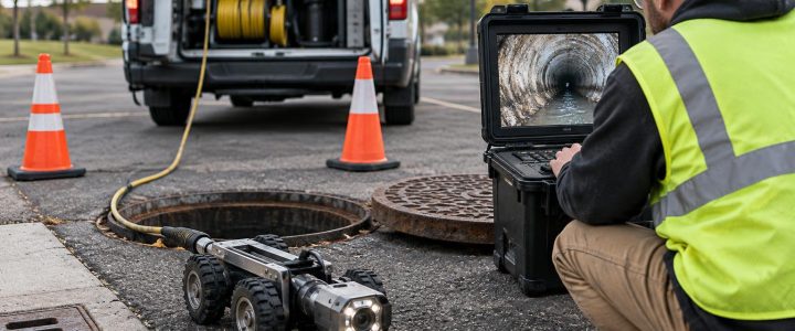
GPR and EM locating are complementary tools, not competing substitutes. A well-planned underground utility detection effort may use both technologies because they answer different questions.
- EM locating can trace a conductive line or tracer wire and may provide a continuous route where a usable signal can be applied or detected.
- GPR can identify other subsurface contrasts, including possible non-conductive utilities, structural remnants, and anomalies that do not carry a traceable EM signal.
- Records, visible features, and site observations provide important context for interpreting both types of data.
For example, an EM sweep may trace several known electrical conduits but leave an unexplained GPR response crossing a proposed bore path. That response may represent a non-metallic utility, an abandoned line, a trench boundary, or another buried feature. Rather than assuming it is harmless, the team can adjust the plan or select a targeted verification location.
For broader design work, these activities may support a Subsurface Utility Engineering and QL-B investigation. However, collecting GPR data alone does not automatically establish a particular ASCE 38-22 Quality Level. The scope, methods, records review, surface designation, geophysical results, and verification work all matter.
When a GPR indication needs physical verification
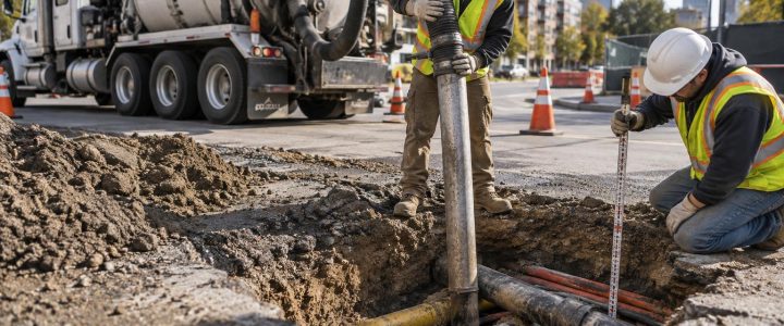
GPR is especially useful for screening and targeting, but critical decisions often require a higher level of certainty. Vacuum excavation or other approved exposure methods should be considered when a suspected utility affects:
- Excavation limits, shoring, or trench routing
- Directional drilling entry, exit, or bore path
- Proposed foundations, footings, piles, or utility crossings
- Deep coring, anchors, or penetrations near sensitive infrastructure
- Design elevations where a vertical conflict could change the project
- Work near high-consequence electrical, gas, steam, process, or communications systems
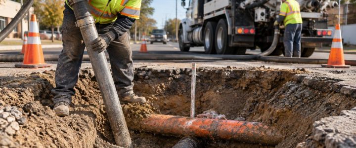
Physical exposure can establish the actual horizontal position, depth, material, size, and configuration at that location. It does not make the GPR survey unnecessary; it uses the survey information to place verification where it has the greatest value. Learn more about vacuum excavation and QL-A verification when a project requires direct utility confirmation.
How to prepare a site for professional GPR services
Preparation improves coverage and helps the field team focus on the project risk. Before a GPR survey, provide available utility plans, as-builts, prior locate markings, bore logs, site photos, and the proposed work limits. Clearly identify the reason for the investigation, such as a new water service, duct bank route, retaining wall, drainage repair, or core-drilling layout.
Where possible, remove movable obstructions from the scan area and provide safe access to pavement, slab, soil, or floor surfaces. Let the investigator know about known utilities, filled excavations, demolition debris, prior remediation, reinforced slabs, and recent rain or flooding. These details do not replace field investigation, but they improve interpretation and help define realistic survey limitations.
FAQ: Practical questions about GPR surveys
Can GPR find every underground utility?
No. Detection depends on the target and the conditions. Some utilities may not create a distinct response, may be too deep for useful data in the existing soil, or may be masked by clutter and conductivity. A professional report should identify relevant limitations rather than treating an area with no clear response as utility-free.
Can GPR tell us exactly how deep a utility is?
GPR can provide interpreted depth estimates, but estimates depend on site conditions and assumptions used to process the data. When depth is critical to safety, design, or construction means and methods, physical verification is usually the more reliable option.
Is GPR useful before excavation or drilling?
Yes. GPR before excavation, drilling, directional drilling, or coring can help identify areas requiring additional caution, alternative routing, EM tracing, or test holes. It is most valuable when used early enough to influence the work plan.
Use GPR findings as part of a defensible investigation
Ground penetrating radar can provide useful evidence where records are incomplete and subsurface conditions are uncertain. Its greatest value comes from matching the method to the project question, interpreting the data carefully, combining it with EM locating and available records when appropriate, and verifying high-risk findings before construction proceeds.
Visionary Subsurface Solutions provides GPR utility locating and subsurface investigation services across Pennsylvania, New Jersey, Delaware, Maryland, New York, and the Washington, D.C. to New York City corridor. Contact our team to discuss the unknown conditions on your project and develop an investigation approach that fits the planned work.