Congested utility corridors create a problem that markings, record drawings, and a single locating method may not solve: several buried lines may occupy the same narrow work area, cross at different elevations, or include private and abandoned infrastructure that is not well documented. Before excavation, drilling, pavement removal, or foundation work, the project team needs a realistic picture of where conflicts may exist.
GPR utility locating can be valuable in these conditions because it looks for changes in subsurface electromagnetic properties, not just a conductive signal on a utility line. That means Ground Penetrating Radar (GPR) may help identify likely non-metallic pipes, abandoned lines, ducts, foundations, and other anomalies that electromagnetic (EM) locating may not directly trace. It is not a stand-alone guarantee, however. Good results depend on site conditions, survey design, careful interpretation, and physical verification where the risk warrants it.
Why congested utility corridors need more than utility records
A congested corridor may exist along an urban street, within a commercial campus, near a building addition, at an industrial facility, or around a utility tie-in. It often contains a mix of public and private utilities, including electric, communications, gas, water, sanitary, storm, irrigation, and process piping.
Records and 811 markings remain important inputs, but they are not a complete subsurface investigation. They may not show private lines, abandoned infrastructure, field changes, or the precise position of older installations. A line shown in plan view may also conceal an important vertical issue: a crossing utility that is much shallower or deeper than expected.
For design and excavation planning, the practical question is usually not simply, “Is there a utility here?” It is, “What evidence do we have for utility paths, crossings, unknown features, and the locations that require verification before work proceeds?”
How GPR detects possible utilities and buried features
GPR transmits electromagnetic energy into the ground and records returning signals from boundaries or objects with different electromagnetic properties than the surrounding material. A buried pipe, trench backfill, void-like condition, reinforcing steel, foundation, or change in soil layer can create a response if there is enough contrast.
When a GPR antenna passes across a small, roughly linear buried object, the response may appear as a curved reflection pattern in the data. A trained operator reviews patterns across multiple parallel scan lines, compares them with visible site conditions and other locating data, and determines whether the response is consistent with a likely utility or another subsurface feature.
This distinction matters:
- Detection means the data shows a subsurface response or anomaly.
- Interpretation means the response appears consistent with a likely pipe, conduit, trench, structure, or other feature.
- Verification means the feature has been physically exposed or otherwise confirmed, allowing its actual position, depth, size, material, and configuration to be documented as appropriate.
GPR does not read labels on buried infrastructure. It cannot reliably determine utility ownership, service status, exact material, or exact depth from a radar response alone. Estimated depth is affected by the assumed signal velocity in the material and by the clarity of the reflection.
Where GPR utility locating is most useful in crowded areas
GPR surveys are often most useful when they are focused on a specific construction decision. Examples include:
- Reviewing a proposed trench, footing, bore path, or utility crossing before excavation.
- Investigating a corridor where records show multiple utilities but do not resolve their relative positions.
- Looking for potential non-metallic lines, such as PVC, HDPE, concrete, or other non-conductive pipe, where site conditions are favorable.
- Evaluating paved areas near buildings, loading zones, roadways, sidewalks, and parking lots for undocumented anomalies.
- Supporting private utility locating at facilities with service laterals, communications ducts, irrigation, site lighting, fire protection, and process lines.
- Investigating suspected abandoned utilities, old foundation remnants, buried tanks, filled trenches, or other obstructions before construction.
In a congested area, the value of GPR is often in adding evidence between or beyond EM-located lines. A radar response may point the team toward a potential conflict that should be included in the plan, investigated further, or verified with a test hole.
GPR and electromagnetic locating work better together
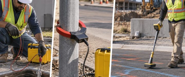
EM locating and GPR answer different questions. EM locating is often highly effective for tracing a conductive utility, a tracer wire, or an applied signal on an accessible line. It can provide a clear route for many electric, communications, metallic water, gas, and other conductive systems when a usable signal can be induced or directly connected.
GPR can add information when a line is non-conductive, has no accessible tracer wire, cannot carry a usable signal, or when the team is investigating features that are not utilities at all. Neither technology should be treated as universally superior.
A practical utility detection workflow may include record review, visible-feature review, 811 coordination where applicable, EM locating, GPR scanning, and comparison of all field evidence. Areas of disagreement deserve attention. For example, an EM-traced route that crosses a separate GPR anomaly may indicate multiple utilities, a crossing, a trench boundary, or an unrelated buried feature. The interpretation should be resolved before relying on the area for excavation clearance.
The Federal Highway Administration describes Subsurface Utility Engineering as a process that combines records research, surface geophysics, survey, and selective exposure to reduce uncertainty. Similarly, FHWA guidance on SUE and the ASCE 38-22 standard overview recognize that different levels of utility information provide different degrees of confidence. Collecting GPR data alone does not automatically establish a SUE Quality Level or replace the need for verification.
What can limit GPR results on a utility corridor
GPR performance changes significantly from site to site. The signal must travel through the ground, reach a target, and return with enough clarity to be recognized. Some sites produce useful, well-defined responses; others are highly challenging.
Soil composition and moisture
Clay-rich soils, conductive soils, and wet ground can reduce penetration and weaken reflections. This is one reason a successful survey at one property does not prove that GPR will perform the same way at another. Guidance from the U.S. Geological Survey on GPR and the Federal Highway Administration’s GPR reference material similarly notes that material properties, including moisture and clay content, affect signal penetration and data quality.
Depth, size, and antenna selection
Higher-frequency antennas generally provide finer detail closer to the surface, while lower-frequency antennas may investigate deeper conditions but with less resolution. There is no universal depth range for utility detection. The useful depth depends on soil conditions, antenna frequency, pipe size, target contrast, nearby features, and survey conditions.
Reinforcement and surface restrictions
Reinforced concrete, dense rebar, wire mesh, metal plates, and closely spaced conduits can create complex responses or mask deeper targets. Surface access also matters. Parked vehicles, stored materials, heavy vegetation, standing water, uneven terrain, and active traffic can limit scan coverage or reduce data consistency.
Utility congestion and orientation
Closely spaced lines can create overlapping responses. A utility that runs at an oblique angle to the scan grid may be harder to interpret than one crossed cleanly by multiple scan lines. Scanning in more than one direction can improve the understanding of a suspected feature, but it does not eliminate uncertainty.
How a professional GPR survey is performed
The field process should be designed around the work area and the decisions the project team needs to make. A typical GPR utility detection survey includes the following steps:
- Define the investigation area. Identify proposed excavation limits, drilling points, bore alignments, planned cuts, structure locations, and known utility access points.
- Review available information. Gather utility plans, prior surveys, record drawings, as-builts, 811 responses, and information from facility staff. These documents are clues, not proof of field location.
- Inspect the site. Note manholes, valves, meters, transformers, pedestals, inlets, cleanouts, building entries, pavement changes, and signs of prior excavation.
- Perform coordinated locating. Use EM locating where appropriate and scan selected areas with GPR on a planned grid or targeted transects.
- Interpret and correlate results. Compare GPR responses with EM marks, records, visible appurtenances, topography, and proposed work limits.
- Mark and document findings. Provide field marks and deliverables appropriate to the scope, while clearly distinguishing confirmed utilities from interpreted anomalies.
- Verify critical conflicts. Use vacuum excavation or another suitable method where horizontal position, elevation, size, material, or clearance must be known before construction.
When to move from GPR to test holes
A GPR survey can help prioritize where verification is needed, but it cannot safely substitute for physical exposure when the project depends on exact information. Test holes are especially appropriate when a utility crosses a planned trench, conflicts with a proposed bore, lies near a deep excavation, or affects structural design.
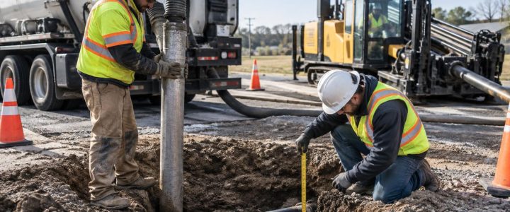
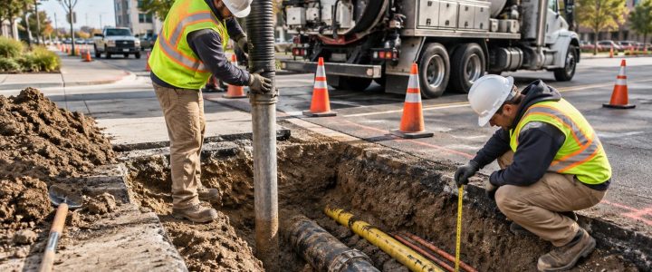
Vacuum excavation can expose a targeted location with less disturbance than conventional mechanical digging when performed under an appropriate work plan. It allows the team to document observed utility characteristics and measure elevation relative to a project datum. Learn more about Vacuum Excavation & QL-A when physical utility verification is needed.
How contractors can prepare for a GPR survey
Preparation helps the field team spend time investigating rather than clearing access issues. Before GPR services arrive, provide the proposed work plan and make the scan area reasonably accessible.
- Share site plans, utility records, prior locating reports, and known concern areas in advance.
- Identify the limits of excavation, drilling, coring, boring, or construction.
- Move vehicles, pallets, debris, and loose materials from the intended scan path where practical.
- Coordinate access, escorts, traffic control, and any site-specific safety requirements.
- Point out utility structures, building entries, old repairs, and locations where field crews have observed unknown lines.
- Plan enough time for investigation and, if needed, follow-up verification before the construction decision is final.
Frequently asked questions about GPR utility detection
Can GPR find plastic pipe?
Sometimes. GPR may detect PVC, HDPE, concrete, and other non-metallic pipes when the pipe or surrounding trench creates enough contrast with the surrounding ground. Results depend on soil conditions, moisture, depth, diameter, orientation, surrounding materials, and congestion. A non-metallic pipe should not be assumed located unless the field evidence supports that interpretation.
Can GPR give an exact utility depth?
GPR can provide an estimated depth to a reflection under suitable conditions, but it should not be treated as exact without verification. Depth estimates depend on the assumed radar-wave velocity and the ability to identify the correct target response. Test holes are the appropriate method when exact elevation or clearance is critical.
Can GPR identify every buried utility?
No. Some utilities may not produce a recognizable response, especially in wet or clay-rich soils, at greater depths, beneath reinforced surfaces, or in highly congested areas. A professional investigation manages this uncertainty by combining methods and identifying locations where verification is needed.
Plan the investigation around the construction risk
For crowded or undocumented utility corridors, the most useful question is not whether GPR can provide a perfect underground image. It is whether a coordinated GPR and utility-locating investigation can reduce uncertainty before the crew reaches a conflict.
Visionary Subsurface Solutions provides GPR utility locating, private utility locating, mapping, and verification support for projects throughout Pennsylvania, New Jersey, Delaware, Maryland, New York, and the Washington, D.C. to New York City corridor. Contact our team to discuss the work area, site conditions, and level of utility information your project needs before excavation or construction begins.