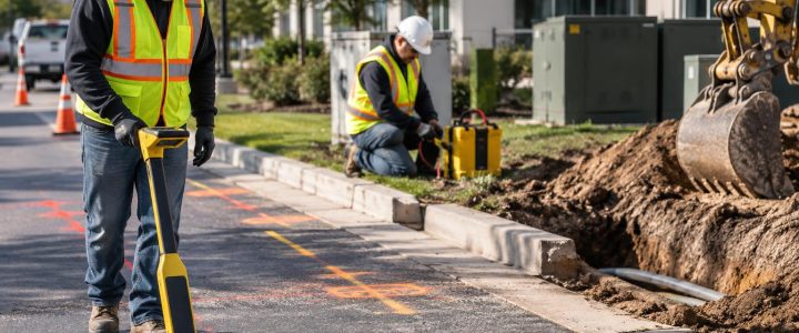
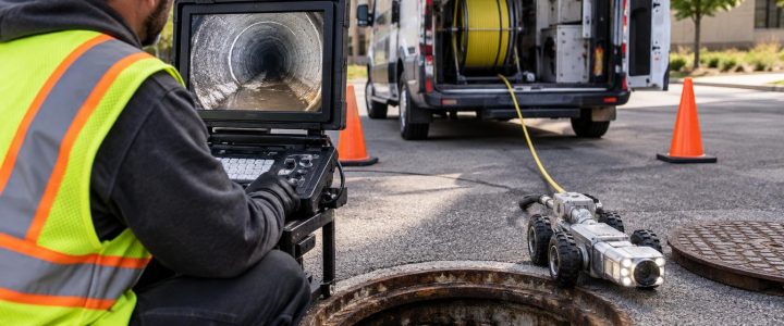
Roadway and parking lot work often starts with an assumption: the underground conditions are known well enough to mill, saw cut, core, trench, drill, or excavate safely. On older commercial sites, campuses, industrial facilities, and redevelopment parcels, that assumption can create costly surprises.
A ground penetrating radar (GPR) survey can help project teams investigate pavement areas where records are incomplete, utility marks do not explain every feature, or proposed work passes through an area with unknown subsurface conditions. GPR utility locating is particularly useful when the investigation may involve non-metallic pipes, abandoned lines, utility crossings, changes in pavement structure, possible voids, or other buried anomalies.
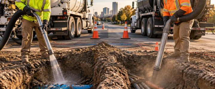
GPR is not a substitute for utility verification. It detects changes in subsurface electromagnetic properties, and a qualified operator must interpret the resulting data. A response may be consistent with a pipe, duct bank, buried structure, pavement layer, or another anomaly, but it does not by itself prove the identity, owner, material, or exact depth of an object. Where a utility location or elevation is critical to the work, vacuum excavation or a properly planned test hole may be needed to physically confirm it.
Why paved areas require a deliberate subsurface investigation
Paved surfaces can hide decades of construction changes. A parking lot may have been expanded over former buildings, utility corridors, drainage structures, abandoned tanks, or previous pavement sections. A roadway may contain multiple utility installations, repairs, sleeves, and crossings from different construction periods.
Common triggers for a GPR survey include:
- Planned trenching for new electric, telecom, water, gas, drainage, or site lighting work
- Directional drilling beneath a roadway or driveway
- Concrete or asphalt coring, saw cutting, anchoring, and sign or barrier installation
- Roadway widening, parking lot reconstruction, or drainage improvements
- Investigating settlement, repeated pavement failure, or a suspected subsurface void
- Design work where public marks and available records do not resolve private-side utility routes
- Redevelopment of an older commercial, industrial, municipal, or institutional property
The goal is not simply to produce more paint marks. The goal is to develop usable information for planning: where potential conflicts are located, where uncertainty remains, and where physical verification should occur before a crew commits to intrusive work.
How GPR utility detection works beneath pavement
GPR equipment sends electromagnetic energy into the ground and records reflected energy returning to the antenna. Reflections occur where the signal encounters a change in material properties. That contrast might occur at the boundary between asphalt and base material, at a concrete slab, around a pipe, within disturbed backfill, or at a void-like condition.
In a roadway or parking lot survey, an operator moves the antenna across planned work areas in organized lines or grids. The collected profiles are reviewed for patterns, shapes, continuity, depth-related timing, and relationships to visible structures and other field evidence.
A round utility running perpendicular to a survey line may create a curved response often called a hyperbola. That response is only one clue. The operator evaluates it across multiple passes, considers its alignment with valves, manholes, pedestals, inlets, and utility marks, and compares it with electromagnetic locating results where available.
What a GPR response can suggest
With favorable site conditions, a GPR survey may help identify:
- Likely utility alignments and crossings
- Possible non-metallic pipes, including some PVC, HDPE, concrete, or clay systems
- Metallic utilities and buried objects, although GPR does not depend on an object being conductive
- Duct banks, conduits, and areas of dense underground congestion
- Buried foundations, slabs, footings, tanks, or abandoned structures
- Changes in pavement thickness or subsurface layering
- Areas of disturbed material, possible loss of support, or other anomalies requiring further investigation
These findings should be expressed with appropriate confidence and limitations. A GPR response can indicate that an anomaly deserves attention; it cannot reliably assign a utility type based on shape alone.
Why GPR is useful for non-metallic utility locating
Electromagnetic (EM) locating is highly effective for tracing many conductive utilities, such as metallic pipes, cables, or non-metallic lines installed with a continuous tracer wire. But a plastic line without accessible or continuous tracer wire cannot always be directly traced with EM equipment.
GPR can provide an additional method because it responds to contrast between the pipe, its contents, bedding, backfill, and surrounding soil. This makes ground penetrating radar utility locating worth considering when crews need to investigate possible plastic water, sewer, storm, irrigation, or conduit systems beneath pavement.
That does not mean every plastic pipe will be visible. Detectability can depend on pipe size, burial depth, orientation, moisture, surrounding soil, backfill, the presence of nearby utilities, and the selected antenna frequency. A small plastic line in wet, clay-rich soil may produce a weak or unreadable response. A larger pipe in dry, uniform material may be much easier to interpret.
Conditions that can limit GPR surveys on roads and parking lots
GPR is a site-dependent method. Before relying on results for design or construction decisions, teams should understand the conditions that can reduce penetration or obscure targets.
Wet and clay-rich soils
Water and conductive soils can reduce signal penetration and make deeper responses difficult to interpret. Clay-rich soils are often challenging because they can attenuate GPR energy quickly. Recent rain, poor drainage, saturated subgrade, and deicing salt exposure may also affect data quality in some paved areas.
Reinforced concrete and dense construction
Concrete reinforcement can create strong, repeated responses that mask deeper features. This is common around concrete pavement, loading areas, building entrances, equipment pads, and structural slabs. GPR concrete scanning may still be valuable for locating reinforcement and shallow embedded features before coring, but the same reinforcement may limit the ability to see below the slab.
Congested utility corridors
Where several utilities run close together, reflections can overlap. Parallel utilities, duct banks, old abandoned lines, and repaired pavement sections can make an individual target difficult to distinguish. In these areas, GPR and EM locating are usually more useful together than either method alone.
Surface access and pavement condition
Standing water, loose debris, parked vehicles, traffic, uneven pavement, curbs, landscaping, and active site operations can limit the survey area or affect antenna contact. A survey plan should account for traffic control, access windows, and safe routes for field personnel.
GPR and EM locating: complementary tools, not competing methods
A practical utility investigation often uses more than one technology. EM locating can trace a conductive line or tracer wire and may provide a strong indication of a utility route. GPR can add information about non-conductive utilities, subsurface anomalies, pavement structure, and possible features that are not connected to an accessible conductor.
For example, an EM survey may trace an energized electrical feeder through a parking lot but show no direct signal on a nearby suspected storm line. GPR may identify a linear anomaly in that area that is consistent with a buried pipe. The two findings can help the team define the investigation, but neither automatically confirms the storm line’s material, size, service, or elevation. A planned test hole may be the appropriate next step if the line conflicts with proposed excavation.
For private-side infrastructure, private utility locating can combine field evidence, EM methods, GPR where conditions support it, and clear documentation of findings and remaining uncertainty.
A practical workflow for a roadway or parking lot GPR survey
1. Define the construction decision
Start with the proposed work limits and the decision the investigation must support. Is the concern a trench route, a bore path, a series of light pole foundations, drainage inlets, or pavement coring? A focused scope produces more useful data than a broad scan with no defined purpose.
2. Gather available information
Provide utility records, design drawings, as-builts, previous locate sketches, 811 responses where applicable, drainage plans, and photographs. Records are valuable starting points, but they should be compared with field conditions rather than treated as final proof.
3. Clear and mark the survey area
Move vehicles, pallets, dumpsters, and loose materials where possible. Identify planned saw cuts, bore paths, excavation limits, or core locations in the field. If the area is active, coordinate safe access and traffic control before the survey begins.
4. Collect GPR and supporting locate data
The field team surveys along planned alignments and, when needed, across them. Cross-lines are important because they can help distinguish a continuous linear feature from isolated clutter. EM locating, visible utility features, and records are considered alongside GPR responses.
5. Interpret results and identify uncertainty
A useful deliverable distinguishes between observed evidence and interpretation. It should identify likely utility routes or anomalies, explain important limitations, and flag locations where a conflict remains unresolved.
6. Verify critical conflicts before intrusive work
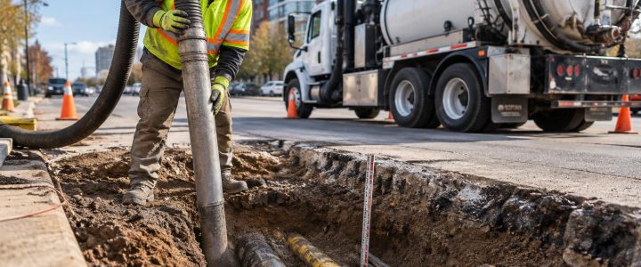
If a suspected line affects excavation depth, bore clearance, structural footing placement, or a high-consequence cut, physically expose it before relying on its position. Vacuum excavation and QL-A test holes can verify the horizontal position, vertical position, size, material, and condition visible at the exposure point.
What a GPR survey can provide to the project team
A professional GPR survey can support early decisions without overstating certainty. Depending on the scope and conditions, project teams may receive marked field findings, annotated plans, utility sketches, photographs, a written summary, or recommendations for additional investigation.
For engineering projects, GPR findings may also help prioritize a broader utility investigation. Subsurface Utility Engineering follows a structured process for managing utility information and uncertainty. GPR data alone does not automatically establish a specific ASCE 38-22 Quality Level, but it can contribute valuable evidence when used as part of a coordinated investigation. Learn more about Subsurface Utility Engineering and QL-B services when design decisions require a more formal utility engineering approach.
Common misconceptions about GPR in paved areas
“GPR sees every utility.”
No. Results vary with soil conditions, target characteristics, depth, congestion, reinforcement, surface conditions, and the survey approach. GPR may not detect every line, especially small or deep features in difficult soils.
“A GPR mark gives the exact depth.”
GPR depth estimates depend on interpreting travel time and estimating the signal velocity through site materials. They should be treated as estimates unless verified. Material changes, moisture, and uncertain velocity can affect the result.
“A strong response proves the type of pipe.”
No. Strong reflections indicate contrast, not identity. A response may be consistent with a pipe or another buried feature. Records, EM results, surface evidence, and test holes help resolve the interpretation.
“Pavement makes GPR ineffective.”
Not necessarily. Asphalt and concrete areas can be practical survey surfaces, but pavement construction, reinforcement, moisture, and underlying soil conditions still affect results. The question is whether site conditions support the information needed for the construction decision.
When to bring in professional GPR services
Consider professional GPR utility locating services before pavement work when the consequences of an unknown condition are significant, utility records are incomplete, non-metallic lines may be present, or planned work cannot tolerate an unverified crossing. Early investigation is especially useful before drilling, directional boring, deep saw cutting, excavation near buildings, or redevelopment work in older paved areas.
Visionary Subsurface Solutions provides GPR surveys, private utility locating, utility mapping, and verification support for projects throughout Pennsylvania, New Jersey, Delaware, Maryland, New York, and the Washington, D.C. to New York City corridor. Contact our team to discuss your roadway, parking lot, or site investigation and determine the right level of utility detection and verification for the work ahead.