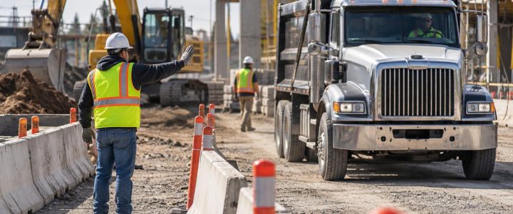
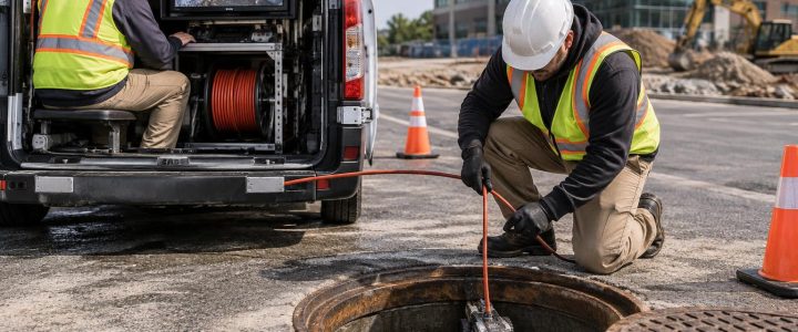
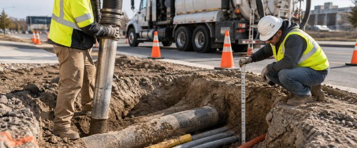
Before a project team drills a soil boring, starts a foundation excavation, installs sign footings, or cuts into pavement, one question needs a practical answer: what may be below the surface?
Record drawings, utility marks, and visible structures are important starting points, but they do not always show every private line, abandoned utility, buried foundation, tank, or change in subsurface conditions. A professional GPR survey before construction can add useful information where underground conditions are uncertain.
Ground penetrating radar, or GPR, is not a guarantee that every buried item will be found. It is a geophysical method that detects contrasts in subsurface electromagnetic properties. The data must be collected systematically and interpreted in context with site conditions, utility records, surface evidence, electromagnetic (EM) locating results, and, when the risk is significant, physical verification by test holes.
For contractors and engineers, the practical value of GPR is not simply a radar image. It is a better basis for deciding where to avoid intrusive work, where to adjust a layout, and where to investigate further before a costly or hazardous conflict occurs.
What a GPR survey can help investigate before construction
GPR sends electromagnetic energy into the ground and records reflections that return when the energy encounters a change in material or condition. A buried pipe, a duct bank, a concrete slab, a backfilled trench, and undisturbed soil can each create different responses because they do not transmit or reflect the energy in the same way.
In favorable conditions, GPR utility detection may help identify subsurface anomalies that are consistent with:
- Buried utilities, including some non-metallic pipes and conduits
- Utility crossings and possible congested corridors
- Abandoned utility lines or unknown service laterals
- Buried foundations, slabs, footings, and walls
- Possible tanks, vaults, pits, or other buried structures
- Backfilled trenches and disturbed ground associated with prior construction
- Changes in pavement structure or subgrade conditions
- Potential void-like or anomalous areas that require further investigation
A radar response is not the same as a confirmed utility. For example, a linear feature may be interpreted as a likely pipe or conduit based on its shape, continuity, location, and relationship to other evidence. It could also represent a trench boundary, a buried structural element, or another subsurface change. This distinction matters when the next step is excavation, drilling, or coring.
Why GPR is useful on redevelopment and addition projects
Unknown conditions are common on developed sites. A proposed building addition may cross former parking areas, demolished structures, old utility routes, or previous phases of construction. A new loading dock, retaining wall, or stormwater feature may require excavation in an area with incomplete records.
GPR services can be particularly useful when a team needs to investigate a defined work zone before committing to intrusive work. Common examples include:
- Screening a proposed foundation, pier, or pile location for indications of utilities or buried obstructions
- Reviewing routes for new water, sewer, gas, electric, communications, or fire protection services
- Investigating paved areas before trenching, directional drilling, or pavement removal
- Looking for evidence of old foundations or subsurface features before grading a redevelopment parcel
- Reviewing areas near buildings where private utility routes may be poorly documented
- Supporting design decisions where a proposed utility must pass through a potentially congested area
The survey area should match the construction decision. If crews will excavate a narrow utility route, a corridor survey may be appropriate. If a building footprint has multiple proposed columns and underground connections, the investigation may need a grid or a series of targeted scan areas. Scanning only the immediate point of a proposed bore may miss a nearby line that could be affected by equipment setup, entry pits, or an adjusted drilling path.
GPR and EM locating work better as a coordinated investigation
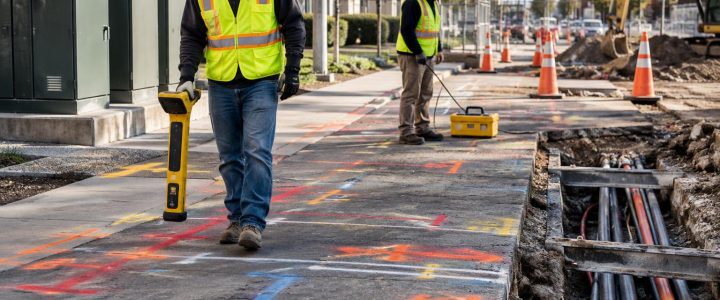
GPR is often most useful when it is paired with electromagnetic utility locating rather than treated as a replacement for it. EM locating can be highly effective for tracing conductive utilities or a conductive tracer wire when access and connection points are available. It may also help distinguish an active trace from other nearby radar responses.
GPR can add information where an EM signal is unavailable, weak, distorted, or not directly applicable. This may include some plastic, PVC, HDPE, concrete, or other non-conductive utility materials. A non-metallic pipe may produce a radar response because of the contrast between the pipe, its contents, the trench backfill, and the surrounding soil. That response depends heavily on conditions and is not assured.
A coordinated private utility locating investigation may include reviewing available records, observing site features, applying active and passive EM methods where appropriate, scanning selected areas with GPR, and comparing the results. When more than one method supports the same interpretation, the project team has stronger information for planning. When the methods disagree or conditions are complex, the disagreement is itself useful: it identifies an area where assumptions should not be carried into excavation.
How a professional GPR survey is performed
A useful GPR survey begins before the antenna moves across the site. The field team needs to understand the work scope, the proposed limits of disturbance, access constraints, and the consequence of missing a feature. A scan intended to support shallow sign footing locations is different from an investigation for a deep utility crossing or a major facility expansion.
1. Define the decision the survey must support
Provide the proposed excavation limits, drill locations, utility alignment, grading plan, or layout sketch whenever possible. Identify whether the project concerns a utility route, foundations, pavement removal, borings, drilling, or another activity. Also identify areas where a utility conflict would create a serious safety, operational, or schedule issue.
2. Review the surface and accessible evidence
Manholes, valves, meters, transformers, hydrants, building entries, utility pedestals, patch lines, and changes in pavement can all help frame the investigation. Available utility plans and prior survey data can be useful, but they should be treated as reference information rather than proof of current field conditions.
3. Select an antenna and scan pattern suited to the target
GPR antenna frequency involves a practical tradeoff. Higher-frequency systems generally provide better detail at shallower depths, while lower-frequency systems may investigate deeper conditions in favorable materials but with less detail. There is no single antenna or depth range that fits every site.
Field teams commonly collect parallel scan lines and, where appropriate, cross lines. A consistent grid can help show whether a response is continuous and linear, localized, or part of a broader subsurface pattern. For utility routes, scans may be taken across and along the proposed alignment to better assess crossings and possible parallel utilities.
4. Interpret data with other evidence
Interpretation considers the shape, depth estimate, continuity, orientation, signal strength, and relationship of radar responses to known surface features and EM results. The output may identify suspected utility paths, anomalies requiring caution, and areas where the data are inconclusive.
5. Mark, map, and verify where necessary
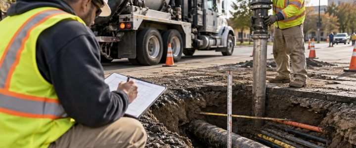
Field markings can communicate the interpreted path of a suspected feature, but markings should identify the basis and limitations of the finding. For design or high-risk excavation decisions, survey control and a documented deliverable may be needed. If the actual horizontal and vertical position, size, material, or condition must be known, targeted vacuum excavation test holes can physically expose the utility.
What affects GPR results
Ground penetrating radar does not “see” underground conditions the way a camera sees a room. Its performance changes from one site to another. A strong response at one location does not mean a similar item will be detectable elsewhere.
Important factors include:
- Soil composition: Clay-rich, conductive soils can reduce penetration and obscure deeper responses. Sandy or dry materials may be more favorable, but conditions still vary.
- Moisture and salts: Wet soils and conductive groundwater conditions can weaken or scatter radar energy.
- Depth and target size: Deeper and smaller targets are generally more difficult to resolve. A useful depth estimate also depends on the assumed radar-wave velocity for the material.
- Object orientation: A pipe or conduit that runs parallel to the scan direction may be harder to recognize than one crossed by the scan lines.
- Material contrast: A utility must create enough contrast with the surrounding ground or backfill to produce an interpretable response.
- Congestion: Multiple utilities, prior trenches, rubble, foundations, and varying backfill can create overlapping reflections.
- Surface conditions: Rough ground, standing water, heavy vegetation, traffic, metal grates, and limited access can affect coverage and data quality.
- Reinforcement and metal: Reinforced concrete and shallow metallic features can mask conditions below them.
For these reasons, a professional should be willing to report uncertainty. An inconclusive GPR area is not necessarily clear of utilities; it may simply be an area where site conditions limited detection.
What GPR cannot reliably tell you by itself
GPR data can be highly informative, but it has clear limits. A GPR survey alone does not reliably establish utility ownership, service status, precise material, pipe contents, or exact depth. It also cannot confirm that a detected response is a utility without supporting evidence or exposure.
Depth values deserve special care. A radar depth estimate is based on the travel time of the signal and an estimated velocity through the material. Soil conditions can vary across a site, so depth should be treated as an estimate unless it has been confirmed by physical exposure or another appropriate method.
Likewise, a clear-looking scan does not prove an area is free of buried utilities. Small lines, deeply buried features, conductive soils, cluttered conditions, and limited survey access can all affect what can be detected.
When test holes should follow a GPR survey
Use GPR to target verification, not to avoid verification when the project requires certainty. Test holes are often appropriate before work that could damage a critical utility or when design depends on the actual utility position.
Consider physical verification when:
- A proposed excavation, bore, or foundation is close to an interpreted utility or anomaly
- The project needs a confirmed elevation for a utility crossing
- Utility size, material, number of conduits, or configuration affects design
- EM and GPR results conflict or conditions are too congested for a confident interpretation
- A critical facility line could affect operations, safety, or project schedule
Vacuum excavation is a controlled method for exposing selected utilities and documenting observed horizontal position, depth, size, and material. It is the appropriate next step when a field interpretation must become a verified construction fact. Visionary Subsurface Solutions can support this progression through Vacuum Excavation & QL-A services.
How GPR fits with SUE and utility mapping
GPR is one tool within a broader subsurface investigation. Depending on the project, results may be combined with records research, surface-feature review, EM locating, survey, utility mapping, and test holes. This coordinated approach can support design, utility conflict review, and construction planning.
Subsurface Utility Engineering, or SUE, uses defined processes and documentation practices to manage utility information for engineering decisions. Collecting GPR data by itself does not automatically create a complete SUE investigation or establish a particular ASCE 38-22 Quality Level. The level of information depends on the methods used, the documentation provided, and whether utilities have been physically verified. Learn more about Subsurface Utility Engineering & QL-B when design-ready utility information is needed.
FAQ: GPR before excavation and drilling
Can GPR locate plastic pipe?
Sometimes. GPR may detect a plastic pipe, its trench, or a contrast associated with the pipe and surrounding materials. Results depend on soil conditions, pipe size, depth, orientation, moisture, backfill, and congestion. It should not be assumed that every PVC or HDPE line will produce a usable response.
Is GPR better than electromagnetic locating?
Neither method is universally better. EM locating is often effective for conductive utilities and tracer wires. GPR can add information about non-conductive utilities and other anomalies. Using both methods, when conditions warrant, provides a more complete investigation than relying on either one alone.
Should GPR be completed before geotechnical drilling?
It can be a prudent step where boring locations are near known or suspected utilities, buildings, paved areas, or undocumented site improvements. The needed survey extent should be based on the drilling plan and the potential consequences of encountering a buried feature.
Does GPR confirm a utility depth?
GPR can provide a depth estimate, but it does not physically confirm depth. If exact vertical position is required for clearance, design, or excavation planning, a test hole is generally the appropriate verification method.
Plan the investigation before intrusive work begins
A GPR survey is most valuable when it is ordered early enough to influence the plan. Give the investigation team the proposed work limits, available records, known utility concerns, access restrictions, and the decisions the findings need to support. That allows the survey to focus on the areas where uncertainty creates real construction risk.
For projects in Pennsylvania, New Jersey, Delaware, Maryland, New York, or along the Washington, D.C. to New York City corridor, contact Visionary Subsurface Solutions to discuss a practical GPR utility locating and subsurface investigation plan for your site.