Before a crew cores a slab, saw cuts a floor, drills an anchor, or installs a post-tension anchor, one question matters: what is inside the concrete and immediately below it? Plans can be incomplete, field changes may not be documented, and a small penetration can damage electrical conduit, plumbing, reinforcement, or post-tensioning steel.
GPR concrete scanning services help project teams investigate these conditions before intrusive work starts. Ground penetrating radar (GPR) can identify many embedded features by detecting changes in electromagnetic properties within concrete and the material below it. The results can help crews choose safer work locations, define areas needing more review, and decide where physical verification is appropriate.
GPR is a valuable investigation tool, but it is not an X-ray and does not make every embedded item visible. Concrete thickness, reinforcement density, moisture, aggregate, feature depth, and site access all affect what can be detected and interpreted. A professional survey should communicate both the findings and the limits of the work.
Why scan concrete before intrusive work?
Concrete is often treated as a known condition because it is visible and appears permanent. In reality, its internal layout may be uncertain. Buildings are renovated, utilities are rerouted, slabs are repaired, and original drawings may not match the area where work is planned.
Concrete scanning is commonly requested before:
- Core drilling for piping, ductwork, drains, and cabling
- Saw cutting for trenching, demolition, and slab removal
- Drilling for anchors, dowels, guardrails, racking, or equipment supports
- Installing post-installed rebar or structural connections
- Concrete demolition and selective removal
- Investigating suspected voids, former openings, or buried structural elements
- Planning work near electrical rooms, mechanical rooms, hospitals, data centers, laboratories, and industrial equipment
The goal is not simply to place marks on a floor. The goal is to give the contractor and engineer usable information for planning the work, avoiding known concerns, and escalating uncertain conditions before they become damage or delay.
How GPR concrete scanning works
A GPR antenna sends a low-power electromagnetic signal into the concrete. When the signal encounters a boundary between materials with different electromagnetic properties, part of the energy can reflect back to the antenna. Steel reinforcement, conduits, voids, changes in slab thickness, and interfaces between concrete and underlying material can create reflections.
The equipment records those reflections along a scan path. An experienced technician reviews the patterns, repeat-scans important areas in more than one direction, and compares the data with visible conditions and project information. A response may support an interpretation such as a likely reinforcing bar, a possible conduit, or a slab-bottom reflection. It does not automatically identify the exact material, owner, use, or condition of an item.
What the scanner detects
GPR detects contrast, not labels. For example, a metallic conduit, a plastic conduit with conductors inside, and a reinforcing bar may all produce reflections. Their likely identity is evaluated from characteristics such as depth, spacing, orientation, continuity, response shape, and the surrounding construction layout.
This is why professional interpretation matters. A single scan line can be ambiguous. Scanning a grid, reviewing perpendicular passes, and considering plans and accessible utility endpoints usually produce a more defensible picture than relying on one isolated signal.
What GPR can help identify in concrete
Conditions vary by structure, but GPR can often assist with detecting or assessing the following:
- Reinforcing steel: Rebar mats, individual bars, welded wire reinforcement, and some other reinforcement patterns may be visible when the concrete and scan conditions allow.
- Post-tensioning tendons: Tendons can create strong responses. Their presence is a critical reason to investigate before drilling or cutting, but GPR findings should be treated carefully and coordinated with structural information.
- Electrical and communication conduits: GPR may detect conduits, particularly when the conduit, conductors, or surrounding conditions create sufficient contrast. An electromagnetic locator may add value when a conductive utility can be accessed and traced.
- Plumbing and process piping: Metal piping can be responsive to GPR. Some non-metallic piping may also be detectable, but results depend heavily on the pipe size, depth, contents, orientation, and contrast with the surrounding concrete.
- Slab thickness and major interfaces: In favorable conditions, radar data may help estimate the location of the slab bottom or identify changes in slab construction. This is an interpretation, not a substitute for design records or physical measurement where exact thickness is critical.
- Anomalies: Unusual reflections can point to possible voids, previous patches, embedded objects, abandoned features, or changes in material. An anomaly should not be called a void or utility without adequate supporting evidence.
What GPR concrete scanning cannot reliably tell you
A common mistake is assuming that a scan provides a complete map of everything hidden in a slab. It does not. GPR does not reliably identify every object, determine whether a conduit is energized, confirm utility ownership, or prove the purpose of an embedded feature.
Depth estimates are also conditional. GPR measures travel time, then uses an estimated radar velocity to convert that time into depth. Actual velocity varies with concrete properties and moisture. As a result, a reported depth is an informed estimate that should be confirmed before work when clearance is limited or the consequence of contact is high.
GPR also cannot guarantee that every non-metallic pipe, small conduit, deeply embedded item, or closely spaced feature will be detected. Plastic, PVC, HDPE, and empty conduits can be difficult to see if they produce little contrast with the surrounding materials. A feature aligned with the scan direction or obscured by dense steel can also be missed or hard to interpret.
Conditions that affect GPR results
Concrete scanning should be planned around the actual structure, not a promised universal depth or accuracy. The following factors can materially affect data quality:
Reinforcement density and depth
A shallow, closely spaced rebar mat can mask deeper features. The radar energy may reflect strongly from the upper steel before it reaches lower reinforcement, conduits, or the bottom of the slab. Multi-layer reinforcement and post-tensioned construction require careful interpretation and may limit what can be resolved below the first layer.
Moisture, concrete composition, and age
Moisture and conductive materials can reduce signal penetration. Concrete mixture, aggregate type, salt exposure, repairs, and moisture conditions can change radar response from one area to another. A scan result from a dry interior slab should not be assumed to represent an exterior slab, equipment pad, or wet process area.
Feature size, orientation, and spacing
Larger and shallower features are generally easier to resolve than small, deep features. Parallel objects that are closely spaced may blend together. Scan direction matters as well: a feature can be easier to recognize when the antenna crosses it rather than travels along it. This is one reason professional GPR surveys commonly use a planned grid or multiple scan directions.
Surface access and condition
For reliable coupling with the slab, the antenna needs practical access to the surface. Loose debris, standing water, floor coverings, heavy stored materials, raised equipment, uneven surfaces, and tight work zones can limit coverage. The final markings should reflect the actual accessible scan area, not an assumed full slab survey.
Choosing the right investigation for the work
GPR is one part of a risk-based investigation. The right approach depends on the planned activity and the consequence of striking an embedded item.
For a small, shallow anchor away from sensitive areas, GPR concrete scanning may provide enough information to help select a location. For a large core through a structural slab, an occupied hospital floor, or an area with suspected post-tensioning, the project team may need a stronger verification plan. That could include reviewing structural drawings, checking accessible conduit routes, using electromagnetic locating where applicable, selecting a different penetration location, or opening a limited exploratory area.
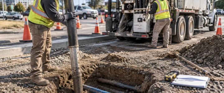
When work extends beyond the slab into soil, the investigation should also address underground utility risk. Concrete scanning does not replace private utility locating outside or beneath a building. Likewise, GPR findings alone do not create a complete Subsurface Utility Engineering deliverable or establish a specific ASCE 38-22 Quality Level. A broader investigation may combine records research, surface utility designation, survey, geophysics, and physical exposure based on the project need.
GPR scanning versus electromagnetic locating
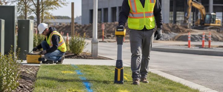
GPR and electromagnetic (EM) locating are often complementary. EM locating is especially useful for tracing accessible conductive utilities, such as metal pipe, tracer wire, or a cable that can be connected to a transmitter. In concrete, an EM locator may help trace a known energized or connected system, subject to field conditions and safe access.
GPR does not require direct connection to the target and can provide information about non-conductive features or other subsurface contrasts. That can make it useful when a utility cannot be accessed, when records are uncertain, or when the concern includes reinforcement and other embedded objects rather than only conductive utilities.
Neither method should be treated as a guarantee. Comparing GPR data, EM responses, visible evidence, drawings, and accessible endpoints can reduce uncertainty more effectively than relying on one method alone.
How to prepare for a GPR concrete scan
A little preparation helps the field team cover the important area efficiently and helps the project team receive more useful results.
- Define the work area. Mark or provide dimensions for every proposed core, cut line, anchor zone, trench, or demolition area. A scan is only as useful as the area it covers.
- Share available information. Provide structural drawings, utility drawings, prior scan reports, renovation records, and photos when available. These documents are useful context, but they should not replace field investigation.
- Make the surface accessible. Remove movable materials and identify areas that cannot be scanned because of equipment, finishes, or access restrictions.
- Identify operational constraints. Let the scanning team know about occupied spaces below, electrical hazards, security rules, shutdown restrictions, and locations where markings cannot remain.
- Coordinate timing. Scan before layouts are finalized and before crews mobilize for intrusive work whenever possible. Late scanning can still help, but it may leave fewer workable alternatives.
What a useful GPR concrete scanning deliverable should communicate
Field paint, chalk, tape, or other markings may help crews work around identified concerns. For critical work, project teams also benefit from clear documentation that states the scan area, notable findings, interpreted depths where appropriate, limitations, and recommendations for verification or additional investigation.
Before cutting or drilling, the superintendent, foreman, engineer, and trade contractor should understand what the markings mean. A marked line is not necessarily a confirmed pipe. An unmarked area is not proof that nothing is present. Clear communication prevents a field crew from treating preliminary findings as either absolute clearance or an unnecessary stop-work condition.
Frequently asked questions about GPR concrete scanning
Can GPR find PVC or plastic conduit in concrete?
Sometimes. GPR may detect a plastic conduit when there is enough contrast between the conduit, its contents, and the surrounding concrete. Detection is affected by conduit diameter, depth, orientation, moisture, reinforcement, and whether conductors or other material are inside. It should not be assumed that every PVC or plastic conduit will be visible.
Can GPR tell whether a line is live?
No. GPR detects reflected energy from material contrasts; it does not determine whether an electrical line is energized. Treat unknown electrical infrastructure cautiously and coordinate with the responsible facility representative and qualified electrical personnel.
Can GPR detect post-tension cables?
GPR can often show responses consistent with post-tensioning tendons, but interpretation can be challenging in heavily reinforced or complex slabs. If post-tensioning is suspected, avoid intrusive work until the condition has been evaluated with appropriate care and project-specific structural information.
Does a clean GPR scan mean it is safe to drill anywhere?
No. A clear or inconclusive scan does not guarantee that no embedded feature exists. The work plan should consider the scan coverage, site limitations, available records, drilling depth, and consequences of contact. Where the risk is high, use an appropriate verification method before proceeding.
Bring GPR into the plan before the crew starts drilling
GPR concrete scanning is most effective when it supports an early decision: where to core, cut, drill, or investigate further. It can reveal conditions that plans do not show, help avoid obvious conflicts, and give the project team a better basis for selecting verification steps.
Visionary Subsurface Solutions provides professional GPR services for construction and engineering work throughout Pennsylvania, New Jersey, Delaware, Maryland, New York, and the Washington, D.C. to New York City corridor. For work that requires physical confirmation of an underground or subsurface condition, our vacuum excavation and QL-A services can support a broader investigation. Contact Visionary Subsurface Solutions to discuss the scan area, planned work, available records, and the level of information your project needs.