Ground penetrating radar (GPR) can be a valuable part of underground utility detection before excavation, drilling, pavement removal, or site redevelopment. But a GPR survey is not simply a matter of rolling one antenna across the ground and receiving a complete underground map.
A key decision is antenna frequency. In practical terms, frequency affects the balance between how deeply radar energy may penetrate and how clearly the system may resolve smaller or closely spaced features. The best choice depends on the project objective, expected utility depths, surface access, soil conditions, and the level of detail needed for the next construction decision.
For contractors and engineers, the main takeaway is straightforward: GPR frequency should be selected to answer a defined field question, not chosen from a generic depth chart. A survey intended to identify shallow utility crossings before saw cutting has different needs than an investigation of potential abandoned lines beneath a parking area.
How GPR detects underground utilities and other features
GPR transmits electromagnetic energy into the ground or a structural element. Some of that energy reflects back when it encounters a contrast in electrical properties between materials. A buried pipe, duct bank, trench backfill boundary, void, reinforcing steel, foundation remnant, or change in soil conditions may create a detectable response.
The radar does not directly read a utility label. It detects patterns and contrasts in the data. An experienced technician interprets whether a response is consistent with a likely utility, a subsurface anomaly, reinforcement, a construction joint, or another feature.
This distinction matters on active project sites. A linear response may suggest a buried line, but GPR alone may not establish the utility owner, contents, material, service status, or exact depth. A response that appears pipe-like may also require additional investigation before it is treated as a confirmed utility.
Guidance from the U.S. Geological Survey and the Federal Highway Administration describes this same basic principle: GPR data depends on contrasts in subsurface properties, and performance is strongly affected by the materials being investigated and the survey approach.
The frequency tradeoff: penetration versus resolution
GPR antennas operate across a range of frequencies. As a general rule, lower-frequency systems may provide greater potential penetration in favorable materials, while higher-frequency systems can provide finer detail closer to the surface. That tradeoff is central to GPR utility locating.
Lower-frequency GPR antennas
Lower-frequency antennas are often considered when the investigation needs to look deeper into the subsurface, such as beneath roadway corridors, open fields, or larger paved areas. They may be useful when the project team is looking for deeper anomalies, larger buried features, broad trench zones, or utility alignments that are not expected to be near the surface.
The tradeoff is reduced resolution. Smaller pipes, tightly spaced utilities, and shallow details can be harder to separate clearly. In a congested corridor, several nearby lines may blend into a complex signal rather than appear as individually identifiable targets.
Higher-frequency GPR antennas
Higher-frequency antennas are generally better suited to shallow, higher-resolution work. They can be useful for applications such as concrete scanning, locating shallow conduits before coring, investigating near-surface features, or assessing utility risk immediately below pavement or slab surfaces.
Higher frequency does not mean better for every project. Its usable investigation depth can be limited, especially where soils are wet, conductive, or rich in clay. A high-resolution scan may provide excellent information near the surface while offering little useful information at the depths that matter for a proposed excavation.
The practical selection question
Instead of asking, “What depth can GPR reach?” a more useful question is: “What feature must we identify, at what approximate depth, and under what ground conditions?”
A professional GPR survey may involve one antenna frequency or more than one, depending on the site and scope. The field team may also adjust grid spacing, scan direction, data collection density, and interpretation methods to improve the chance of recognizing meaningful patterns.
Why soil conditions often control GPR results
Soil is not a neutral medium for radar. Its moisture level, mineral content, density, layering, and electrical conductivity can change how radar energy travels and reflects.
Clay-rich and wet soils
Clay-rich soils and wet ground can reduce GPR penetration because they can attenuate, or weaken, radar energy. In these conditions, a deeper pipe may not produce a usable response even if it is present. Surface water, recent rain, poor drainage, and seasonal moisture changes can also affect survey results.
This is one reason a universal GPR depth claim is not technically responsible. A radar system may produce useful deeper data in dry, resistive materials and much more limited data in wet, conductive soils only a short distance away.
Backfill, gravel, and disturbed ground
Utility trenches may contain backfill that differs from native soil. That contrast can sometimes make a trench zone visible even when the pipe itself is unclear. Gravel bases, cobbles, fill materials, and buried demolition debris can also create reflections that complicate interpretation.
Seeing a trench-like feature is useful information, but it is not the same as confirming the number, type, or exact position of utilities within that corridor.
Pavement and concrete conditions
GPR can be used on roads, parking lots, sidewalks, slabs, and other hard surfaces. The surface may provide an efficient area for scanning, but it can also introduce challenges. Thick or heavily reinforced concrete, multiple asphalt lifts, mesh, rebar, wire, and dense pavement repairs can create strong reflections that obscure deeper targets.
For shallow structural work, a concrete-focused GPR approach may help identify reinforcing steel, post-tension elements, conduits, and other features before coring or cutting. The survey scope should clearly distinguish this work from a broader underground utility investigation outside the slab.
What antenna frequency cannot solve
Selecting the right antenna improves the investigation method, but it does not remove the limits of GPR. A different frequency cannot guarantee detection of every utility or convert an ambiguous response into a confirmed line.
GPR may be limited when:
- Soils are highly conductive due to clay, moisture, or dissolved salts.
- A target is small, deep, damaged, poorly oriented for detection, or surrounded by similar materials.
- Multiple utilities are tightly grouped in a congested corridor.
- Metal reinforcement, scrap, debris, or surface features create overlapping signals.
- Access is blocked by stored materials, equipment, vegetation, traffic, or unsafe conditions.
- The target has little contrast with surrounding soil or backfill.
Non-metallic utility locating is a common reason to consider GPR. PVC, HDPE, fiberglass, concrete, and other non-conductive pipes may not be directly traceable with electromagnetic (EM) locating equipment unless a tracer wire, detectable tape, or other conductive component is present. GPR can sometimes identify these features when the pipe, trench, or surrounding material creates enough contrast. Results still depend on pipe diameter, depth, orientation, soil conditions, and nearby interference.
GPR and electromagnetic locating work better together
For many construction investigations, GPR and EM locating are complementary tools rather than alternatives.
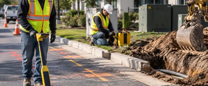
EM locating can be highly effective for tracing conductive utilities or accessible tracer wires. When a line can be connected to directly, clamped, or induced, EM methods may help follow its route and provide a depth estimate under suitable conditions. GPR can add information where EM signals are unavailable, uncertain, distorted, or unable to address non-conductive pipes and other subsurface anomalies.
A combined investigation may help a project team compare multiple lines of evidence:
- EM markings for traceable conductive utilities.
- GPR responses that indicate likely utility paths, trench limits, or unknown anomalies.
- Visible structures such as valves, meters, cleanouts, handholes, and manholes.
- Available utility records and as-built information.
- Physical verification where the work requires certainty.
This approach is especially useful around commercial buildings, industrial facilities, redevelopment sites, utility crossings, and older properties where private utility records may be incomplete.
When to use GPR before construction activity
Ground penetrating radar services are often worth considering when the consequence of an unknown underground condition is high. Common triggers include:
- Planned excavation, trenching, grading, or foundation work.
- Directional drilling or other trenchless installation methods.
- Proposed utility crossings and tie-ins.
- Drilling, geotechnical borings, soil nails, anchors, or probes.
- Pavement cuts, roadway reconstruction, or parking-lot improvements.
- Concrete coring, saw cutting, or slab penetrations.
- Site redevelopment where abandoned utilities, tanks, foundations, or undocumented lines may exist.
- Utility corridors that appear congested based on records, field evidence, or prior work.
Early GPR utility locating can help the team identify areas that need a closer look before finalizing an excavation path, bore profile, structure location, or construction sequence. It is most valuable when findings are incorporated into the design and field-planning process rather than collected after crews are already mobilized.
From a GPR indication to a field decision
GPR findings should be communicated with appropriate confidence. A useful deliverable may identify marked locations, interpreted alignments, anomalous areas, survey limits, access constraints, and recommendations for further investigation. It should not overstate uncertain information as fact.
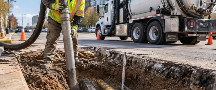
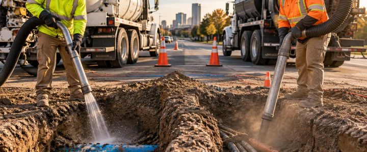
When a buried feature will affect excavation clearance, drilling elevation, or a critical design decision, physical exposure is often the appropriate next step. Vacuum excavation test holes can verify a utility’s actual horizontal position, vertical position, size, material, and field condition at a specific location. That verification is different from a GPR interpretation and should be planned before work approaches the suspected feature.
For larger design programs, GPR and other geophysical methods can support Subsurface Utility Engineering and Quality Level B investigation. However, collecting radar data alone does not automatically establish a particular ASCE 38-22 Quality Level. The scope, methods, documentation, interpretation, and verification performed all matter.
How to prepare for a professional GPR survey
Good preparation helps the field team focus on the areas that matter most. Before the survey, provide available utility records, site plans, prior locate markings, proposed drawings, and the specific construction limits. Identify planned excavation depths, bore paths, coring locations, and areas where utility clearance is critical.
On the day of the survey, make practical access arrangements where possible. Move parked vehicles, pallets, dumpsters, and loose materials from priority scan areas. Note locked gates, active traffic lanes, wet areas, surface hazards, and operating restrictions. If the work area is large, prioritize decision points rather than treating every square foot as equally urgent.
Bring in GPR services when the question is specific
The strongest GPR scopes begin with a clear construction or engineering question: Is there a likely utility crossing at this proposed trench? Are there shallow conduits below this core location? Does this paved area show evidence of a former trench or buried structure? Are non-metallic lines possible where EM locating found no traceable signal?
Visionary Subsurface Solutions provides GPR utility locating and subsurface investigation support for projects across Pennsylvania, New Jersey, Delaware, Maryland, New York, and the Washington, D.C. to New York City corridor. Contact our team to discuss your site conditions, planned work, and whether GPR, private utility locating, or physical verification is appropriate for the decisions ahead.