Electromagnetic (EM) utility locating is often one of the first tools used to identify underground utilities before excavation. It can be highly useful for tracing conductive pipe, conduit, cable, and tracer wire. In a congested utility corridor, however, the work is rarely as simple as following one clean signal from point A to point B.
Multiple buried conductors can carry or pick up the same signal. Nearby electrical systems, fences, reinforced concrete, overhead lines, and poor grounding conditions can affect the locator response. The result may be shifted markings, inconsistent depth estimates, or several possible paths that require further investigation.
For contractors and engineers, the practical question is not whether EM equipment can produce a mark. It is whether the information is reliable enough for the next project decision. That may mean preliminary layout, design coordination, potholing, trenching, directional drilling, or a critical crossing.
This guide explains how professional EM utility locating in congested areas is approached, what can complicate the results, and when to move from surface designation to physical verification.
Why congested utility corridors are difficult to locate
An EM utility locator detects an electromagnetic field associated with a conductive target or a signal applied to that target. In an open area with a single accessible metallic line, the signal may be relatively easy to trace. Congestion changes the signal environment.
A typical commercial site may contain electric, communications, gas, water, fire service, irrigation controls, site lighting, abandoned lines, grounding conductors, and building services within a small area. Some are active, some are private, and some may not appear on readily available plans.
Several conditions commonly make underground utility detection more difficult:
- Two or more conductive utilities run parallel or cross closely together.
- A transmitted signal transfers onto a neighboring conductor.
- One line is shallow while another is deeper, creating a stronger response from the shallow line.
- Utilities enter a building, vault, handhole, transformer, or substation where connections multiply.
- Reinforcing steel, metal fencing, guardrail, or other site metal carries or distorts the signal.
- There is limited access to connect a transmitter directly to the intended utility.
- An abandoned, disconnected, damaged, or poorly grounded line does not carry a traceable signal continuously.
These issues do not make EM locating useless. They mean the locator must assess the signal rather than assume that the strongest response is automatically the intended utility.
How EM signals can move beyond the intended utility
Signal coupling onto parallel utilities
When conductive utilities run near one another, a transmitter signal placed on one line can couple onto another line. This is especially common where long, parallel runs share a trench or corridor. A locator may then respond over more than one apparent utility path.
For example, a signal connected to a metallic water service may be detected on an adjacent electrical conduit or communications cable. The affected lines can appear to be one broad signal path, or they can produce competing peaks that change as the locator moves along the route.
A professional private utility locator looks for changes in signal behavior, compares readings at multiple points, and considers the known layout of accessible structures. When there is uncertainty, the area should be treated as a utility corridor rather than reduced to a single presumed line.
Bleed-off and poor continuity
Signal bleed-off occurs when the transmitted current leaves the intended route through nearby grounds, bonded systems, damaged insulation, branches, or other conductive paths. This can weaken the trace or cause the apparent route to change.
Poor continuity can create a similar field problem. A utility may be metallic but difficult to trace past an insulating fitting, break, valve arrangement, disconnected segment, or damaged tracer wire. A signal that ends at the surface does not prove the utility ends there. It may simply mean the locator can no longer trace that particular signal path.
Ambient interference and background signals
Passive locating uses naturally occurring electromagnetic fields, including power-frequency energy and radio-frequency signals present on some conductive utilities. It can help identify a possible utility path, but it does not identify every utility and may not distinguish one nearby conductor from another.
Active locating, where a transmitter applies a chosen signal, usually offers more control. Even then, electrical interference, overhead power, cathodic protection systems, traction systems, and industrial electrical equipment may affect the usable signal. A site near substations, rail infrastructure, large industrial facilities, or dense downtown electrical networks may need additional time and investigation.
What parallel utilities do to field markings and depth estimates
Surface markings are an important communication tool, but they are not a physical exposure. In congested ground, a line mark represents the locator’s interpretation of the detectable signal at the surface. The mark may require qualification where signals overlap, shift, or cannot be separated with confidence.
EM depth readings also require careful interpretation. The receiver estimates depth from the measured field geometry and the assumptions of the locating method. The reading is not a direct measurement of the top, centerline, or invert of every utility.
Depth estimates can be affected by:
- Signal distortion from nearby conductors, reinforced concrete, or structural steel.
- Signal coupling onto parallel lines.
- Off-center receiver position or an incorrect assumed route.
- Changes in utility direction, elevation, or alignment.
- Large-diameter pipe, multiple ducts, or bundled cables.
- A weak, unstable, or irregular signal.
- Shallow lines masking deeper conductive utilities.
For planning purposes, a depth estimate can help identify a potential conflict and prioritize investigation. It should not be used as the sole basis for machine-clearance decisions at a critical crossing. Where the horizontal position or elevation matters, vacuum excavation is the appropriate way to physically verify the utility.
A practical approach to EM utility locating for construction
Good results begin with a defined purpose. A locator needs to know whether the work supports a proposed bore path, a footing excavation, a utility replacement, a pavement cut, or early design. The required confidence level changes with the risk.
1. Define the work area and planned disturbance
Provide the locator with current plans, limits of excavation, proposed utility routes, boring alignments, staging areas, and known access restrictions. Clearly identify where the project needs answers, not just the overall property boundary.
For an excavation project, include anticipated depths, trench widths, equipment access, and proposed crossing locations. A narrow investigation area can miss a utility that curves toward the work zone.
2. Start with available information, but do not rely on it alone
Records, prior as-builts, utility maps, visible appurtenances, valve boxes, manholes, handholes, meters, electrical rooms, and mechanical rooms all help form an investigation plan. They are useful clues, not conclusive proof of location or current condition.
Public 811 marks should be requested before excavation as required by the applicable process. Those marks generally address participating public utility facilities within the ticket area. Privately owned services and site utilities beyond the utility’s point of delivery may not be included. A private utility locating scope can investigate these additional facilities and help close gaps before construction.
3. Use the best available access point and connection method
When an accessible conductive target is available, direct connection can place a trace signal on a specific cable, pipe, or tracer wire. A clamp can induce a signal onto an accessible cable or conductor without opening it. Induction may be used when direct access is not practical, but it can energize nearby conductors more readily in congested areas.
The appropriate method depends on the target, access, electrical safety considerations, surrounding congestion, and the field response. No one method is best for every site.
4. Trace, verify, and document uncertainty
A careful EM investigation checks the signal along the suspected route rather than marking from a single response. The locator may change frequencies, compare active and passive responses, inspect accessible features, and investigate signal changes near crossings and branches.
When the path cannot be isolated, the findings should communicate that uncertainty. A clear note such as “multiple conductive responses present” is more useful for construction planning than a false impression of precision.
Which utilities can EM equipment locate?
EM locating is most effective when the target can carry an electromagnetic signal. Common examples include metallic pipe, metallic conduit, electrical cable, communications cable with a conductive shield or tracer, and tracer wire installed alongside non-metallic pipe.
Plastic, PVC, HDPE, fiberglass, concrete, and other non-conductive facilities generally cannot be directly traced with standard EM equipment. They may be traceable if they have a continuous and accessible tracer wire, metallic tape, conductive component, or another installed means of applying a signal.
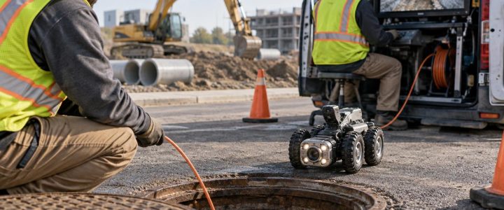
Even a tracer wire is not a guarantee of a complete locate. It may be broken, unconnected, poorly grounded, inaccessible, or coupled to another conductor. Non-metallic utility concerns may call for complementary methods, such as ground penetrating radar where site conditions are suitable, access-point investigation, CCTV and sonde locating for certain pipe systems, or test holes.
Where Quality Level B fits in the investigation
ASCE 38-22 describes a Quality Level framework for utility investigations. Quality Level B involves the use of appropriate surface geophysical methods to designate the horizontal position of existing subsurface utilities. EM locating can be one of the methods used for this purpose, particularly for traceable conductive utilities.
An EM locate by itself does not automatically create a complete Subsurface Utility Engineering investigation or resolve every utility on a site. The scope, methods used, records review, field conditions, survey control, deliverables, and unresolved findings all matter. For design-stage projects, Subsurface Utility Engineering and Quality Level B services can integrate surface designation into a broader utility-risk process.
The American Society of Civil Engineers describes ASCE 38-22 as a standard for investigating and documenting existing utilities, while the Federal Highway Administration also recognizes the role of utility investigation in reducing conflicts during project development. Review the ASCE 38-22 standard information and coordinate project requirements with the responsible design and construction teams.
When to move from EM locating to test holes
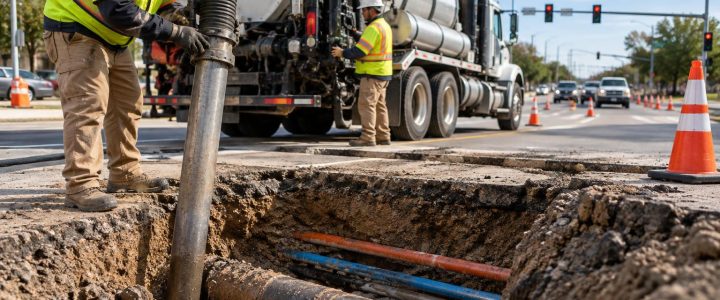
Vacuum excavation or other approved non-destructive exposure methods should be considered when a project needs actual physical confirmation of a utility’s location. This is especially important at proposed utility crossings, deep excavations, directional drill paths, structure foundations, and areas with multiple close utilities.
Test holes can verify information that surface EM methods cannot establish with certainty, including the exposed utility’s actual horizontal position, approximate elevation, size, material, and configuration at that location. They can also reveal whether the line identified on the surface is the utility that creates the conflict.
For high-consequence work, use the surface investigation to plan the test-hole program rather than treating designation as the final answer. Learn more about vacuum excavation and Quality Level A verification when physical exposure is needed.
Pre-locate checklist for contractors and engineers
- Request 811 utility markings through the applicable process before excavation.
- Identify private property limits, building service areas, and likely customer-owned utility systems.
- Send current plans and clearly mark proposed excavation, drilling, or structure limits.
- Provide known utility records, prior locate sketches, and available as-builts.
- Arrange access to electrical rooms, telecom spaces, mechanical rooms, manholes, vaults, meters, and other relevant features where appropriate.
- Remove temporary obstacles when practical and disclose locked gates, traffic controls, hazards, and site-access requirements.
- Identify critical crossings and state the required decision: preliminary avoidance, design data, or physical verification.
- Keep excavation equipment clear until required markings, documentation, and verification steps are complete.
FAQ: EM locating in congested areas
Can an EM utility locator identify every underground utility?
No. EM equipment is designed to detect electromagnetic fields associated with conductive utilities or conductive tracer systems. Non-conductive utilities without a usable tracer system may require other methods, and some conductive utilities may be difficult to trace because of access, damage, grounding, interference, or congestion.
Does a strong signal prove the marked line is the target utility?
No. A strong signal can come from the intended line, but it can also result from a shallow conductor, coupled signal, or nearby metallic feature. The locator should evaluate the trace along its route and consider the site conditions before relying on the finding.
Can EM locating provide an exact utility depth?
No. EM equipment provides an estimated depth based on the detectable signal and field conditions. It is useful for screening and planning, but physical exposure is needed when actual depth or clearance is critical.
When should a contractor hire a private utility locating company?
Bring in a private utility locator when planned work extends beyond public 811 coverage, when the property has private infrastructure, when plans are incomplete, when the site is congested, or when utility conflicts could affect cost, safety, schedule, or design. Early investigation generally gives the project more options for adjusting the work before crews mobilize.
Plan for uncertainty before excavation begins
EM utility locating is a practical and valuable way to trace many conductive underground utilities, but congested corridors demand careful interpretation. Treat marks and depth estimates as informed field findings, evaluate signal quality, and use test holes where the project needs confirmation.
Visionary Subsurface Solutions provides private utility locating, EM utility designation, SUE support, and vacuum excavation services across Pennsylvania, New Jersey, Delaware, Maryland, New York, and the Washington, D.C. to New York City corridor. Contact our team to discuss the utility risks, access conditions, and verification needs for your project before excavation begins.