Unknown underground pipe routes can slow design, complicate excavation, and make drainage problems difficult to solve. A manhole, catch basin, cleanout, or outlet may be visible, but the route between those features may be uncertain. Records may be incomplete, outdated, or inconsistent with field conditions.
Professional video pipe inspection can be a useful part of the investigation. A camera can document what is visible inside an accessible pipe, including its direction of travel, junctions, laterals, changes in material or diameter, obstructions, and defects. When paired with a transmitter, surface locating, and survey control, the inspection can also help a project team develop a more reliable understanding of the system.
However, a camera inspection is not the same as a complete utility survey or an engineering determination. The right approach depends on what the project needs to know, how accessible the system is, and how much certainty is required before construction or rehabilitation begins.
Start by defining the question the investigation must answer
“Locate the pipe” can mean several different things. Before scheduling field work, identify the decision that depends on the result. This helps determine whether CCTV pipe inspection alone is appropriate or whether the work should include locating, surveying, cleaning, test holes, or engineering review.
Common project questions include:
- Where does a catch basin or roof-drain line discharge?
- Does a storm drain connect to a public system, a detention structure, a culvert, or an unknown outlet?
- Which sanitary lateral serves a particular building or tenant space?
- Are two visible structures connected, and if so, by what route?
- Where does a suspected blockage, break, or root intrusion occur?
- Does an existing pipe conflict with planned grading, foundations, paving, or utility work?
- Is an abandoned-looking structure still connected to an active system?
- What is the condition of a pipe before rehabilitation, redevelopment, or property acquisition?
A clear question also prevents overreliance on a single method. For example, video may show that a pipe turns at a branch connection, but it does not automatically establish a survey-grade horizontal alignment or invert elevation. If the planned work requires precise coordinates or physical confirmation, additional investigation is usually appropriate.
What video pipe inspection can show inside an accessible pipe
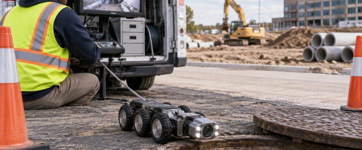
In a video pipe inspection, a camera is introduced through a suitable access point such as a manhole, cleanout, catch basin, inlet, or other opening. A push camera may be suitable for smaller accessible lines. A crawler or robotic pipe inspection platform may be used where pipe size, access, and site conditions allow.
As the camera travels through the pipe, the operator can observe and record visible conditions. Depending on the system and field conditions, the inspection may help identify:
- Pipe direction from the entry point
- Changes in pipe diameter, material appearance, or configuration
- Wyes, tees, junctions, manhole connections, and lateral connections
- Open joints, displaced joints, cracks, fractures, holes, or visible deformation
- Root intrusion, sediment, debris, grease, or construction materials
- Standing water, surcharge conditions, or flow that limits visibility
- Apparent offsets, collapses, blockages, or inaccessible reaches
- Outfalls, end sections, and other identifiable termination points
This information can be especially valuable when a drainage system is poorly documented. A camera run can reveal whether an inlet line actually reaches the downstream structure shown on a plan, whether a pipe branches before reaching that structure, or whether an obstruction stops the inspection short of the expected destination.
Video observations should be described as observations. A visible crack may be important, but video alone may not establish why it occurred, whether it extends beyond the visible area, or whether it has reduced the pipe’s structural capacity. Those conclusions may require cleaning, additional inspection, excavation, testing, or engineering analysis.
How camera-based pipe locating works
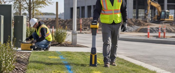
Many inspection systems can use a transmitter, often called a sonde, that emits a detectable signal from inside the pipe. A trained technician follows that signal at the ground surface with a compatible receiver. This process can help establish the approximate surface position of the camera at selected points or at a feature of interest.
For example, a team may pause the camera at a suspected branch, obstruction, or transition and mark its apparent position at the surface. If the project needs coordinates, a survey crew can collect those marks using the project’s required control and datum.
Useful applications for a sonde during sewer line locating
- Tracing an unknown sanitary lateral from a building cleanout
- Following a storm drain from an inlet toward a downstream structure
- Identifying the approximate position of a buried connection or branch
- Marking the apparent location of a blockage before repair excavation
- Comparing an observed route with record drawings or utility maps
- Supporting design investigation where a pipe may conflict with proposed work
Signal tracing has limitations. Depth estimates can be affected by signal strength, soil conditions, interference, nearby utilities, reinforcement, access limitations, and the physical route of the pipe. The transmitter follows the camera’s position, not necessarily the centerline of every inaccessible portion of the system. Bends, water, metallic components, and other field conditions can also affect results.
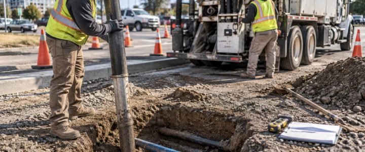
For that reason, camera-assisted locating is often best treated as one line of evidence. Where a pipe’s exact position, elevation, size, material, or connection must be confirmed before design or excavation, the team may need survey support and targeted physical verification. Private utility locating can help evaluate other detectable utilities in the area, while vacuum excavation can expose selected points where direct confirmation is necessary.
A practical workflow for tracing unknown drainage and sewer systems
A disciplined workflow produces more useful results than sending a camera into the nearest opening and hoping it reaches the answer. The following sequence is commonly useful for existing commercial, municipal, industrial, and development sites.
1. Review available information without treating it as verified
Gather record drawings, utility maps, as-builts, maintenance records, previous inspection videos, drainage plans, and known complaint locations. Note the apparent structures, pipe directions, and outlets shown on those documents.
Records are valuable for planning access and forming questions. They should not be assumed to represent current field conditions, particularly on older sites or properties with multiple renovations.
2. Walk the site and identify access points
Locate visible manholes, cleanouts, catch basins, area drains, roof drains, outfalls, pump stations, and building connections. Check whether covers can be safely opened and whether traffic control, confined-space procedures, access permits, or coordination with the owner is required.
Not every structure provides a usable camera entry point. Access dimensions, flow, depth, pipe size, and internal configuration affect which inspection equipment can be used.
3. Clean or prepare the pipe when visibility is limited
A camera cannot provide a meaningful condition record through heavy sediment, grease, debris, roots, or standing water. If these conditions are present, cleaning may be needed before the inspection or between inspection passes.
Preparation should match the project purpose. A line being evaluated for rehabilitation or construction acceptance may require more complete cleaning than a short diagnostic investigation intended only to identify the location of a blockage.
4. Inspect from known points toward unknown reaches
Begin at structures or connections with a known identity whenever possible. Record the entry point, direction of travel, distance counter readings, visible features, and the point where the camera stops or exits.
When investigating a network, inspect from more than one direction when access allows. A downstream-to-upstream run and an upstream-to-downstream run may help confirm whether two structures connect, especially when a blockage or branch limits one direction of travel.
5. Locate and survey selected features
Use camera-based locating at the points that matter to the project: suspected junctions, route changes, obstructions, damaged areas, crossings, or pipe ends. Surveyed positions can then be incorporated into a site base map, utility exhibit, or design model when the requested accuracy and control are available.
6. Decide whether the results require verification
Video and locating may be enough to support maintenance planning or a preliminary design decision. They may not be enough where excavation will occur close to the pipe, where the apparent route conflicts with plans, or where the consequence of error is high.
In those cases, targeted test holes may provide direct confirmation of a pipe’s location, depth, diameter, material, and configuration. Visionary Subsurface Solutions can coordinate camera findings with vacuum excavation and QL-A verification when field conditions and project objectives call for it.
Common findings when investigating unknown pipe connections
Unknown systems rarely have only one issue. During stormwater pipe inspection and sewer pipe inspection, field teams often find conditions that explain why records and performance do not match.
- Unmapped connections: A lateral, roof drain, area drain, or abandoned branch may connect to a line not shown on available drawings.
- Broken continuity: A pipe may terminate at a buried structure, be disconnected, or be too obstructed to confirm the expected downstream route.
- Construction debris: Mortar, wood, stone, grout, plastic, and other materials can restrict flow in new and older systems.
- Sediment accumulation: Sediment may reduce capacity and obscure joints, defects, and branches.
- Defective joints: Open, offset, or displaced joints can contribute to infiltration, soil migration, or flow restrictions, but the cause and significance need appropriate evaluation.
- Roots or grease: These conditions can create recurring maintenance issues and may prevent the camera from reaching the full line.
- Damage near prior work: Deformation, fractures, or localized disruption may warrant closer investigation before repair decisions are made.
Use standardized reporting when condition data will drive decisions
A basic video file is useful evidence, but it may not be enough for an asset-management, rehabilitation, or capital-planning program. When a project requires standardized defect observations, the scope should state that requirement before mobilization.
NASSCO’s Pipeline Assessment Certification Program, commonly known as PACP, provides a standardized framework for documenting observations in sewer and stormwater pipelines. LACP is the related framework for laterals. These systems support consistent coding and reporting of observable conditions; they do not replace engineering judgment or make every inspection automatically a certified PACP or LACP assessment.
A professional report should clearly identify the inspection limits, access points, direction of travel, observed features, footage or distance references, screenshots or video references, and any segments that could not be inspected. It should also distinguish between observed conditions and recommended next steps that need further confirmation.
FAQ: tracing unknown underground pipes
Can a sewer camera locate an underground pipe precisely?
Not by itself. A camera can help trace an accessible pipe, and a transmitter can help identify the camera’s approximate position from the surface. Precise horizontal and vertical location may require survey control, additional locating methods, physical exposure, or other verification.
Can CCTV confirm that two manholes or catch basins are connected?
It can often provide strong evidence when the camera travels from one structure to another or identifies recognizable features along the route. A complete blockage, inaccessible pipe, severe debris, or unsuitable configuration may prevent confirmation.
Can video inspection determine whether a pipe must be replaced?
Video can document visible defects and operational concerns, but replacement decisions should consider the pipe’s function, condition, risk, material, loading, repair options, and engineering requirements. Additional investigation may be needed.
When should an unknown storm drain be inspected?
Inspection is often useful before redevelopment, utility installation, paving, rehabilitation, drainage repairs, property acquisition, or work near suspected underground infrastructure. It is also useful when a system experiences ponding, recurring blockage, erosion, backups, or unexplained drainage failures.
Get an investigation built around the project decision
Unknown storm and sanitary connections should be investigated with a method that matches the risk. A well-planned video inspection can document accessible pipe conditions, trace likely routes, identify connections, and show where the available evidence ends. Locating, survey, cleaning, vacuum excavation, and engineering review can then be added where the project needs a higher level of certainty.
Visionary Subsurface Solutions provides professional video pipe inspection for stormwater, sanitary sewer, drainage, and accessible underground piping systems throughout Pennsylvania, New Jersey, Delaware, Maryland, New York, and the Washington, D.C. to New York City corridor. Contact our team to discuss the unknown pipe connections, drainage issue, or documentation needs on your project.