Redevelopment sites often carry more underground history than the available records show. Former buildings, additions, fuel systems, drainage changes, utility relocations, and tenant improvements may have left pipes, conduits, vaults, and service lines in place. Some are disconnected. Some remain active. Others may be partially abandoned but still connected to a live system farther away.
That uncertainty matters before demolition, grading, foundation work, utility installation, or pavement reconstruction. A line that looks unused on an old plan can still contain water, gas, electrical conductors, communications cable, or a connection to an active drainage system. Even a truly inactive line can affect excavation, settlement, environmental planning, or the route of a new utility.
A careful investigation of abandoned utilities does not begin with a single instrument or a single set of markings. It uses a step-by-step process to identify what is known, test important assumptions, and document remaining uncertainty for the project team.
Why abandoned utilities deserve attention
An abandoned utility is not automatically harmless. Its condition and connections determine the risk. For example, an old sewer lateral may be empty and capped, may receive drainage from an unrecognized source, or may have failed underground. A duct bank may appear inactive but contain live cable installed later. A demolished building’s utility services may have been cut near the structure while the remainder of the line was left in the ground.
These conditions can create practical problems:
- Unexpected obstructions during trenching, drilling, pile installation, or demolition.
- Damage to active utilities that were assumed to be abandoned.
- Stormwater or sanitary flow entering a damaged or unknown pipe.
- Voids, deteriorated structures, or leaking lines beneath pavement and slabs.
- Conflicts between proposed work and old utility corridors.
- Incomplete records that lead to incorrect design assumptions.
The goal is not to prove that every buried feature is inactive. The goal is to give the owner, engineer, and contractor enough reliable information to make safe, well-supported decisions about removal, protection, rerouting, or further investigation.
Start with a utility history, not just a utility map
Existing utility plans are valuable, but they are only one source of evidence. On older commercial, industrial, institutional, and municipal sites, plans may reflect original construction rather than later field changes. They may omit privately owned service lines, abandoned branches, or systems installed by a tenant.
Before fieldwork, gather records that can help establish a working history of the site:
- As-built drawings, civil plans, and utility relocation plans.
- Demolition plans and prior site-development drawings.
- Building utility plans, plumbing drawings, and electrical one-lines where available.
- Maintenance records, drain-cleaning reports, CCTV reports, and repair invoices.
- Utility-owner records and one-call responses for public facilities.
- Historic aerial imagery, site photographs, and records of former structures.
- Facility staff knowledge about shutoffs, recurring drainage issues, or past repairs.
This review should produce questions for the field team, not premature conclusions. A plan might show a former gas service, for example, but field verification is still needed before treating that route as clear. Likewise, the absence of a line on a drawing does not prove that it is absent from the ground.
Use surface evidence to guide the investigation
A structured site walk can reveal clues that records miss. Investigators look for manholes, cleanouts, valve boxes, meters, transformers, handholes, utility poles, patch lines, curb inlets, building entry points, unusual pavement settlement, and remnants of old foundations. Differences in pavement age or surface repairs can also point to earlier utility work.
These observations help establish likely utility corridors and identify features worth inspecting. They also help the team plan access around traffic, occupied buildings, landscaping, security requirements, and active operations.
Surface observations alone cannot identify every buried line. They are most useful when combined with records, geophysical methods, direct connections, and selective excavation.
Match the investigation method to the question
Different tools answer different questions. A productive abandoned-utility investigation uses each method for what it can reasonably support.
Private utility locating for traceable systems
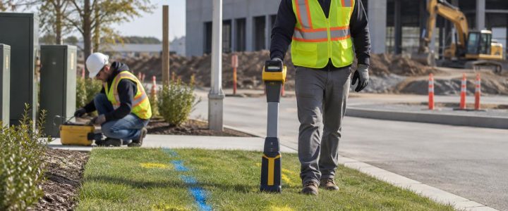
Electromagnetic locating can help trace conductive utilities or utilities that can accept a signal through an accessible point. This may include certain metallic pipes, tracer-wire-equipped plastic lines, cables, conduits, and duct systems. Access to a meter, pedestal, vault, valve, cleanout, or exposed cable can make a major difference.
Locating results should be interpreted carefully. A detectable signal may follow a pipe or cable, but it can also couple onto nearby conductive paths. Congested areas, poor access, damaged tracer wire, and discontinuous or nonconductive materials can limit results. Private locating is often an important first step, but it is not a substitute for physically verifying a critical crossing or tie-in.
For work outside the public utility corridor, a private utility locating investigation can help identify privately owned electric, communications, water, gas, irrigation, and site-lighting systems that may not be addressed by a standard one-call request.
Ground penetrating radar for additional evidence
Ground penetrating radar, or GPR, sends electromagnetic energy into the ground and records reflections from changes in subsurface conditions. It can provide useful evidence of possible utilities, structures, voids, and disturbed areas, particularly where a target cannot be traced electromagnetically.
GPR should not be treated as an underground X-ray. Results depend on soil conditions, moisture, target size, depth, orientation, site congestion, and the contrast between the target and surrounding material. Conductive or wet soils can reduce penetration. A GPR response may indicate an anomaly rather than identify a specific utility material, owner, or exact depth.
The Federal Highway Administration notes that geophysical methods have limitations and that results should be correlated with other information and verified where necessary. Its discussion of subsurface utility engineering also supports using investigation quality levels that reflect how information was obtained rather than presenting all utility data with the same confidence.
CCTV and robotic inspection for pipes and structures
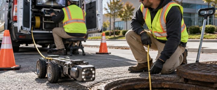
When an abandoned or questionable pipe has an accessible entry point, CCTV or robotic inspection can provide direct visual information about its interior. This is especially useful for storm, sanitary, industrial, and large-diameter drainage systems.
Video inspection may help determine whether a pipe is open, blocked, collapsed, connected to another structure, carrying flow, or affected by roots, debris, offsets, cracks, or corrosion. The inspection can also reveal whether a line that appears abandoned is actually receiving water or connected to a live network.
Not every pipe is accessible, passable, or safe to inspect with a camera. Deposits, standing water, collapses, tight bends, and missing access points can limit the inspection. Still, pipe video can reduce uncertainty that surface locating alone cannot resolve. For pipe-condition questions, see Visionary’s Video Pipe Inspection service.
3D LiDAR scanning for manholes and underground structures
Manholes, vaults, catch basins, and other accessible structures may contain important evidence about pipe size, direction, inverts, connections, and condition. Three-dimensional LiDAR scanning can document the geometry of accessible structures in detail and support design coordination.
This method is particularly useful when a project needs more than a surface location. It can help show the physical relationship between incoming and outgoing pipes, benching, wall conditions, and structural features. It does not replace safe access practices or direct verification of buried pipe routes beyond the scanned structure.
Vacuum excavation and test holes for critical confirmation
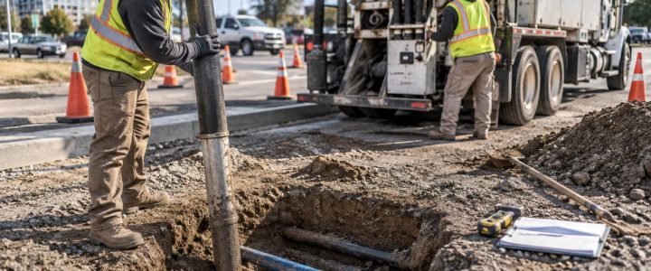
When a utility’s presence, horizontal position, depth, size, or condition will affect a major decision, test holes are often the most dependable way to resolve the question. Vacuum excavation removes soil with controlled suction so the feature can be exposed and documented with less disturbance than conventional mechanical digging.
Test holes can confirm whether a suspected line exists, whether it is active, its approximate outside dimensions, depth at the exposure point, and its relationship to planned work. They are especially valuable at proposed crossings, foundation locations, tie-in points, congested utility corridors, and areas where records and field findings conflict.
ASCE’s utility investigation quality-level framework distinguishes between records research, surface designation, and exposed verification. Under this framework, Quality Level D generally relies on existing records, Quality Level C adds visible surface features, Quality Level B uses geophysical designation, and Quality Level A uses exposure to obtain the highest level of confidence at a specific point. The quality level applies to the information collected; it does not make untested portions of a utility certain.
Create a decision-focused field plan
Fieldwork is more efficient when the team identifies the decisions that need support. Rather than attempting to investigate every possible utility equally, organize the work around construction and design risks.
Useful questions include:
- Which former services pass through proposed excavation, foundation, or roadway areas?
- Which pipes or conduits could still connect to an occupied building or active system?
- Where will demolition expose, cut, or load an unknown utility?
- Which suspected drainage lines could affect the stormwater design?
- Where do new utility routes cross known or suspected older lines?
- Which findings require physical verification before design is finalized or excavation begins?
Mark investigation priorities on a current site base map. Assign a reason for each priority, such as “possible active service,” “proposed bore crossing,” “unknown drainage outlet,” or “demolition conflict.” This gives the project team a clear basis for choosing where to use locating, pipe inspection, GPR, scanning, or test holes.
Document both findings and limitations
A useful utility map does more than show colored lines. It should communicate how each feature was identified and how reliable the information is for the intended use. Field notes should distinguish between records-based features, surface observations, geophysical designations, camera observations, and physically exposed utilities.
For each important feature, document available details such as:
- Location reference and date observed.
- Method used to identify it.
- Observed direction, visible appurtenances, and accessible connection points.
- Depth or elevation information, including where and how it was obtained.
- Whether flow, conductors, pressure, or other evidence suggested active use.
- Known limitations, gaps, and recommended next steps.
This level of documentation helps prevent a common mistake: treating a preliminary field mark as final design data. It also makes it easier for designers, estimators, and field supervisors to understand which risks have been resolved and which still require care.
Plan for findings that change the work
An investigation may confirm that a line is inactive, but removal or abandonment still needs coordination with the appropriate owner, designer, and utility provider. It may be necessary to cap a line, fill a void, maintain drainage, protect an adjacent service, or revise a proposed route. Those are project-specific decisions that should be made using verified information and applicable requirements.
It is also wise to maintain an escalation path during construction. If crews encounter an unmarked line, a changed condition, or a feature that does not match the investigation, stop work in the affected area, protect the feature, and reassess. The earlier a mismatch is reported, the easier it is to verify and incorporate it into the plan.
Reduce uncertainty before it becomes an excavation problem
Abandoned utilities are often manageable when they are identified early and evaluated with the right level of effort. Records and site observations establish context. Private locating and GPR add surface evidence. Pipe inspection and 3D scanning provide condition and geometry information where access exists. Vacuum test holes provide direct confirmation at the locations where a decision cannot safely rely on assumptions.
For projects in Pennsylvania, New Jersey, Delaware, Maryland, New York, or the Washington, D.C. to New York City corridor, contact Visionary Subsurface Solutions to discuss an investigation approach that fits your redevelopment scope, schedule, and site conditions.