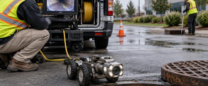
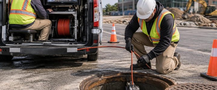
A crowded utility corridor creates more than a locating problem. It creates a planning problem. A proposed trench, drilled pier, directional bore, curb line, or building addition may pass through an area containing active and abandoned lines, private utilities, unknown connections, duct banks, foundations, and other buried features.
Ground penetrating radar (GPR) utility locating can be a useful part of the investigation in these conditions. It can help identify subsurface responses that may not be traceable with electromagnetic (EM) locating alone, including some non-metallic pipes and unknown buried objects. But GPR does not produce a simple underground photograph. It detects changes in subsurface electromagnetic properties, and a trained professional must interpret those responses in the context of the site.
For contractors and engineers, the practical goal is not simply to collect GPR data. It is to develop a defensible picture of potential conflicts, identify areas that need more investigation, and physically verify critical utilities before work reaches them.
Why congested utility corridors need a deliberate approach
Utility congestion is common around commercial buildings, industrial facilities, campuses, roadways, redevelopment sites, loading areas, and older urban properties. The original utility layout may have changed several times. Records may show only public lines, while private electric, telecom, water, sewer, gas, irrigation, fire protection, and process utilities remain undocumented.
Common warning signs include:
- Multiple visible utility entries at a building or facility.
- Old utility markings that do not match available plans.
- Manholes, valves, pedestals, meters, and pull boxes packed into a small area.
- Past additions, paving changes, utility repairs, or demolished structures.
- A proposed excavation or bore that crosses several known services.
- Unexplained settlement, pavement patches, abandoned stubs, or inactive structures.
In these settings, a single locating method can leave important gaps. EM locating is often effective for conductive lines that can be directly connected to or induced with a signal. GPR may add useful information by identifying other anomalies or apparent utility-like features. Neither method alone confirms a utility’s exact identity, depth, material, ownership, or current operational status.
How GPR utility detection works in a crowded area
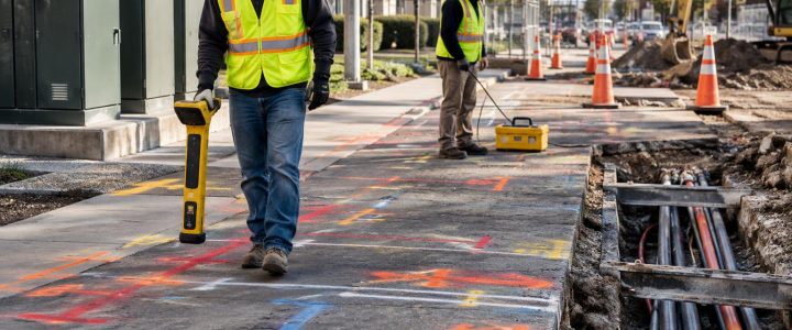
A GPR antenna sends short electromagnetic pulses into the ground or concrete surface. When the signal encounters a change in material properties, such as a pipe, void, soil boundary, reinforcement, trench backfill, or buried structure, part of the energy may reflect back to the antenna.
The equipment records the timing and strength of those returned signals. In a GPR profile, a linear pipe or conduit often creates a curved reflection pattern as the antenna passes over it. An experienced operator reviews the patterns across multiple survey lines, considers the site layout, and compares the data with visible features, records, EM results, and surface observations.
That process matters because many subsurface conditions can create similar-looking responses. A GPR response may be interpreted as a likely utility, but it remains an interpretation until the feature is exposed or confirmed by another reliable method.
What GPR may help identify
Depending on conditions, a GPR survey may help identify:
- Potential utility alignments and crossing locations.
- Some non-metallic pipes, including PVC, HDPE, concrete, and other non-conductive materials.
- Metallic utilities and conduits, particularly where their contrast with surrounding soil is clear.
- Trench backfill and signs of prior utility installation.
- Abandoned pipes, ducts, foundations, tanks, or buried debris.
- Changes in pavement, base material, or subsurface layering that may affect construction planning.
- Areas that warrant test holes, design adjustment, or additional investigation.
GPR is especially valuable when the project team needs more than a trace of a known conductive line. For example, an EM signal may trace a primary electrical conduit, while GPR may indicate nearby parallel anomalies, crossings, or non-metallic lines that deserve closer review.
What makes GPR challenging in congested utility corridors
A busy corridor can produce overlapping reflections from several lines at different elevations. Paved surfaces, reinforcement, shallow metal, curbs, surface clutter, and nearby structures can further complicate data collection and interpretation.
Soil and moisture conditions
GPR performance is strongly affected by the ground. Dry, sandy, or granular soils may allow clearer signal penetration than wet, conductive, or clay-rich soils. Moisture and clay can weaken the signal quickly, reducing the depth at which useful information can be collected. This is why a result from one part of a site should not be assumed to apply everywhere else on the property.
Object size, depth, and orientation
Larger, shallower features are generally easier to detect than small or deeply buried ones. A pipe’s orientation also matters. A line crossing the survey path can produce a clearer response than a line running parallel to it. The surrounding material is equally important: a plastic pipe may be more visible when there is a strong contrast between the pipe, bedding, and native soil, and less visible where those materials have similar properties.
Surface access and interference
GPR data quality can be limited by rough pavement, standing water, stored materials, parked vehicles, vegetation, fencing, and tight access around structures. Reinforced concrete and dense rebar can mask deeper features. Shallow metal objects, such as plates, grates, or scrap, can also create strong reflections that obscure other targets.
These limits do not make GPR unhelpful. They define where the method is most useful and where the investigation should shift toward other tools or direct verification.
A practical GPR survey workflow before excavation or drilling
The best GPR utility locating work starts before the antenna is moved across the ground. A structured workflow helps the project team turn field data into usable construction information.
1. Define the work limits and the decision to be made
Provide the planned trench, bore path, footing layout, drill locations, saw-cut limits, or excavation boundary. The locating team needs to know what area affects the decision. A broad site scan may be useful during early design, while a tight grid may be more appropriate around a proposed bore pit, building connection, or critical crossing.
2. Review available evidence
Utility plans, as-builts, 811 markings, facility records, prior survey files, and visible appurtenances all provide useful context. They should be treated as evidence, not final proof. Records can be incomplete, outdated, schematic, or limited to certain utility owners.
3. Combine GPR with appropriate locating methods
Where practical, GPR should be paired with EM utility locating. EM methods can trace many conductive utilities, while GPR can provide another view of the subsurface and may help identify non-conductive lines or other anomalies. Comparing results can increase confidence, but conflicting results should be investigated rather than averaged or ignored.
For larger design projects, the work may also fit within a broader Subsurface Utility Engineering and QL-B process. GPR data by itself does not automatically establish a particular SUE Quality Level. The investigation method, records review, field designation, survey control, documentation, and verification all matter.
4. Collect data on a planned grid and targeted lines
In congested areas, survey lines in more than one direction help distinguish linear features from isolated anomalies. A grid can be useful around proposed drill locations, utility crossings, and areas where several services appear to run together. Targeted passes along suspected utility routes can supplement the grid.
5. Interpret results with the construction plan in view
A useful deliverable identifies detected and interpreted features, areas of uncertainty, and locations where verification is recommended. The project team should compare these findings with the proposed work, not view them as a stand-alone map. An apparent anomaly outside the excavation limit may have little effect, while a poorly defined response directly beneath a planned bore can be critical.
6. Verify critical conflicts with test holes
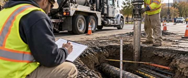
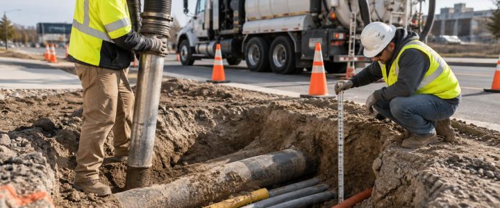
When a utility’s position affects clearance, constructability, safety planning, or final design, physical exposure is often the next step. Vacuum excavation can expose a utility more carefully than mechanical digging and can establish the line’s actual horizontal position, vertical position at the test-hole location, size, and observable material. Learn more about Vacuum Excavation and QL-A verification when a suspected conflict needs to be resolved.
When GPR results should lead to additional investigation
Bring in further investigation when any of the following conditions apply:
- A likely utility or unexplained anomaly falls within the planned excavation, drilling, or bore envelope.
- GPR and EM results indicate different locations or alignments.
- Available records conflict with field findings.
- Multiple responses make it difficult to separate individual lines.
- The work requires reliable vertical clearance between existing and proposed utilities.
- The area includes critical electrical, gas, steam, fire protection, process, or communications infrastructure.
- Ground conditions limit GPR penetration or produce unclear data.
For directional drilling, auger drilling, and foundation work, it is important to understand that a GPR depth estimate is not a substitute for exposing a critical crossing. Depth interpretation depends on estimated signal velocity in the material and can vary with site conditions. A test hole provides direct information at one location; it does not automatically confirm conditions along an entire route, so the verification plan should match the construction risk.
How contractors can prepare for GPR utility locating services
Field access and clear communication improve the usefulness of a GPR survey. Before the crew arrives, identify the proposed work limits, provide available utility information, and make the area safe and reasonably accessible.
- Remove parked vehicles, pallets, equipment, and loose materials where possible.
- Share current design drawings, bore profiles, grading plans, and known utility records.
- Identify restricted areas, site hazards, traffic controls, and required access procedures.
- Point out known utility structures, recent repairs, abandoned buildings, and surface patches.
- Coordinate 811 notifications and private utility locating as appropriate for the project.
- Allow time for data review and verification before finalizing excavation or drilling plans.
Early investigation is generally more useful than a last-minute scan after crews and equipment are already mobilized. It gives designers and contractors more options to adjust alignments, plan test holes, sequence work, and avoid unplanned stoppages.
Frequently asked questions about GPR in congested areas
Can GPR locate every underground utility?
No. GPR may not detect every utility, especially where soil is conductive, targets are deep or small, conditions are highly congested, or the target has little contrast with surrounding material. It should be used as part of a site-specific investigation rather than treated as a guarantee.
Can GPR identify a pipe as gas, water, sewer, or electric?
Not reliably on its own. GPR detects a subsurface response, not utility ownership or service type. Records, EM tracing, visible connections, access structures, and physical verification may help determine identity.
Is GPR better than electromagnetic locating?
Neither method is universally better. EM locating can be highly effective for conductive utilities that can carry a traceable signal. GPR can add information about some non-conductive utilities and other underground anomalies. In many congested corridors, using both methods is more informative than relying on either one alone.
When is a test hole necessary after a GPR survey?
A test hole is appropriate when the actual position of a utility is critical to the work, particularly where clearance, depth, crossing elevation, or utility identity affects excavation, drilling, or design decisions.
Use GPR findings to make better field decisions
GPR utility locating is most valuable when it is tied to a specific construction or engineering decision. In a congested corridor, it can help the team identify likely conflicts, investigate non-metallic utility possibilities, focus test-hole locations, and reduce uncertainty before the work begins. Its limits should be stated clearly, and critical findings should be verified rather than assumed.
Visionary Subsurface Solutions provides GPR surveys, private utility locating, SUE support, and vacuum excavation services throughout Pennsylvania, New Jersey, Delaware, Maryland, New York, and the Washington, D.C. to New York City corridor. Contact our team to discuss the utility conditions, work limits, and level of verification your project requires.