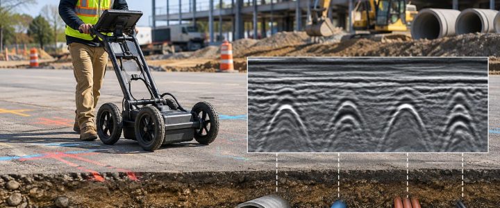
Calling 811 is an essential first step before excavation. It starts the notification process for participating utility operators and helps establish where their marked facilities may be located. But an 811 ticket is not the same as a complete underground utility investigation of a project site.
Contractors regularly encounter utilities that are outside the scope of public utility markings: private electric feeds beyond a meter, site lighting circuits, irrigation lines, communications lines, private gas piping, fire water lines, abandoned services, and utilities serving one building or one parcel. The exact responsibilities and marking practices vary by state, utility operator, and site conditions. A pre-excavation plan should therefore confirm what has been marked, what remains unknown, and who owns the risk of investigating privately owned facilities.
Private utility locating before excavation uses methods such as electromagnetic (EM) locating to investigate accessible conductive utilities and their associated tracer wires. It can add important information for construction planning, but it does not make every buried line visible or eliminate the need for physical verification at critical conflicts.
Why 811 markings and private locating serve different purposes
811 notification systems coordinate requests to utility operators that participate in the local one-call system. The Common Ground Alliance explains the basic purpose of 811 as notifying affected utility companies before digging so they can identify the approximate location of their facilities. That process is vital, but the marks received are tied to the facilities each operator is responsible for locating.
On commercial, institutional, industrial, and multifamily properties, the ownership boundary can be especially important. A utility operator may mark its distribution line to a meter, service point, property boundary, or another defined point of responsibility. Downstream infrastructure can be privately owned. A campus may also contain a mix of active, disconnected, undocumented, and owner-maintained utilities.
Before a crew mobilizes, review the ticket response, field marks, available utility records, and the planned excavation limits. Do not assume an unmarked area is clear. It may mean no responding operator reported a facility to mark, not that no private or unknown facility exists there.
Common private facilities that may need investigation
- Electric service laterals and feeders beyond meters or transformers
- Private site lighting, gate, sign, and security circuits
- Communications, fiber, data, and control conduits on a private site
- Private gas, fuel, steam, compressed-air, or process piping
- Fire protection, irrigation, domestic water, and sewer facilities
- Utilities between buildings on campuses, medical facilities, warehouses, and industrial sites
- Abandoned or rerouted lines that do not appear on current drawings
A professional private utility locating scope can be planned around those gaps. The locator should understand the proposed work, access limitations, 811 marks already placed, and any known private systems before beginning the field investigation.
How electromagnetic utility locating helps identify private utilities
EM utility locating equipment detects an electromagnetic field associated with a conductive utility or a conductor placed with that utility. A transmitter applies a controlled signal to a line when access and conditions allow. A receiver is then used at the surface to trace the signal response and place paint or flags along the interpreted route.
For private utility locating, EM methods are often effective for metallic pipe, metal conduit, electrical cable, and a tracer wire installed beside a nonmetallic pipe. The result is an interpreted horizontal path, not a promise that the line is at the center of every mark or at a constant depth.
Three ways an EM signal may be applied
- Direct connection: The transmitter is connected to an accessible conductive point, such as a cable, pipe, tracer wire, valve box, pedestal, or cleanout-associated tracer wire. When a suitable connection and return path are available, this method often provides a more controlled signal than broad induction.
- Clamp induction: A transmitter clamp is placed around an accessible cable or pipe. This can apply a signal without a direct metal-to-metal connection, provided the conductor forms a suitable continuous path.
- Induction: The transmitter is placed on the ground above the suspected route to induce a signal onto nearby conductors. This can be useful when direct access is unavailable, but nearby utilities may also pick up signal. Interpretation is particularly important in congested areas.
Passive scanning is another part of a careful field process. In passive mode, the receiver listens for naturally present power-related fields or radio-frequency energy carried on conductive lines. Passive responses can identify areas for further investigation, but they do not establish that every utility is found or that a detected signal belongs to one specific facility.
What EM locating can and cannot detect
EM locating works best when a utility can carry a usable signal. That is why metallic utilities and tracer-wire-equipped nonmetallic utilities are common targets for EM utility detection services.
Utilities commonly traceable with EM equipment
- Metallic water, gas, and process piping, when electrically continuous enough to carry a signal
- Electrical cables and metallic conduit
- Copper communications cables and some shielded communications systems
- Nonmetallic water, sewer, gas, and conduit systems with continuous, accessible tracer wire
- Metallic pull tape, detectable tape, or other conductive locating components where present and usable
Utilities that may not be directly traceable
- PVC, HDPE, fiberglass, concrete, and other nonconductive pipe without tracer wire or another conductive component
- Nonconductive ducts containing no accessible or signal-carrying cable
- Broken, disconnected, corroded, or poorly grounded conductive facilities
- Short isolated metallic sections that do not carry a traceable signal path
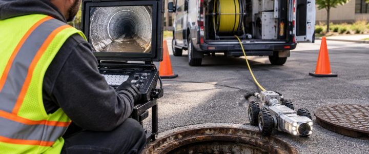
A plastic pipe may still be investigated if its tracer wire can be accessed, connected, and traced. A sewer camera sonde may help identify the position of a camera head within a pipe during an inspection. Those approaches answer different questions and have their own limits. When a nonconductive utility has no traceable component, other methods, records review, entry-point investigation, or carefully planned test holes may be appropriate.
Why EM marks and depth readings need field judgment
An EM receiver can estimate depth by interpreting the signal field at the surface. That estimate is useful for screening potential conflicts and planning the next step, but it is not a surveyed, physically verified elevation. The reliability of a depth estimate depends on the signal path and field conditions.
Several conditions can shift a signal away from the actual utility or make depth results less dependable:
- Parallel pipes, cables, or conduit banks carrying coupled signal
- Congested corridors where several conductors respond at the same frequency
- Signal bleed-off through branches, bonds, grounds, casings, or nearby infrastructure
- Changes in utility direction, depth, or material
- Damaged tracer wire, poor connections, and weak grounding
- Rebar, fencing, rail, building steel, guardrails, and electrically noisy equipment
- Large diameter pipe, deep utilities, or limited access near structures and pavement
For example, a signal applied to one cable may couple onto a parallel cable for part of a route. Both may produce a response, and the strongest response is not automatically the intended line. An experienced utility locator checks the response using more than one setup where practical, follows the signal behavior, considers known access points, and documents uncertainty rather than treating one receiver reading as conclusive.
Frequency selection is part of that judgment. Lower frequencies may reduce unwanted coupling in some situations, while higher frequencies may help establish a response on a difficult line but can spread more readily to nearby conductors. There is no single “best” frequency for every site. The proper choice depends on the utility, available access, grounding, congestion, and purpose of the investigation.
Where EM locating fits in an ASCE 38-22 investigation
ASCE 38-22 provides a framework for communicating the quality level of existing utility information. Quality Level B generally involves designating the approximate horizontal position of utilities using appropriate surface geophysical methods, combined with available records and visible evidence. EM locating can be an important method in a Quality Level B investigation when it is appropriate for the utility being investigated.
However, an EM locate alone does not automatically create a complete Subsurface Utility Engineering deliverable or establish a Quality Level B result for every utility on a site. The investigation must be planned, performed, documented, and interpreted for the project purpose. For design teams that need a coordinated investigation, Subsurface Utility Engineering and QL-B services can integrate field designation with records research, survey support, and engineering-quality utility documentation.
Quality Level A is different. It involves obtaining precise information through physical exposure, typically with nondestructive excavation. If a trench, footing, bore path, utility crossing, or tie-in depends on actual elevation and clearance, EM depth estimates should not replace verification. A planned test hole can confirm the utility’s horizontal position, depth, size, material as observed, and configuration at that specific exposure location.
A practical pre-excavation workflow for contractors and engineers
- Define the work limits. Identify excavation areas, bore paths, pavement cuts, proposed structures, and anticipated depths.
- Submit the 811 notification. Allow the required response time and review each response before work begins.
- Compare marks to the site. Note buildings, meters, transformers, manholes, valve boxes, pedestals, drains, site lighting, and other visible clues that may indicate private infrastructure.
- Gather available information. Provide as-builts, utility plans, prior surveys, facility contacts, and proposed design drawings to the private utility locator.
- Set a locating scope. Include the work zone and a practical buffer. Ask which systems can reasonably be investigated by EM methods and where results may be limited.
- Resolve critical conflicts. Use test holes before excavation or drilling where alignment, elevation, or utility identity must be physically confirmed.
- Protect and communicate. Brief field crews on the markings, limits of the investigation, no-dig areas, and the process for stopping work if an unknown feature appears.
When to hire a private utility locating company
Private EM utility locating is especially valuable before trenching, directional drilling, utility installation, demolition, pavement removal, foundation work, or excavation near occupied facilities. It is also worth considering whenever public marks end at a service point while the planned work continues into privately owned infrastructure.
Bring in a utility locating company early when the schedule allows. Early designation can help a project team adjust an alignment, budget test holes, avoid redesign after a conflict is discovered, and give crews clearer information before equipment arrives. On a complex site, waiting until the excavation crew is ready to dig can turn an unknown-utility issue into a schedule issue.
FAQ: EM locating before excavation
Can an EM locator find every underground utility?
No. EM equipment detects electromagnetic fields on conductive utilities or on accessible conductive components such as tracer wire. Nonconductive pipe without a usable tracer wire, damaged lines, inaccessible systems, and heavily congested areas may require additional investigation.
Does an EM depth reading tell us exactly how deep a utility is?
No. It is an estimate based on the detected signal. Use it for planning and screening, then physically expose the utility when exact depth or clearance is important to the work.
Can 811 marks be used as the only utility information for a commercial site?
Not always. 811 marks are essential, but privately owned utilities may fall outside an operator’s marking responsibility. Review the responses and investigate site-owned systems relevant to the planned work.
Plan the locate around the work, not just the ticket
The goal of electromagnetic utility locating is not simply to place paint on the ground. It is to give the project team a clearer, technically realistic picture of detectable underground utilities, remaining unknowns, and locations that need verification before excavation.
Visionary Subsurface Solutions provides private utility locating and EM utility investigation services throughout Pennsylvania, New Jersey, Delaware, Maryland, New York, and the Washington, D.C. to New York City corridor. Contact our team to discuss your work limits, available records, and the appropriate utility investigation approach for your project.