Before excavation, drilling, directional boring, pavement removal, or structural work begins, project teams need a realistic picture of what may be below grade. A Ground Penetrating Radar (GPR) utility survey can help identify subsurface anomalies, possible utility routes, and other buried features that may not appear on available records.
However, GPR is not a push-button utility map. It detects changes in subsurface electromagnetic properties. A trained professional reviews those responses alongside surface evidence, utility records, electromagnetic (EM) locating results, site history, and project needs. Good planning helps the field team collect more useful data and helps the contractor understand where verification is still needed.
This guide explains how contractors, engineers, and facility teams can plan a GPR utility locating survey before construction and use the findings responsibly.
Start with the construction question, not the equipment
A productive GPR survey begins by defining the decision the project team needs to make. “Locate everything” is understandable, but it is rarely specific enough to set boundaries, select methods, or determine whether findings need to be physically verified.
Instead, identify the planned work and the underground risk it creates. For example:
- Will an excavator trench across an undocumented utility corridor?
- Will a directional drill cross several existing services?
- Will a contractor install signs, bollards, foundations, or light poles near a building?
- Will a crew core, saw cut, or anchor into a concrete slab?
- Will roadway reconstruction disturb possible abandoned lines, foundations, or drainage structures?
- Does a design team need utility information before finalizing a route or elevation?
These questions help define the survey limits, the appropriate antenna frequency, the need for EM locating, and whether vacuum excavation should be included in the investigation plan.
What a GPR utility survey can contribute
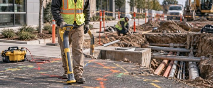
GPR sends electromagnetic energy into the ground and records reflections caused by changes in material properties. A buried pipe, duct bank, void, trench backfill boundary, reinforced area, foundation remnant, or tank may create a response if there is enough contrast between the feature and surrounding material.
For underground utility detection, GPR can be especially useful when a project may involve non-conductive materials that cannot be directly traced with conventional EM equipment. Depending on site conditions, this may include PVC, HDPE, concrete, fiberglass, and other non-metallic utilities.
GPR may also help investigate:
- Possible abandoned utilities and unknown crossings
- Undocumented structures below pavement or landscaped areas
- Areas of disturbed soil that may indicate prior trenching
- Buried tanks, foundations, slabs, or other subsurface features
- Utility corridors where several lines may be present
- Potential anomalies that need closer evaluation before construction
A field mark from GPR represents an interpreted response, not automatic proof of utility type, owner, material, depth, or condition. A hyperbolic reflection may be consistent with a pipe or conduit, but the same data must be considered with other evidence before a team assigns a likely identity.
What GPR cannot reliably determine on its own
GPR is valuable, but it has limits that matter on active construction sites. It cannot guarantee that every buried utility or feature will be detected. It also should not be treated as a standalone method for confirming exact depth or utility identity.
Without physical exposure, a GPR survey generally cannot conclusively establish:
- Utility ownership or whether a line is public or private
- The exact material, size, or service carried by a buried line
- The precise horizontal and vertical position required for conflict-free excavation
- Whether a suspected utility is active, abandoned, empty, or damaged
- Whether all utilities are present, especially in difficult soil or congested areas
Depth estimates from GPR depend on the assumed signal velocity through the ground. Since soil and fill conditions vary, those estimates should be treated as interpreted approximations unless verified. When a utility crossing, drill path, or excavation is critical, a test hole can physically confirm the line’s location and elevation.
Plan GPR and electromagnetic locating together when appropriate
GPR and EM locating solve different parts of the underground utility problem. They are often complementary rather than competing methods.
EM locating can be highly effective for tracing a conductive pipe, cable, tracer wire, or accessible utility signal. It may allow a technician to follow a line from a known connection, pedestal, valve, cleanout, meter, or other access point. But EM locating may be limited when a line is non-conductive, inaccessible, unenergized, poorly grounded, or affected by signal distortion and nearby conductors.
GPR does not require a utility to be conductive. It may identify reflections from a plastic pipe, duct bank, or other buried feature when the surrounding soil provides sufficient contrast. Yet GPR performance can be limited by wet or clay-rich soil, depth, small target size, dense reinforcement, or overlapping buried features.
For many projects, combining EM and ground penetrating radar utility locating provides a stronger basis for interpretation. The team can compare direct EM traces, GPR responses, visible appurtenances, records, and field observations. Conflicting results are not a reason to ignore one method; they are often a reason to investigate further.
For projects that need a more structured design-stage utility investigation, Visionary Subsurface Solutions can incorporate geophysical findings into Subsurface Utility Engineering and QL-B services. The level of investigation and final deliverable should be matched to the project’s risk, schedule, and design needs.
Factors that affect GPR results
Soil type and moisture
Ground conditions strongly affect GPR penetration and clarity. Dry, resistive soils may allow useful responses at greater depths than wet, conductive, or clay-rich soils. Moisture and clay can absorb or scatter radar energy, reducing penetration and making buried targets harder to distinguish.
Urban fill can also be variable. Rubble, slag, debris, cobbles, and changing backfill materials can create complex reflections that require careful interpretation.
Target size, depth, and orientation
Larger, shallower features generally produce more recognizable responses than small or deep targets. A pipe that crosses the survey path may generate a clearer response than one running nearly parallel to the antenna travel direction. Surveying an area in more than one direction can help reveal patterns that a single pass may miss.
Antenna frequency and survey design
GPR antenna selection involves a tradeoff. Higher-frequency antennas typically provide finer detail near the surface but have less penetration. Lower-frequency antennas may investigate deeper conditions in favorable materials, but they provide less detail and may not resolve closely spaced shallow features as clearly.
A qualified GPR provider selects the approach based on the expected targets, material above the target, site access, and the construction question. There is no single antenna or universal depth range that applies to every project.
Surface conditions and access
Loose debris, standing water, parked equipment, dense vegetation, uneven ground, and traffic can restrict survey coverage. Reinforced concrete, wire mesh, metal plates, and closely spaced surface features can also complicate interpretation. A scan over a small accessible portion of the work area may not represent the conditions beneath the entire site.
How to prepare a site for professional GPR services
Preparation does not eliminate uncertainty, but it gives the field team better information and safer access. Before the survey, provide available documents and identify the area where the work will actually occur.
Information to provide before mobilization
- Current site plan, civil drawings, utility plans, and as-built records, if available
- The limits of excavation, drilling, boring, coring, saw cutting, or proposed construction
- Known utility locations, visible utility features, and prior utility conflicts
- Available 811 markings and information about private utility systems
- Site history, including prior structures, fills, tanks, removals, or renovations
- Required deliverables, such as field markings, photographs, CAD-compatible information, or a utility investigation report
- Access restrictions, security procedures, traffic control needs, and work-hour limitations
Prepare the work area
- Clearly mark or communicate the proposed work limits.
- Remove movable materials, when practical, from the scan area.
- Provide safe access around traffic, stored materials, trenches, and active equipment.
- Coordinate entry into fenced areas, mechanical rooms, loading areas, or operational facilities.
- Identify surfaces that cannot be marked and discuss alternate documentation methods.
- Do not begin destructive work in the area simply because a survey has been scheduled.
Records and prior locate marks remain useful inputs, but they should not be treated as complete proof of underground conditions. Public utility notification processes and private utility locating address different portions of the site. Private-owned electric, communications, gas, water, sewer, storm, and process lines may extend beyond the scope of public utility markings.
Use a field workflow that separates detection from verification
A responsible subsurface investigation should make the difference clear between a detected anomaly, an interpreted likely utility, and a verified utility.
- Review records and site evidence. Compare drawings, utility markings, valves, meters, manholes, pedestals, cleanouts, and building entry points.
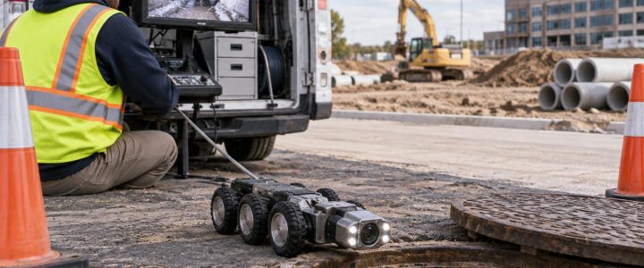
- Perform EM locating where conditions support it. Trace accessible conductive lines and identify signals that need correlation.
- Conduct the GPR survey. Scan planned work areas using a survey pattern suited to the target and site access.
- Interpret and correlate findings. Compare GPR responses with EM results, surface features, known routes, and site history.
- Mark and document findings. Clearly distinguish observed evidence from interpreted features and areas of uncertainty.
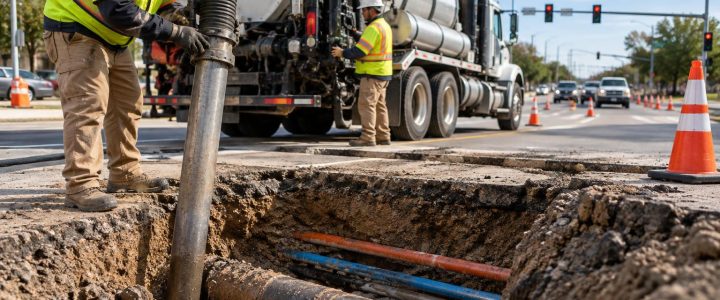
- Verify critical conflicts. Use non-destructive vacuum excavation or another appropriate method to expose the utility before final design or intrusive work.
Where a project needs physical confirmation, vacuum excavation and QL-A services can expose a utility with less disturbance than conventional mechanical digging. Verification can establish actual observed location, depth, size, material, and configuration at the test-hole location. It does not automatically define the conditions along the entire utility route, so test-hole locations should be planned around the project’s highest-risk crossings and conflicts.
Common planning mistakes to avoid
Waiting until crews are ready to dig
Calling for GPR utility detection after equipment and labor are already committed can limit the team’s options. Early investigation gives designers and contractors time to adjust layouts, change sequencing, plan test holes, or refine a bore path.
Assuming every line creates a clear radar response
A non-metallic pipe may be detectable in one area and difficult to identify a short distance away because soil, moisture, depth, orientation, or surrounding material changes. No result should be read as proof that the area is clear.
Using a single marked line as a final excavation depth
GPR marks are not a substitute for safe excavation practices, project-specific planning, or physical verification where needed. Conditions can change along the route, and interpreted depth is not the same as observed elevation.
Requesting data without defining the needed deliverable
A contractor may need field markings before a small excavation, while an engineer may need surveyed utility information for design coordination. Discussing the intended use before the survey helps avoid a mismatch between field effort and deliverable.
When to bring in a professional GPR utility locating company
Professional GPR survey services are particularly useful when utility records are incomplete, private utilities may be present, site history is uncertain, non-metallic lines are a concern, or the work involves high-consequence excavation or drilling. They can also support early design by identifying areas that warrant additional investigation before a route or structure is finalized.
For projects in Pennsylvania, New Jersey, Delaware, Maryland, New York, or the Washington, D.C. to New York City corridor, Visionary Subsurface Solutions can help plan a practical GPR and private utility locating approach based on the work scope, access, site conditions, and required level of verification. Contact our team to discuss your project before excavation, drilling, or construction begins.