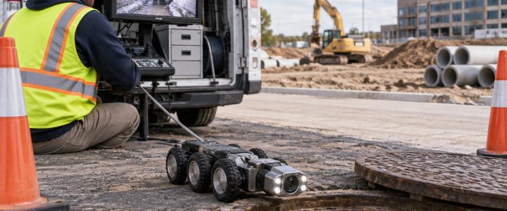
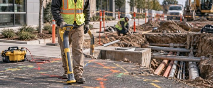
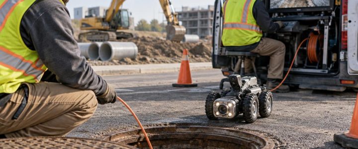
Roadway widening, intersection reconstruction, streetscape work, drainage improvements, and complete-street projects often place new construction directly beside—or directly over—existing utilities. Plans may show a water main, duct bank, sewer, or communications line in the area, but they may not answer the question that controls the work: where is the utility actually located, and what clearance is available?
Utility daylighting uses vacuum excavation to physically expose a known or suspected utility at selected locations. The exposed utility can then be observed, measured, and documented. For roadway teams, that information can help resolve conflicts before a contractor encounters them with an excavator, drill rig, or pavement saw.
Daylighting is not a replacement for utility locating, surveying, design review, or safe excavation planning. It is a targeted verification step used when an interpreted utility position is not enough for design or field decisions.
Why roadway projects need physical utility verification
Roadway work can involve a crowded and changing subsurface environment. Utility installations may have occurred over decades, often before current roadway geometry, curb lines, drainage systems, or easements were in place. Historical plans can be useful, but they may be incomplete, generalized, or based on intended installation rather than as-built field conditions.
Actual utility conditions can differ from records for several reasons:
- A utility was installed at a different offset or depth than shown on a drawing.
- A road was widened, milled, overlaid, or reconstructed after the utility was installed.
- Previous repairs, service taps, abandoned lines, or relocations were not fully recorded.
- Settlement, grade changes, and utility crossings changed the available vertical clearance.
- Multiple owners installed facilities in the same corridor at different times.
Electromagnetic locating and ground penetrating radar can provide valuable designation and investigation information. They can help identify a traceable line, indicate a likely route, or reveal subsurface features that deserve more attention. However, those methods do not always provide the physical certainty required for a proposed storm crossing, curb-drain tie-in, utility relocation, bore path, or structural foundation.
When decisions depend on the actual position, depth, size, material, or configuration of a utility, planned utility exposure may be appropriate.
What utility daylighting can verify
A carefully completed test hole can provide direct observations that are difficult or impossible to confirm from records or geophysical signals alone. Once the utility is safely exposed, the field team may be able to document:
- The utility’s actual horizontal position at the test-hole location.
- Depth below the existing surface or another defined project datum.
- The top, centerline, invert, or other relevant reference point, depending on the utility and project need.
- Outside diameter or observable width of a pipe, conduit, duct bank, or casing.
- Observable material, such as metal, plastic, concrete, clay, or composite components.
- Number and arrangement of visible conduits or cables.
- Utility crossings, apparent vertical separation, and available working room.
- Features such as encasement, casing pipe, tracer wire, warning tape, or unexpected obstructions.
Physical exposure does not automatically establish an accurate surveyed elevation. A tape measurement from the surface may be sufficient for some construction planning. When design requires reliable horizontal or vertical coordinates, a surveyor or another appropriate measurement process should tie the exposed utility feature to the project control and datum.
Locating, daylighting, and surveying each have a different role
Roadway teams get better results when they treat these activities as connected steps rather than competing methods.
Utility locating identifies and designates potential utility routes
Electromagnetic methods can trace many conductive facilities or an applied signal on a line. Ground penetrating radar may help identify changes in subsurface materials or features, particularly where a line cannot be directly traced. Results require interpretation and can be affected by congestion, soil conditions, depth, signal distortion, inaccessible connection points, and utility construction.
For a broader investigation before selecting test-hole locations, Subsurface Utility Engineering and QL-B services can help organize records research, field designation, and utility conflict analysis.
Vacuum excavation physically exposes the utility
Vacuum excavation removes loosened soil with suction, using pressurized water for hydro excavation or compressed air for air excavation. It is commonly used for non-destructive excavation around known or suspected utilities because it can remove soil in a controlled area without relying on conventional mechanical digging immediately adjacent to the line.
It is still excavation. Operators need suitable equipment, trained personnel, deliberate exposure techniques, and jobsite controls. Vacuum excavation reduces risk compared with mechanical excavation near utilities; it does not make utility damage impossible.
Surveying turns observed field conditions into design data
After daylighting, the project team should decide which feature needs to be measured: top of pipe, centerline, crown, invert, duct-bank edge, casing, or another defined point. A survey tie can provide usable coordinates and elevations when performed within the project’s survey control, accuracy requirements, and documentation process.
How daylighting supports Quality Level A investigations
In the ASCE 38-22 framework, Quality Level B generally relates to the application of appropriate surface geophysical methods to designate utilities. Quality Level A involves obtaining precise information through exposure and measurement at discrete locations. The ASCE 38-22 standard describes a structured approach to communicating existing subsurface utility information and its quality.
A vacuum-excavated test hole can be an important part of a Quality Level A investigation, but not every pothole automatically meets every Quality Level A requirement. The investigation needs a defined purpose, appropriate measurement and documentation, and methods suited to the project. The deliverable should clearly state what was exposed, what was measured, the datum used where applicable, and any limitations observed in the field.
This distinction matters. A field note that says “utility found approximately 5 feet deep” may assist a crew. It may not be enough for a final profile design, utility relocation plan, or high-consequence crossing decision.
Common roadway situations that warrant utility test holes
Proposed drainage crossings
A new storm sewer may appear to pass beneath or above an existing utility on the profile. Before finalizing grades or ordering structures, daylighting can confirm whether the existing utility is where the plans suggest and establish the actual crossing relationship. The team can then evaluate whether the proposed drainage alignment, slope, structure location, or protection approach needs adjustment.
Utility relocation and conflict resolution
Roadway widening can place poles, curb lines, retaining walls, sidewalks, and new drainage directly in a utility corridor. Test holes near critical conflict points can confirm the utility’s location and observable construction before relocation plans are developed. This helps utilities, designers, and contractors discuss a field condition rather than an assumption on a composite plan.
Directional drilling and trenchless crossings
HDD entry and exit areas, bore paths, and crossing points should be investigated carefully. Daylighting selected utilities may help establish constraints for bore planning and reduce uncertainty at key crossings. It does not eliminate the need for an HDD-specific design, drilling procedures, tolerance review, and active monitoring appropriate to the work.
Work near structures and streetscape features
Light-pole foundations, signal bases, signs, tree pits, bus shelters, and retaining elements can conflict with shallow private or public utilities. A small, well-placed utility test hole may prevent late changes after concrete, materials, and crews are already committed.
A practical process for planning roadway daylighting
Random potholing can create cost and disruption without answering the project’s most important questions. A planned approach is more useful.
- Define the decision. Identify what the team must know: crossing clearance, utility elevation, material, diameter, available offset, or relocation extent.
- Review available information. Compare utility records, design plans, survey information, site observations, and prior locating results. Note conflicts and gaps rather than assuming one record is correct.
- Select high-value exposure points. Prioritize drainage crossings, proposed structure locations, tie-ins, HDD paths, congested intersections, and areas where a design change is still practical.
- Choose an excavation method. Hydro excavation may be effective in many cohesive or compact soils. Air excavation can be advantageous where minimizing slurry is important or water use and disposal are concerns. Soil, restoration requirements, environmental conditions, and utility sensitivity affect the choice.
- Plan access and controls. Consider lane closures, traffic control, pedestrian routing, equipment placement, utility-owner coordination, permits, staging room, and restoration requirements.
- Expose and document consistently. Record utility identity where known, dimensions, material, depth reference, observed configuration, photographs where allowed, and any uncertainty or limitation.
- Survey critical findings. Obtain survey information when the design requires coordinates or elevations tied to project control.
- Share results quickly. Update the design, conflict matrix, field plan, and utility coordination discussion before construction advances.
Hydro excavation or air excavation for roadway utility exposure?
Both methods use a vacuum system to remove loosened soil. The best choice is site-specific.
Hydro excavation uses pressurized water to break up soil. It can be productive in many soil types and can help penetrate compacted material. However, it produces slurry that must be managed, transported, or disposed of in accordance with site and local requirements. Water use, freezing conditions, pavement restoration, and drainage protection also need planning.
Air excavation uses compressed air to loosen soil for vacuum removal. It can produce dry spoils rather than slurry and may be useful where water management is a concern. Its production rate can vary with soil type, moisture, and compaction. Dust control and the management of dry excavated material remain important.
Neither method is universally better. Access, soil, groundwater, depth, traffic conditions, utility congestion, disposal needs, restoration expectations, and the specific utility being exposed should guide the work plan.
Documentation mistakes that reduce the value of a test hole
A utility exposure is most valuable when the result can be understood later by designers and field crews. Avoid these common gaps:
- Recording a depth without stating the point measured, such as top of pipe or centerline.
- Using an assumed surface elevation without identifying the reference point.
- Failing to note the observed utility size, material, conduit count, or encasement.
- Not documenting whether the utility was fully exposed or only partially visible.
- Leaving out the horizontal relation to a baseline, station, curb, structure, or survey point.
- Treating an unverified utility owner or service as confirmed based only on appearance.
- Not communicating the finding before final design or active excavation proceeds.
Limits and field conditions to consider
Utility daylighting can produce valuable verification, but conditions can affect the work. Deep utilities, unstable soils, groundwater, frozen ground, heavy traffic, restricted access, congestion, pavement thickness, and limited spoil or slurry handling options may change the method, cost, schedule, or extent of exposure. Surface restoration and environmental requirements should be addressed before work starts.
Established utility coordination and damage-prevention guidance also supports using reliable information, communication, and appropriate excavation practices before disturbing the ground. The Federal Highway Administration’s utility program resources and the Common Ground Alliance Best Practices Guide both emphasize the importance of utility coordination and safe excavation planning.
Make roadway utility information usable before construction
For roadway projects, the value of utility daylighting is not simply a hole in the ground. It is the ability to replace a critical assumption with documented field information. Used with locating, survey control, SUE planning, and sound construction coordination, vacuum excavation can help teams make earlier and better-informed decisions about conflicts, drainage, relocations, and excavation methods.
Visionary Subsurface Solutions provides vacuum excavation and QL-A utility verification services for roadway, civil, and utility projects across Pennsylvania, New Jersey, Delaware, Maryland, New York, and the Washington, D.C. to New York City corridor. Contact our team to discuss critical utility exposure points, documentation needs, and a practical daylighting plan for your project.