Before an excavator opens a trench, starts a foundation cut, or removes pavement, the project team needs to know more than where a utility may be located. They need to know whether that utility conflicts with the planned work, how deep it is, and how it is configured in the field.
Utility daylighting uses vacuum excavation to carefully remove soil around a known or suspected utility so it can be physically observed. This is often the right next step when utility records, markings, electromagnetic (EM) locating, or Ground Penetrating Radar (GPR) identify a possible utility path but do not provide enough certainty for design or excavation decisions.
For contractors and engineers, the question is not whether every marked line needs a test hole. It is whether the consequences of being wrong justify physical verification before conventional excavation begins.
When utility daylighting should happen before excavation
Utility daylighting is especially valuable when an underground utility could affect the safety, sequence, cost, or constructability of planned work. It is a planned form of non-destructive excavation, not simply a response after an excavator encounters an unexpected line.
Consider utility potholing or test holes before excavation when any of the following conditions apply:
- A proposed trench, footing, retaining wall, pole base, or storm structure is close to a marked utility.
- Plans show a utility, but its actual depth is unknown or based only on old records.
- A crossing is expected and the required vertical separation has not been confirmed.
- Several utilities are present in a congested corridor, such as an urban street, medical campus, industrial site, or commercial redevelopment.
- A utility alignment affects a proposed directional drill bore path, casing, or receiving pit.
- The design depends on an existing utility elevation or pipe size.
- Private utility records are incomplete, conflicting, or unavailable.
- A utility appears abandoned, but its status, connection, or physical condition is uncertain.
- Mechanical excavation will occur within the utility owner’s or project’s required tolerance area.
These conditions do not guarantee that a conflict exists. They do indicate that relying only on a paint mark, a geophysical response, or a record drawing may leave too much uncertainty for the work at hand.
Locating identifies a possible position; daylighting verifies field conditions
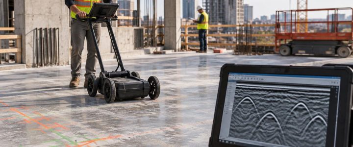
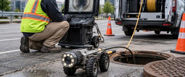
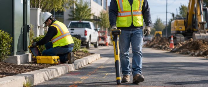
Private utility locating and SUE designation are important early investigation tools. EM locating can trace many conductive lines, including energized cables, tracer wires, and metallic pipe. GPR can sometimes identify subsurface anomalies or non-metallic utilities where site conditions permit. Each method can provide useful interpreted information, but neither replaces physical exposure when the project requires direct confirmation.
An estimated depth from a locator is not the same as a depth measured at an exposed utility. Likewise, a marked route is not automatically the utility’s exact horizontal position, particularly around bends, tees, congested crossings, transitions, or signal distortion.
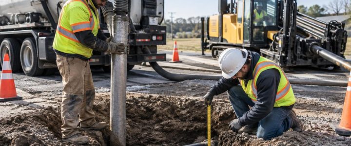
Vacuum excavation for utilities allows a qualified field team to uncover the utility with controlled soil removal. Once exposed, the team may be able to observe and document:
- The utility’s actual horizontal position at the test-hole location
- Depth below the existing surface, using an appropriate field measurement method
- The top or other defined point of the utility needed for the project
- Pipe outside diameter or conduit dimensions that are visible and measurable
- Observable material characteristics, such as metallic pipe, plastic conduit, duct bank, concrete, or casing
- Multiple conduits, encasement, casing configuration, or bundled facilities
- Crossing relationships and apparent vertical separation between exposed utilities
- Visible evidence that may warrant further condition investigation, such as deformation, abandoned components, or unexpected connections
Physical exposure does not by itself determine utility ownership, prove that a line is active, or establish precise coordinates. If the design requires coordinates or elevations, surveying and clearly defined measurement procedures are still needed.
How utility daylighting supports better construction decisions
A daylighted utility gives the field team information that can be used before larger excavation equipment is committed. That can change the layout, excavation sequence, support approach, drill profile, or protection plan while changes are still manageable.
Foundation and building work
On commercial sites, electrical feeders, communications ducts, gas services, fire lines, and site drainage may run near proposed foundations or building additions. Test holes can help determine whether a utility needs to be protected, relocated, rerouted, or incorporated into the excavation plan. They can also identify whether a marked line is actually within the footprint or simply near it.
Trenching and utility installation
For a new water, sewer, electric, or communications installation, the proposed trench may cross multiple existing facilities. Daylighting at critical crossings helps the contractor plan the grade and sequence of work based on observed conditions rather than assumed depths. This is particularly useful when a gravity pipe needs a specific slope or a new utility must pass above or below an existing line.
Roadway, streetscape, and municipal work
Reconstruction projects often involve legacy utilities installed over many decades. Pavement overlays, curb changes, drainage improvements, signal work, and ADA upgrades can all encounter buried infrastructure. Utility test hole services can help confirm conditions at proposed catch basins, sign foundations, light bases, signal poles, and utility crossings before the work zone becomes active.
Directional drilling and bore planning
For horizontal directional drilling, the utility crossing points and entry or exit areas deserve focused investigation. Daylighting can help confirm whether the intended bore profile has adequate separation from exposed utilities at key locations. It should be coordinated with the drilling plan, locating data, and site-specific safety procedures; it is not a substitute for safe drilling practices or ongoing monitoring.
Quality Level B and Quality Level A: an important distinction
Subsurface Utility Engineering uses defined quality levels to communicate the reliability of utility information. In general terms, Quality Level B involves geophysical designation of utilities, while Quality Level A involves obtaining information through physical exposure and measurement at selected points. The ASCE standards program publishes ASCE 38-22, which addresses investigating and documenting existing utilities, and the Federal Highway Administration’s SUE guidance also describes the role of test holes in reducing uncertainty at critical locations.
In practical terms, Quality Level B findings can help select where physical verification is needed. Quality Level A test holes can then provide observed utility data at those targeted points. A vacuum excavation project does not automatically constitute a complete SUE investigation, and a test hole does not automatically satisfy every Quality Level A documentation requirement. The scope, field methods, measurements, survey control, records, and reporting must match the project’s stated needs.
When the investigation is part of design, teams can coordinate vacuum excavation with Subsurface Utility Engineering and QL-B services so design decisions are based on a planned progression from designation to targeted exposure.
Plan test holes around decisions, not just markings
Random potholes can create cost and disruption without resolving the project’s most important questions. A stronger approach is to identify the decisions that need dependable field information, then place test holes where they can answer those questions.
A useful pre-excavation daylighting plan should define:
- The purpose of each hole. For example: confirm a storm pipe invert area, verify clearance at a proposed duct-bank crossing, or expose a gas line before a footing excavation.
- The utility information already available. Review records, mark-outs, prior locating, survey data, design drawings, and known site history.
- The information to collect. Specify the utility characteristics, reference points, measurements, photos, and survey deliverables needed.
- The excavation method. Select hydro excavation or air excavation based on soil, utility sensitivity, water availability, restoration, slurry handling, and site constraints.
- Access and work-zone needs. Consider traffic control, pavement cuts, overhead obstructions, staging room, site access, and public impacts.
- Restoration and material handling. Plan for spoils or slurry, water management, backfill, temporary patching, and final surface restoration.
Document the exposure so the result can be used
An exposed utility is most valuable when the result is communicated clearly to the people making design and field decisions. At a minimum, documentation should identify the test-hole location, date, observed utility, measurement reference, depth or elevation information collected, visible dimensions, and relevant field conditions.
If exact design-grade information is required, arrange for a survey professional or other appropriate project procedure to capture horizontal coordinates and elevations. The field record should make clear what point was measured: for example, top of pipe, top of conduit bank, centerline if determined, or another defined feature. Ambiguous notes can create the same uncertainty the test hole was meant to resolve.
Photos can be useful when they include scale and a clear connection to the test-hole record. However, photos alone may not show the full configuration beyond the exposed area. A single exposure represents conditions at that point, not necessarily along the entire route.
Limitations to address before mobilizing a vacuum excavation contractor
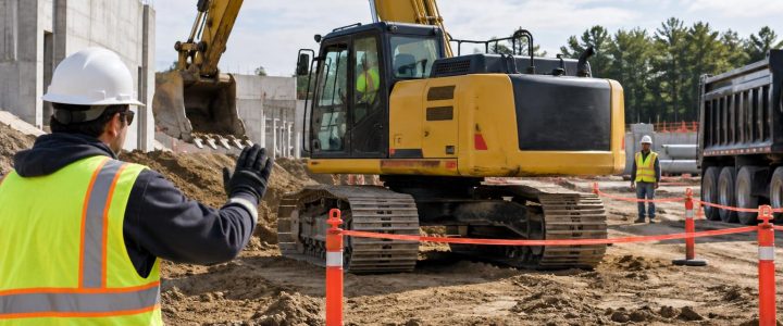
Vacuum excavation is intended to reduce the risk of damage compared with mechanical digging around known or suspected utilities. It is still active excavation, and it is not risk-free. Appropriate locating, equipment selection, trained operators, utility-specific precautions, and jobsite safety controls remain essential.
Project conditions that can affect production, exposure quality, and cost include:
- Dense clay, cobbles, rock, frozen ground, or heavily compacted fill
- Groundwater, unstable excavations, or difficult dewatering conditions
- Deep targets and limited hose reach or equipment access
- Dense utility congestion and restricted exposure space
- Traffic control needs and work-zone limitations
- Water supply, slurry disposal, and environmental requirements for hydro excavation
- Surface restoration requirements for pavement, landscaping, or specialty finishes
- Utility owner requirements and site-specific excavation procedures
Hydro excavation may be effective in many compacted soils, but it creates slurry that must be managed. Air excavation can be useful where water use or slurry handling is a concern, but soil type and production needs can limit its practicality. The right method depends on the specific site and the information the project needs.
Frequently asked questions about utility daylighting
Does a paint mark show the exact location and depth of a utility?
No. Marks communicate an interpreted utility path and are valuable for planning, but they do not necessarily establish exact horizontal position or depth. Physical exposure may be needed at critical locations.
Can vacuum excavation confirm a utility elevation?
It can expose the utility so a depth can be measured and a survey crew can capture an elevation. Vacuum excavation alone does not automatically create a surveyed elevation or coordinate.
Can a test hole confirm pipe material and size?
Often, the exposed portion allows the team to observe and document visible material characteristics, outside diameter, conduit count, casing, or configuration. The extent of confirmation depends on how much can be safely exposed and observed.
Should daylighting occur before or after construction starts?
For known high-risk conflicts, daylighting before major excavation usually provides more time to adjust design or sequencing. It can also be performed during construction when field conditions reveal a question that requires physical verification.
Make utility verification part of the excavation plan
Underground utility information becomes more dependable when locating, records review, design coordination, physical exposure, and survey work are used together. Utility daylighting before excavation is most effective when it addresses a defined construction or design decision: where to dig, what to protect, how to maintain clearance, or whether the planned work needs to change.
Visionary Subsurface Solutions provides vacuum excavation and QL-A services for contractors, engineers, municipalities, and facility teams across Pennsylvania, New Jersey, Delaware, Maryland, New York, and the Washington, D.C. to New York City corridor. Contact our team to discuss a planned utility daylighting, utility potholing, or test-hole scope for your project.