When a project crosses an established utility corridor, the main challenge is rarely finding one known line. The challenge is understanding the full area: active and abandoned utilities, private services, crossings at different elevations, repairs, ducts, foundations, and other buried features that may not appear on available records.
A properly planned ground penetrating radar (GPR) survey can help a project team investigate these uncertain conditions before excavation, directional drilling, pole installation, pavement removal, or final design. GPR does not “see” a labeled utility map underground. It detects changes in subsurface electromagnetic properties, and a trained technician interprets those responses alongside surface evidence, utility records, electromagnetic (EM) locating results, and other field information.
That distinction matters. In a congested area, GPR can identify likely utility paths, crossings, and anomalies that deserve attention. It cannot by itself confirm the exact material, owner, service status, or precise depth of every target. Where the work will approach a suspected utility, vacuum excavation or a test hole may be needed to physically verify its position.
Why congested utility corridors require more than records and paint marks
Utility congestion is common around commercial buildings, hospitals, campuses, industrial facilities, streetscapes, and redevelopment sites. The corridor may contain electric, gas, water, sewer, communications, fire protection, irrigation, site lighting, drainage, and abandoned infrastructure placed over several decades.
Plans and utility maps are useful starting points, but they may show design intent rather than field-installed conditions. They also may not include private utilities, later modifications, abandoned lines, or exact crossing elevations. A locate mark on the surface is valuable information, but it is not a complete picture of the space below grade.
This becomes a construction problem when crews need to answer questions such as:
- Is there a likely utility crossing where the proposed trench, bore path, or footing will go?
- Are several utility lines stacked or closely spaced within the same corridor?
- Could an unmarked private line serve a building, sign, site light, gate, or irrigation system?
- Is an apparent clear area actually affected by a buried duct bank, abandoned pipe, foundation, or previous excavation?
- Which locations need daylighting before finalizing the work plan?
GPR utility locating services can add another layer of evidence to this investigation, especially where non-metallic pipes or undocumented features are possible.
How GPR helps identify crossings and subsurface anomalies
GPR transmits electromagnetic energy into the ground and records reflected signals from boundaries where material properties change. A buried pipe, conduit, trench backfill boundary, void, rock, reinforcement, or change in soil conditions can create a response in the data.
When a survey line crosses a relatively narrow, pipe-like target, the response may form a curved pattern commonly called a hyperbola. By collecting multiple parallel lines or a gridded survey, the technician can compare responses and look for a consistent path. This helps distinguish a possible linear feature from isolated clutter or changing soil conditions.
In a crowded corridor, the field team may use GPR to look for:
- Likely utility crossings that do not align with visible marks or records
- Possible non-metallic pipe or conduit routes
- Buried duct banks and areas of dense subsurface disturbance
- Changes that may indicate an abandoned utility, old trench, foundation, or slab remnant
- Potential conflicts between proposed work and detected features
- Areas that require a more focused survey or physical verification
A detected response is not automatically a utility. It is an anomaly until the available evidence supports a more specific interpretation. For example, a linear GPR response may be consistent with a pipe, but it can also be influenced by a trench boundary, rock, debris, or other buried construction feature.
GPR and EM locating work best as complementary tools
GPR is often discussed as an alternative to electromagnetic locating, but on many projects the two methods are more useful together.
EM locating can be highly effective when a conductive utility, tracer wire, or accessible cable can be energized and traced. It can provide a clear route for many metallic lines and traceable non-metallic utilities. However, an EM receiver generally cannot directly trace a plastic pipe that has no tracer wire, conductive cable, or other locatable component.
GPR may help identify a response associated with some non-conductive utilities, including PVC, HDPE, concrete, and other plastic pipe. Results depend heavily on the site. Pipe diameter, burial depth, orientation, moisture, surrounding soil, backfill, and nearby utilities all affect whether the pipe or its trench can be distinguished.
Using both methods can help the project team compare evidence. An EM trace may establish a known utility route, while GPR may identify a possible crossing or nearby feature not represented by that trace. Neither result should be treated as a substitute for daylighting where a planned excavation will be close to the suspected facility.
For projects that need coordinated field data and engineering use, Subsurface Utility Engineering & QL-B can organize surface-level investigation information for design and conflict evaluation. A GPR scan alone does not automatically constitute a complete SUE investigation or establish a particular ASCE 38-22 Quality Level.
What makes a GPR survey difficult in utility corridors?
GPR performance is site-specific. A useful survey starts with an understanding of those limits rather than an assumed detection depth or accuracy. In general, lower-frequency antennas can investigate deeper conditions in favorable materials, while higher-frequency antennas provide finer detail at shallower depths. The appropriate setup depends on the target, surface, soil, and project question.
Soil type and moisture
Dry, sandy, or low-conductivity ground can sometimes allow stronger GPR penetration than wet, clay-rich, saline, or highly conductive soils. Water and conductive clay minerals can reduce signal penetration and obscure deeper responses. Recent rain, irrigation, drainage conditions, and variable fill can change results across the same site.
Depth, size, and orientation of the target
Shallow, larger, and well-defined targets are often easier to distinguish than small, deep, or poorly contrasted targets. A utility running perpendicular to the survey direction may create a clearer response than one running parallel to it. Surveying in more than one direction can improve the interpretation where access permits.
Dense utilities and disturbed ground
Closely spaced utilities can create overlapping reflections. Old trench backfill, rubble, reinforced concrete, surface metal, and repeated repairs can add clutter. In those areas, a GPR operator may be able to identify a zone of congestion without reliably separating every individual line.
Surface access and pavement conditions
GPR equipment needs practical access to the survey surface. Heavy traffic, parked vehicles, stored materials, landscaping, steep grades, rough pavement, and obstructions can limit coverage. Reinforced concrete and surface metal can also complicate interpretation. Survey limits should be documented so the project team understands which areas were scanned and which were inaccessible.
A practical workflow for GPR utility detection before construction
Good GPR results are not just a matter of moving an antenna over the ground. The work should be tied to the actual construction risk and decision that the data needs to support.
- Define the work area and proposed disturbance. Provide excavation limits, bore paths, footing locations, proposed utility routes, coring locations, or pavement removal limits. A broad site scan may not answer a narrow conflict question.
- Gather available information. Utility plans, as-builts, one-call marks, previous locate reports, site photographs, valve and manhole locations, and facility staff knowledge can guide the field investigation.
- Perform a visual site review. Technicians look for meters, pedestals, cleanouts, handholes, valves, manholes, transformers, building entries, pavement patches, and other evidence of utility routing.
- Use appropriate detection methods. A professional investigation may combine EM utility locating, GPR, accessible structure tracing, and other methods based on site conditions.
- Collect GPR data in a useful pattern. Parallel lines, cross lines, or grids may be used around key work zones. Tighter spacing can improve the ability to interpret closely spaced responses.
- Interpret and compare evidence. GPR observations should be evaluated with EM signals, surface features, records, and the geometry of the site. Conflicting evidence should be identified, not ignored.
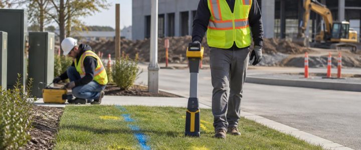
- Mark and document findings. Surface marks, sketches, photographs, and mapping can communicate suspected routes, anomalies, and limitations to the project team.
- Verify critical targets. Where the risk is significant, use non-destructive vacuum excavation to expose the utility and confirm its horizontal and vertical position before intrusive work proceeds.
When a GPR finding needs a test hole
GPR can improve planning, but it is not physical confirmation. A test hole is especially appropriate when a suspected target is near a proposed excavation, bore path, foundation, utility crossing, or other critical work area.
Consider verification when:
- A GPR response appears to cross the proposed work area
- Available records and field evidence disagree
- The corridor contains multiple overlapping utilities
- A non-metallic or untraceable line may be present
- Depth separation affects design clearance or constructability
- The consequence of a strike, outage, or delay is high
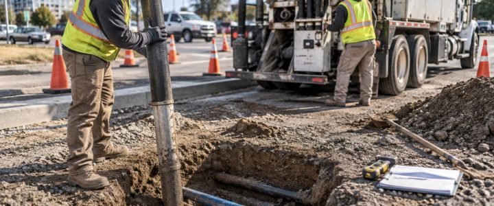
Vacuum Excavation & QL-A provides a controlled way to daylight a utility where physical verification is required. Exposing the facility can confirm what a surface investigation cannot: the actual feature, its location at the exposure point, and its observed depth.
Preparing a site for GPR survey services
Contractors and project managers can improve the usefulness of a GPR survey by sharing the decision the survey must support. The most helpful preparation includes:
- A marked plan or clear description of proposed excavation and construction limits
- Known utility records, previous locate information, and available as-builts
- Access to gated areas, building representatives, and utility structures where appropriate
- Removal or relocation of vehicles, pallets, equipment, and debris from critical scan areas when feasible
- Notice of recent paving, trenching, utility repairs, irrigation, or unusual site conditions
- Information about schedule constraints and the consequence of a utility conflict
It is also important to plan time for review. The field markings and deliverables should be discussed before crews begin intrusive work, particularly where findings are uncertain or indicate a potential conflict.
Frequently asked questions about GPR in crowded utility areas
Can GPR locate every underground utility?
No. GPR does not guarantee detection of every utility. Some facilities may produce weak or unclear responses because of soil conditions, depth, size, moisture, nearby congestion, orientation, shielding, or limited site access. GPR findings should be considered with other investigation methods and site evidence.
Can GPR determine the exact depth of a utility?
GPR data can support an estimated depth interpretation, but that estimate depends on assumptions about subsurface signal velocity and target identification. Conditions can vary across a site. When exact depth is needed for construction clearance, physical exposure is the more reliable verification method.
Can GPR tell whether a pipe is active, abandoned, or privately owned?
No. A GPR response does not establish ownership or operating status. Records, facility information, accessible structures, tracing methods, and verification may help resolve those questions.
Is GPR useful on paved sites?
Often, yes. GPR surveys can be performed on many asphalt, concrete, roadway, parking lot, and sidewalk surfaces. Surface condition, reinforcement, traffic control, access, and the subsurface materials still affect what can be detected and interpreted.
Make GPR part of a defensible preconstruction investigation
In congested utility corridors, the goal is not to create false certainty. It is to reduce unknowns early enough that the project team can adjust the design, select safer excavation methods, target verification, and avoid preventable surprises.
Ground penetrating radar can be a valuable part of underground utility detection when it is selected for the right conditions, combined with EM locating and records review where appropriate, and followed by vacuum excavation for critical confirmation. For construction and engineering projects across Pennsylvania, New Jersey, Delaware, Maryland, New York, and the Washington, D.C. to New York City corridor, contact Visionary Subsurface Solutions to discuss a practical GPR survey and utility investigation approach for your project.