When a project depends on knowing where a utility actually sits, surface marks and record drawings may not be enough. A utility can be traced from the surface, but its true depth, outside diameter, material, configuration, or vertical relationship to another line may still be uncertain.
Utility daylighting uses vacuum excavation to carefully remove soil and physically expose a buried utility. Once exposed, the team can observe and document conditions that a geophysical signal alone cannot reliably confirm. For contractors and engineers, the main method decision is often air excavation vs. hydro excavation.
Both methods are forms of non-destructive excavation. Both can support utility potholing, test holes, conflict investigation, and construction planning. Neither is automatically the right fit for every site. Soil, access, weather, restoration requirements, utility sensitivity, water handling, and the information needed from the test hole all affect the decision.
Why physically expose a utility?
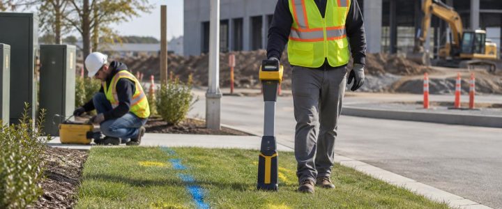
Utility locating and utility verification are related, but they are not the same task. Electromagnetic locating and ground penetrating radar can help identify a utility corridor or interpreted position. Their results can be highly useful for planning, but they may not provide the level of certainty required where a design, excavation, or bore path approaches an existing line.
A properly planned utility exposure can help verify observable field conditions, including:
- The actual horizontal position of an exposed utility at the test-hole location
- Depth measured from an identified surface reference to the utility
- Pipe or conduit outside diameter
- Visible material, such as steel, plastic, concrete, clay, or ductile iron
- The number and arrangement of visible conduits or cables
- Casing, encasement, abandoned-line, or crossing conditions
- Vertical separation where two utilities are safely exposed and observed
- Conditions that differ from available utility records or design drawings
Physical exposure does not automatically provide a surveyed elevation. If design decisions require precise horizontal coordinates, elevations, or utility profiles, a surveyor or appropriate measurement procedure should tie the exposed feature to the project control system. Likewise, an exposed section represents conditions at that location; it does not prove that the same depth, material, or alignment continues across the entire site.
How hydro excavation works for utility daylighting
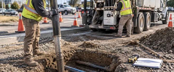
Hydro excavation uses controlled water to loosen soil while a vacuum system removes the soil-water mixture into a debris tank. It is commonly used for utility potholing because it can remove compacted soil efficiently and create a relatively narrow excavation around a target utility.
For many projects, hydro excavation is a practical choice when production matters and the site can support water use and slurry management. The operator controls water pressure, nozzle technique, stand-off distance, and excavation approach based on soil conditions and the known or suspected utility. Careful work remains essential near exposed infrastructure.
Where hydro excavation may be a strong fit
- Dense, dry, or cohesive soils that are difficult to loosen with air alone
- Multiple test holes where efficient soil removal supports the schedule
- Utility daylighting for roadway, site-development, and utility-coordination work
- HDD planning where entry, exit, crossing, or tie-in utilities need exposure
- Locations where slurry can be contained, hauled, and disposed of appropriately
Hydro excavation planning considerations
Water turns excavated material into slurry. That material needs a planned handling and disposal path, particularly on paved sites, constrained urban projects, or locations with environmental restrictions. Groundwater, winter temperatures, access for the vacuum truck, and required surface restoration can also affect productivity.
Hydro excavation is intended to reduce the risk of damage compared with conventional mechanical digging near known or suspected utilities. It is not risk-free. Excessive pressure, poor technique, inadequate locating, unstable excavation conditions, or assumptions about what is in the hole can still create hazards. The work requires qualified personnel, a defined exposure plan, and project-specific safety controls.
How air excavation works for utility exposure
Air excavation uses compressed air to break up and displace soil while a vacuum system removes loosened material. Because it does not introduce water into the excavation, air excavation can be useful where dry spoils, cleaner restoration, or avoidance of slurry is important.
Air excavation can also provide a deliberate approach in certain sensitive areas. However, its effectiveness varies significantly with soil type and moisture. Dense clay, wet soil, frozen ground, cobbles, and heavily compacted material can slow production. Loose dry soil may be more manageable, but dust control and work-zone conditions must still be addressed.
Where air excavation may be a strong fit
- Sites where introducing water could complicate restoration or material handling
- Facilities where slurry generation is undesirable
- Investigations that benefit from keeping the excavation and spoils relatively dry
- Areas with restricted drainage or limited space for water-management controls
- Selected utility exposure work where soil conditions are suitable
Air excavation planning considerations
Air does not eliminate the need for careful utility exposure practices. The excavation still needs to be planned around available designation data, expected depths, soil behavior, utility congestion, and access. In difficult soils, the slower progress of air excavation may affect whether it is the best option for a short construction window.
Air excavation vs. hydro excavation: the project questions that matter
Instead of choosing a method based on a general preference, start with the decision the test hole must support. A practical planning discussion should address the following questions.
What utility information is needed?
For a proposed storm line crossing a private electric duct bank, the team may need the actual top elevation of the duct bank, its width, conduit configuration, and the available vertical separation. For a directional drilling crossing, the question may be whether the bore path can maintain clearance from each verified utility. For a building addition, the key issue may be the size and location of a private water service shown only generally on old plans.
The required information helps determine test-hole position, excavation dimensions, documentation needs, and whether survey support is needed. It should be defined before crews arrive, not after the utility is exposed.
What are the site and soil conditions?
Consider soil type, moisture, groundwater, fill, rock fragments, frozen ground, and known obstructions. Also consider vehicle access, hose routes, traffic exposure, overhead clearance, and the distance from the vacuum truck to the work area. A method that works well on an open site may be impractical in a tight city corridor or active facility entrance.
How will excavated material be handled?
Hydro excavation produces slurry that must be managed. Air excavation may produce drier spoils, but those spoils may still require containment, removal, or appropriate reuse. Project teams should clarify disposal responsibilities and site-specific requirements before work begins rather than treating spoil handling as an afterthought.
What restoration is required?
Test holes may be in landscaped areas, pavement, sidewalks, roadways, or active loading zones. Restoration expectations affect the selected excavation footprint, traffic-control plan, backfill approach, and schedule. In some locations, the smallest practical test hole is important, but it must still be large enough to safely observe and measure the required utility characteristics.
How vacuum excavation supports SUE and Quality Level A investigations
In Subsurface Utility Engineering, Quality Level B generally refers to geophysical designation of utilities. Quality Level A involves the highest level of information and relies on exposing the utility and obtaining precise measurements and documentation at a specific point. The ASCE 38-22 standard describes a framework for investigating and documenting existing subsurface utilities.
A vacuum excavation test hole can be an important part of a Quality Level A investigation, but the excavation itself is not the entire process. The test-hole location must be selected for the design question. Measurements, survey control, records, and documentation methods must also be suitable for the intended use. The Federal Highway Administration likewise describes SUE as an engineering process that integrates utility investigation methods with design and construction needs.
For this reason, random potholes may not resolve a utility conflict. A useful SUE test-hole program identifies likely conflict points, anticipated utility paths, proposed grades, crossing locations, and the information that must be collected at each exposure.
What to document after daylighting a utility
Field documentation gives the exposure lasting value. At a minimum, the project team should establish what information needs to be recorded before excavation begins. Depending on the scope, documentation may include:
- Test-hole identifier, date, and location reference
- Utility type as observed or as identified through the investigation
- Visible material, outside diameter, configuration, and apparent condition
- Measured depth from a defined surface reference
- Horizontal offset or coordinates, when appropriate
- Surveyed utility elevation when required for design
- Top, centerline, or invert measurement basis, clearly identified
- Crossing details and measured vertical separation
- Photographs and notes describing any limits on the observation
- Differences between observed conditions and available plans or records
Clear terminology matters. An estimated depth from a locator should be identified as an estimate. A depth measured after exposure should state the reference point and what portion of the utility was measured. A surveyed elevation should identify the feature surveyed, such as top of pipe, centerline, or invert.
Common utility daylighting mistakes to avoid
- Testing the wrong location: A test hole should address a known design or construction question, not merely confirm that a utility exists somewhere nearby.
- Relying on a single surface mark: Designation data helps guide excavation, but congested corridors and signal limitations may require additional investigation.
- Collecting incomplete measurements: A depth without a reference, or an elevation without a feature description, can be misleading.
- Assuming records are as-built conditions: Installation changes, prior repairs, reconstruction, settlement, and incomplete records can all create differences.
- Skipping survey coordination: If design profiles depend on elevation, involve survey support before the hole is backfilled.
- Ignoring access and restoration: Traffic control, spoil handling, pavement repair, and work-area protection should be included in the plan.
Plan utility test holes before construction pressure builds
Vacuum excavation for utilities is most valuable when used before a conflict becomes an emergency. During design, targeted test holes can help engineers refine profiles, adjust utility crossings, and identify constructability concerns. Before excavation, daylighting can give field crews better information for safe dig plans. During construction, it can help resolve an unexpected conflict with less disruption than broad mechanical excavation around uncertain utilities.
For projects in Pennsylvania, New Jersey, Delaware, Maryland, New York, and the Washington, D.C. to New York City corridor, Visionary Subsurface Solutions provides vacuum excavation and Quality Level A services to support planned utility verification. Contact our team to discuss the test-hole objectives, access conditions, documentation needs, and utility daylighting approach for your project.