- For many commercial properties, campuses, industrial sites, municipalities, and healthcare facilities, underground utility information is spread across old drawings, contractor records, maintenance files, and the memories of long-time staff. Those sources can be useful, but they rarely provide a complete, current picture of what is below grade.
A well-planned utility map helps turn that scattered information into a practical record. It can support routine maintenance, emergency response, renovations, pavement work, drainage repairs, and future capital planning. More importantly, it gives project teams a clearer starting point before anyone opens the ground.
Utility mapping is not simply drawing lines on an aerial image. A reliable map should show where information came from, how the feature was identified, what has been verified, and where uncertainty remains. That distinction matters when a team is deciding where to core, trench, install a sign foundation, replace a water service, or plan a building addition.
Why facility utility records become unreliable over time
Most underground records begin with good intentions. They may have been prepared for design, permitting, construction, warranty closeout, or a specific repair. The problem is that underground systems change often, while the record system does not always keep pace.
Common causes of incomplete or conflicting information include:
- Utility installations that were changed in the field from the original design.
- Abandoned lines that remained in the ground after replacement.
- Private electric, communications, gas, water, irrigation, steam, sewer, and storm systems that were not included in public utility records.
- Site expansions completed by different owners, contractors, or departments.
- Paper drawings, scanned PDFs, and GIS files that use different coordinate systems or reference points.
- Repairs made under urgent conditions with limited documentation.
- Surface changes, such as repaving, landscaping, or building additions, that make old reference dimensions less useful.
The result is often a map that looks complete at first glance but leaves important questions unanswered. Is the line active? Is it a public or private asset? Is its shown location based on a design drawing, a field observation, an instrument response, or direct exposure? Can the map be used for planning only, or is it detailed enough to guide a proposed excavation?
Start with the decisions the map needs to support
The best utility mapping program starts with a purpose. A facilities team does not need the same level of investigation everywhere on a large property. It makes sense to concentrate effort where upcoming work, operational risk, or poor records create the most uncertainty.
Before field work begins, identify the decisions the map should help people make. For example:
- Can maintenance crews identify likely utility corridors before digging?
- Where are shutoffs, cleanouts, manholes, handholes, valves, and other access structures?
- Which buried lines serve critical buildings or equipment?
- Where might a future addition, parking expansion, or drainage improvement conflict with existing utilities?
- Which areas need further investigation before a contractor prices work?
- What information should be given to a design team at the start of a capital project?
These questions help define the mapping limits, the features to collect, the needed accuracy, and the appropriate investigation methods. They also prevent a common mistake: collecting a broad set of utility indications without connecting the work to a real operating or construction need.
Build the map from several evidence sources
No single source reliably describes every buried utility on every site. A stronger map combines available evidence and keeps that evidence visible in the final deliverable.
1. Collect records, but treat them as leads
Start with as-built drawings, civil plans, utility company information, previous locating reports, maintenance records, plumbing diagrams, survey files, and renovation documents. Staff knowledge can also be valuable, especially when it points to past breaks, abandoned systems, or unusual routing.
Records should be compared rather than assumed correct. A drawing may show design intent, not the final installed location. A record can still guide the investigation, but it should not automatically be treated as field confirmation.
2. Document visible surface features
Surface appurtenances often provide strong clues about underground systems. Utility mapping teams can document items such as manholes, catch basins, valves, hydrants, cleanouts, pedestals, handholes, meter pits, vaults, utility poles, and building service entrances.
Features should be photographed and surveyed or otherwise tied to a consistent site reference system when practical. Their labels, visible condition, and apparent function can be recorded as well. However, a surface feature does not by itself prove every connected pipe or conduit route.
3. Use locating methods suited to the utility and site
Electromagnetic locating can help identify traceable conductive utilities or utilities with an accessible tracer wire. Ground penetrating radar may identify subsurface anomalies or help investigate certain non-conductive utilities, but performance depends on soil conditions, depth, congestion, moisture, material, and site access.
These methods provide field evidence, not certainty in every situation. An experienced investigation team compares instrument responses with records, visible features, utility connections, and site conditions. When results conflict, that conflict belongs in the project record instead of being hidden behind a clean-looking line on a map.
For work involving private systems beyond the public utility point of service, a focused private utility locating investigation can help establish a more informed picture of likely routes before the map is finalized.
4. Confirm critical locations by exposing them when needed
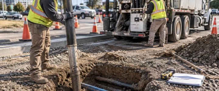
When a proposed excavation, foundation, crossing, or utility connection depends on a specific location and depth, direct observation may be needed. Vacuum excavation can expose a utility with less disturbance than conventional mechanical digging when performed with an appropriate work plan and safe procedures.
Direct exposure can document observed horizontal position, approximate depth, size, and visible material at that point. It does not prove that the utility remains at the same depth or alignment everywhere else. Each exposed location should be recorded with its own date, location, observations, and limitations.
This approach aligns with the quality-level framework described in the Subsurface Utility Engineering & QL-B process: information quality should be communicated clearly, and higher-confidence data should be developed where project risk justifies it. The quality-level concepts in ASCE 38 and Federal Highway Administration guidance similarly distinguish between records research, surface observations, geophysical designating, and physical verification.
Show confidence, not just utility lines
A utility map is most useful when users can tell how much confidence to place in each feature. A line that came from a 30-year-old site plan should not be displayed as though it has the same basis as a surveyed utility exposed in a test hole.
Consider including the following information in the map, GIS layer, or accompanying report:
- Utility type and apparent status, such as active, inactive, unknown, or suspected abandoned.
- Source of the information: record drawing, field observation, electromagnetic response, radar response, inspection, or direct exposure.
- Date of investigation and date of the source record.
- Known access points and associated structures.
- Survey control or coordinate reference information.
- Observed depth values, clearly labeled by the method and location of observation.
- Areas that could not be accessed or fully investigated.
- Conflicts between records and field findings.
- Notes stating where further verification is recommended before excavation.
This documentation lets future users make better decisions. It also reduces the chance that an old interpretation will be mistaken for a verified fact years later.
Coordinate mapping with survey and site-control practices
A utility map only works as a shared project tool when it aligns with the site’s survey control. If one drawing uses assumed coordinates, another uses a state plane coordinate system, and a third is based on building grid lines, overlaying them can create misleading offsets.
For larger sites or projects expected to continue over several phases, establish a consistent base map and coordinate reference early. Coordinate with the project surveyor on control points, units, datum, file format, and how utility features will be represented. This makes it easier to combine utility information with topographic surveys, design models, aerial imagery, and construction layouts.
It is also wise to distinguish between a planning-level map and a construction staking document. A facility utility map can be highly valuable for planning while still requiring additional field verification before excavation or connection work.
Keep the map current after repairs and projects
A utility map loses value if it becomes another static closeout file. The most successful programs assign responsibility for updates and establish a simple process for adding new information.
After a repair, replacement, or capital project, collect the details that will help the next team: final routing, tie-in locations, access structures, installed depth where observed, material notes, photographs, and survey information. Store the information with a clear date and source. If the project did not verify a portion of the system, state that plainly.
Facilities teams may also benefit from a periodic review of high-risk areas, especially around critical services, recurring maintenance locations, planned redevelopment zones, and areas with repeated record conflicts.
Use the map to ask better questions before digging
Even a careful utility map is not a substitute for site-specific planning, applicable one-call notifications, safe excavation practices, or field verification. Its value is that it helps teams identify questions early, when they are easier to address.
Before work begins, a map can prompt useful discussions: Which systems could affect this scope? What private utilities may be present? Is there enough confidence in the mapped route? Do we need to investigate a crossing point, confirm a depth, inspect a pipe, or adjust the proposed layout?
That is a more practical standard than expecting one document to eliminate every underground unknown. Good utility mapping makes uncertainty visible, prioritizes it, and provides a record that improves with each investigation.
Plan a map that fits your property and upcoming work
Visionary Subsurface Solutions helps project teams across Pennsylvania, New Jersey, Delaware, Maryland, New York, and the Washington, D.C. to New York City corridor develop utility information for planning, design, and field decision-making. Contact our team to discuss your property, available records, and the level of investigation that may fit your upcoming project.