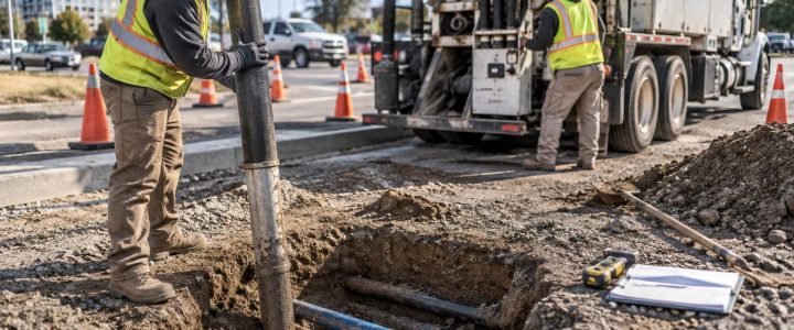
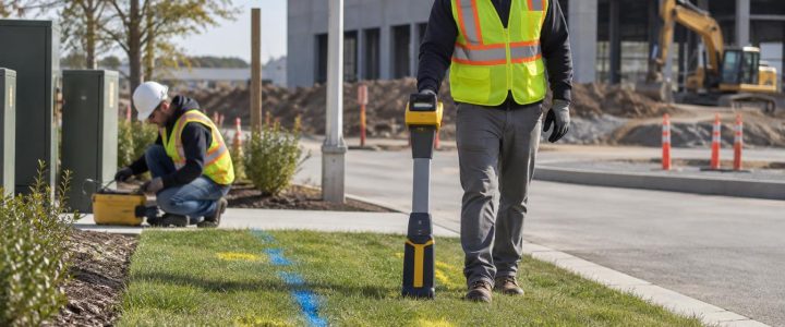
When an underground pipe system is causing backups, settling, repeated maintenance, or design conflicts, the first question is often simple: What is happening below ground? The right answer is rarely a single technology. A pipe camera, robotic crawler, and 3D manhole LiDAR scan each provide different information, and each has limits.
Selecting the inspection method early helps project teams avoid collecting images or measurements that do not answer the real project question. It can also help engineers, contractors, and facility managers plan access, cleaning, traffic control, bypass pumping, repair options, and utility coordination before field work begins.
This article explains how CCTV, robotic inspection, and 3D manhole LiDAR fit into an underground pipe investigation—and how to decide what information is needed before work starts.
Start with the decision the inspection must support
Before choosing equipment, define the decision that depends on the inspection. A useful scope identifies the asset, the concern, the area to be investigated, and the deliverable needed by the project team.
For example, the purpose may be to:
- Confirm whether a storm or sanitary line is obstructed, cracked, displaced, or root-intruded.
- Document observed pipe defects before rehabilitation or repair design.
- Determine whether a pipe can remain in service during a site redevelopment.
- Measure a manhole structure for rehabilitation planning or connection design.
- Locate the source of recurring inflow, infiltration, sediment buildup, or surcharge concerns.
- Collect defensible condition information for maintenance planning or asset records.
A clear question keeps the scope practical. For example, a video showing debris may support a cleaning decision, but it may not establish pipe slope, wall thickness, the condition of an inaccessible lateral, or the cause of water entering the system. Those questions may require additional investigation, records review, survey, cleaning, testing, or excavation.
CCTV inspection: a practical view inside accessible pipe
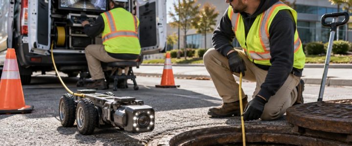
CCTV inspection uses a camera to view the inside of a pipeline, commonly from a manhole, cleanout, inlet, or other available access point. It is often a useful starting method when the team needs to see observable conditions in a pipe segment.
What CCTV can help reveal
Depending on access, flow, pipe cleanliness, camera setup, and the condition of the line, CCTV may help document observable conditions such as:
- Debris, sediment, grease, or other obstructions.
- Roots, visible cracks, open joints, fractures, or displaced sections.
- Intruding taps and service connections.
- Visible corrosion, surface deterioration, or pipe deformation.
- Standing water, changes in flow, or other signs that warrant follow-up.
- Locations along the inspected run where an observed issue appears.
For many municipal and commercial systems, CCTV findings are organized using standardized condition-assessment terminology. The National Association of Sewer Service Companies maintains the Pipeline Assessment and Certification Program, commonly known as PACP, to support consistent observation and coding of pipeline conditions. The U.S. Environmental Protection Agency also identifies CCTV as a common tool for assessing sewer condition and supporting maintenance and rehabilitation decisions.
That consistency matters. A useful inspection deliverable should make it easier for a facility team or engineer to understand what was observed, where it was observed, and what follow-up may be appropriate. It should not turn a limited visual observation into an unsupported conclusion.
Where CCTV has limits
A camera can only document what it can reach and see. Heavy debris, cloudy water, active flow, damaged access points, sharp bends, collapsed pipe, and poor surface preparation can limit the quality or reach of an inspection. Cleaning may be needed before the camera enters the line.
Video alone also does not confirm every underlying condition. A visible crack does not automatically establish the full extent of structural loss behind the pipe wall. A wet joint may suggest a condition worth investigating, but it does not by itself prove the source, rate, or path of infiltration. Likewise, a camera-based distance reading is useful operational information, but project teams should understand the equipment setup and reference point before relying on it for design or excavation decisions.
Robotic pipe inspection: when access or pipe conditions are more demanding
Robotic pipe inspection generally uses a remotely operated crawler or specialized camera platform. It can be valuable where a standard push camera may not have the needed reach, stability, lighting, maneuverability, or control. The right system depends on pipe diameter, access structure, bends, flow conditions, material, expected debris, and the specific inspection objective.
Situations where a robotic platform may be useful
- Longer or larger-diameter pipe runs where a controlled crawler is better suited to the inspection.
- Lines with conditions that require stronger lighting, pan-and-tilt viewing, or a steadier camera position.
- Projects where the team needs detailed visual documentation of manholes, pipe connections, junctions, or known problem areas.
- Systems where multiple observations must be tied to a consistent inspection log for engineering review or maintenance planning.
- Investigations in which personnel entry would be unnecessary, unsuitable, or subject to confined-space requirements.
Robotic equipment is not a substitute for planning. A crawler may be unable to proceed through a blockage, severe deformation, collapsed segment, unsuitable diameter transition, or inaccessible entry point. Active flows and debris can also affect inspection results. The field team should review available utility records, access locations, pipe sizes, known flow conditions, and safety constraints before mobilization.
For repair and rehabilitation planning, robotic video may provide the detail needed to prioritize observed defects. However, a visual inspection should be interpreted alongside the project’s broader evidence. Records, maintenance history, surface settlement, cleaning results, hydraulic observations, survey, and targeted excavation may all matter when the team must determine cause and select a repair approach.
 3D manhole LiDAR: measuring structures, not just viewing them
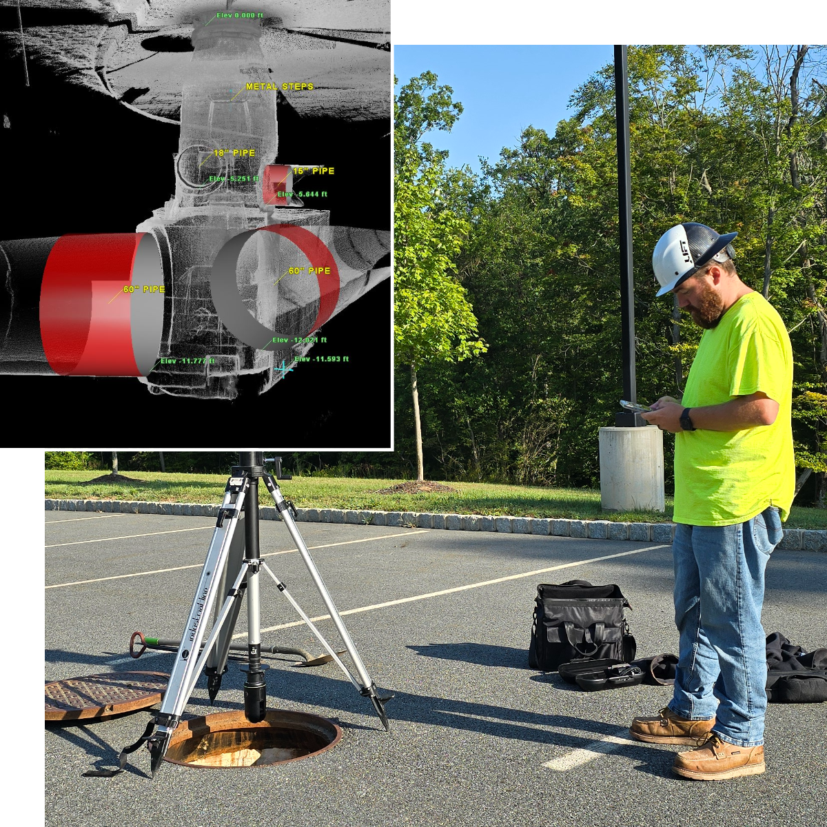
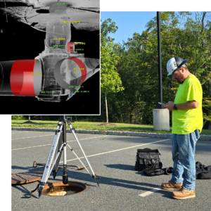
Manholes are more than access points. They may contain channels, benches, pipe penetrations, drops, steps, frames, covers, changing diameters, and signs of deterioration. A 3D LiDAR scan can capture the geometry of an accessible manhole structure and create a detailed digital representation for evaluation and planning.
This makes 3D scanning particularly useful when a project needs accurate documentation of the structure around pipe connections—not simply video of the pipe interior.
Questions 3D manhole LiDAR can help answer
- What are the approximate dimensions and configuration of the manhole chamber?
- Where are incoming and outgoing pipes located relative to the structure?
- What is the shape and geometry of channels, benches, and drop connections?
- Are there visible irregularities or deterioration areas that should be reviewed for rehabilitation planning?
- How can existing structure geometry be documented for design coordination or asset records?
LiDAR results can be especially helpful for rehabilitation scoping, connection planning, and coordination with engineers or survey teams. It can reduce the need to rely solely on hand sketches or limited photographs from a complex structure.
Still, a scan is not a complete condition diagnosis. It may not capture every obscured surface, determine the internal condition of connected pipe beyond its visible opening, measure hidden wall loss, or identify a defect concealed by water, debris, coatings, or access limitations. Project teams should also confirm the required coordinate control, datum, accuracy expectations, and deliverable format before scanning begins if the data will be used in design.
Learn more about 3D Manhole LiDAR scanning for documenting manhole structures and pipe connections.
Use methods together when the problem crosses asset boundaries
Many underground pipe problems do not stop at one structure or one pipe segment. A recurring backup may involve a downstream obstruction, a damaged connection, a sag, a deteriorated manhole channel, or a private lateral that was not included in earlier inspections. In those situations, combining methods can create a more useful picture.
A coordinated investigation might include:
- Records and access review. Identify known structures, ownership boundaries, available access points, pipe sizes, and prior maintenance information.
- Cleaning and preparation. Remove conditions that would prevent a meaningful visual inspection where practical and appropriate.
- CCTV or robotic inspection. Document reachable pipe segments and observed conditions using a clear reporting framework.
- 3D LiDAR scanning. Capture manhole geometry where structure dimensions, complex connections, or rehabilitation planning require more detail.
- Targeted follow-up. Consider survey, flow evaluation, leak testing, or carefully planned excavation when the available evidence does not resolve a critical question.
For example, video may show roots at a joint near a manhole. A 3D scan may document the connection geometry inside that structure. If a proposed excavation or repair needs precise confirmation of the pipe’s field position, a test hole may be the appropriate next step. Each method should reduce a specific uncertainty rather than simply add data.
Plan for safe and useful access
Access conditions often determine whether an inspection succeeds. Before scheduling field work, identify manholes, cleanouts, roof drains, inlets, valve boxes, or other possible entry points. Confirm whether structures are buried, paved over, blocked by equipment, located in traffic areas, or affected by site security requirements.
Manholes and other utility structures can present serious hazards. Work near or within them may involve traffic exposure, fall hazards, hazardous atmospheres, moving equipment, and confined-space considerations. Inspection planning should account for the applicable site safety procedures and the actual conditions encountered in the field. Video and scanning tools can reduce the need for entry in some situations, but they do not remove the need for a thoughtful safety plan.
Ask for deliverables that match the next step
The most helpful underground pipe inspection deliverable is one the next decision-maker can use. Before work begins, discuss who will review the information and what they need to do with it.
Useful deliverables may include:
- Inspection video with clear run identification and observations.
- Condition logs using an agreed coding or reporting approach.
- Photos of structures, access points, and notable conditions.
- Location information tied to available project control or asset references.
- 3D scan data, models, or drawings in a format compatible with the design team’s needs.
- A concise summary distinguishing observed conditions from items that require further confirmation.
For broader planning, Visionary Subsurface Solutions can also coordinate pipe findings with other utility investigation work. Where needed, video pipe inspection services can support a focused look at accessible storm and sanitary assets before repair, redevelopment, or excavation decisions are made.
Technical references for condition assessment
For organizations developing inspection standards or reviewing condition reports, the NASSCO PACP program provides information on standardized pipeline condition assessment. The U.S. EPA guide for evaluating capacity, management, operation, and maintenance programs discusses the role of inspection, including CCTV, in sewer system assessment and maintenance planning.
Make the inspection answer the project question
CCTV is often the practical choice for viewing accessible pipe interiors. Robotic platforms can provide more controlled inspection in demanding pipe conditions. 3D manhole LiDAR can document the geometry of structures and connections that video alone may not capture. The best approach depends on the condition question, access, safety constraints, and the decision that follows.
If your project involves unknown pipe condition, complex manhole geometry, recurring drainage issues, or upcoming construction near buried systems, contact Visionary Subsurface Solutions to discuss an investigation approach suited to your site and project goals.